185.2.134.133 - IP Lookup: Free IP Address Lookup, Postal Code Lookup, IP Location Lookup, IP ASN, Public IP
Country:
Region:
City:
Location:
Time Zone:
Postal Code:
IP information under different IP Channel
ip-api
Country
Region
City
ASN
Time Zone
ISP
Blacklist
Proxy
Latitude
Longitude
Postal
Route
Luminati
Country
ASN
Time Zone
Europe/Berlin
ISP
Vodafone GmbH
Latitude
Longitude
Postal
IPinfo
Country
Region
City
ASN
Time Zone
ISP
Blacklist
Proxy
Latitude
Longitude
Postal
Route
IP2Location
185.2.134.133Country
Region
thuringen
City
sulzbach
Time Zone
Europe/Berlin
ISP
Language
User-Agent
Latitude
Longitude
Postal
db-ip
Country
Region
City
ASN
Time Zone
ISP
Blacklist
Proxy
Latitude
Longitude
Postal
Route
ipdata
Country
Region
City
ASN
Time Zone
ISP
Blacklist
Proxy
Latitude
Longitude
Postal
Route
Popular places and events near this IP address
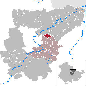
Weimarer Land
District in Thuringia, Germany
Distance: Approx. 4703 meters
Latitude and longitude: 51,11.42
Weimarer Land is a Landkreis (district) in the east of Thuringia, Germany. Neighboring districts are (from the northeast clockwise) the district Burgenlandkreis in Saxony-Anhalt, the district Saale-Holzland and the district-free city Jena, the district Saalfeld-Rudolstadt, Ilm-Kreis, and the district-free city Erfurt. The district-free city Weimar is completely enclosed by the district.

Apolda
Town in Thuringia, Germany
Distance: Approx. 2595 meters
Latitude and longitude: 51.01666667,11.51666667
Apolda (German: [aˈpɔlda] ) is a town in central Thuringia, Germany, the capital of the Weimarer Land district. It is situated in the center of the triangle Weimar–Jena–Naumburg near the river Ilm, c. 15 kilometres (9 miles) east by north from Weimar.

Frankendorf
Municipality in Thuringia, Germany
Distance: Approx. 4644 meters
Latitude and longitude: 50.96833333,11.44944444
Frankendorf is a municipality in the Weimarer Land district of Thuringia, Germany.
Hohlstedt
Village of Großschwabhausen in Thuringia, Germany
Distance: Approx. 4785 meters
Latitude and longitude: 50.96,11.47916667
Hohlstedt is a former municipality in the Weimarer Land district of Thuringia, Germany. Since 1 December 2007, it is part of the municipality Großschwabhausen.

Kapellendorf
Municipality in Thuringia, Germany
Distance: Approx. 3357 meters
Latitude and longitude: 50.975,11.46805556
Kapellendorf is a municipality in the Weimarer Land district of Thuringia, Germany.
Mattstedt
Ortsteil of Ilmtal-Weinstraße in Thuringia, Germany
Distance: Approx. 5923 meters
Latitude and longitude: 51.05472222,11.50472222
Mattstedt is a village and a former municipality in the Weimarer Land district of Thuringia, Germany. Since 31 December 2013, it is part of the municipality Ilmtal-Weinstraße.

Niederroßla
Ortsteil of Ilmtal-Weinstraße in Thuringia, Germany
Distance: Approx. 3420 meters
Latitude and longitude: 51.03333333,11.48333333
Niederroßla is a village and a former municipality in the Weimarer Land district of Thuringia, Germany. Since 31 December 2013, it is part of the municipality Ilmtal-Weinstraße.
Oßmannstedt
Ortsteil of Ilmtal-Weinstraße in Thuringia, Germany
Distance: Approx. 4546 meters
Latitude and longitude: 51.01861111,11.42722222
Oßmannstedt is a village and a former municipality in the Weimarer Land district of Thuringia, Germany. Since 31 December 2013, it is part of the municipality Ilmtal-Weinstraße.

Wiegendorf
Municipality in Thuringia, Germany
Distance: Approx. 3897 meters
Latitude and longitude: 50.98638889,11.43777778
Wiegendorf is a municipality in the Weimarer Land district of Thuringia, Germany.

Umpferstedt
Municipality in Thuringia, Germany
Distance: Approx. 5939 meters
Latitude and longitude: 50.97694444,11.41277778
Umpferstedt is a municipality in the Weimarer Land district of Thuringia, Germany.
Prager house
Distance: Approx. 3104 meters
Latitude and longitude: 51.025,11.51361111
The Prager-Haus or Bernhard-Prager-Haus is the former home of the Jewish Prager family, situated in Apolda, Thuringia, Germany, in Pragergasse, a narrow alley.
Apolda station
Railway station in Apolda, Germany
Distance: Approx. 4149 meters
Latitude and longitude: 51.030753,11.526
Apolda station is a through station on the Halle–Bebra railway in the town of Apolda in the German state of Thuringia. It was opened on 1 April 1890 and Deutsche Bahn assigns it to category 4.
Weather in this IP's area
broken clouds
5 Celsius
2 Celsius
5 Celsius
5 Celsius
1019 hPa
53 %
1019 hPa
986 hPa
7781 meters
3.58 m/s
7.15 m/s
51 %
