Country:
 Romania
Region:
City:
Latitude and Longitude:
Time Zone:
Postal Code:
IP information under different IP Channel
ip-api
Country
Region
City
ASN
Time Zone
ISP
Blacklist
Proxy
Latitude
Longitude
Postal
Route
IPinfo
Country
Region
City
ASN
Time Zone
ISP
Blacklist
Proxy
Latitude
Longitude
Postal
Route
MaxMind
Country
Region
City
ASN
Time Zone
ISP
Blacklist
Proxy
Latitude
Longitude
Postal
Route
Luminati
Country
ROASN
Time Zone
Europe/Bucharest
ISP
Hosterion Srl
Latitude
Longitude
Postal
db-ip
Country
Region
City
ASN
Time Zone
ISP
Blacklist
Proxy
Latitude
Longitude
Postal
Route
ipdata
Country
Region
City
ASN
Time Zone
ISP
Blacklist
Proxy
Latitude
Longitude
Postal
Route
Popular places and events near this IP address

Cluj-Napoca
City and county seat of Cluj County, Romania
Distance: Approx. 2273 meters
Latitude and longitude: 46.76666667,23.58333333
Cluj-Napoca ( KLOOZH-na-POH-kə; Romanian: [ˈkluʒ naˈpoka] ), or simply Cluj (Hungarian: Kolozsvár [ˈkoloʒvaːr] , German: Klausenburg), is a city in northwestern Romania. It is the second-most populous city in the country and the seat of Cluj County. Geographically, it is roughly equidistant from Bucharest (445 km; 277 mi), Budapest (461 km; 286 mi) and Belgrade (483 km; 300 mi).

Cluj-Napoca Botanical Garden
Distance: Approx. 1562 meters
Latitude and longitude: 46.7603,23.5867
The Cluj-Napoca Botanical Garden, officially Alexandru Borza Cluj-Napoca University Botanic Garden (Romanian: Grădina Botanică Alexandru Borza a Universităţii Cluj-Napoca), is a botanical garden located in the south part of Cluj-Napoca, Romania. It was founded in 1872 by Hungarian linguist Sámuel Brassai, known as the "Last Transylvanian Polymath". Its director in 1905 was Aladár Richter, then Páter Béla, Győrffy István, and then, in 1920, it was taken over by the local university and by Alexandru Borza.

Nord-Vest (development region)
Region in Romania
Distance: Approx. 2273 meters
Latitude and longitude: 46.76666667,23.58333333
Nord-Vest (English: North West) is a development region in Romania, created in 1998. As other development regions, it does not have any administrative powers, its main function being to co-ordinate regional development projects and manage funds from the European Union.
University of Agricultural Sciences and Veterinary Medicine of Cluj-Napoca
Agricultural university in Cluj-Napoca, Romania
Distance: Approx. 1949 meters
Latitude and longitude: 46.76055556,23.57055556
The University of Agricultural Sciences and Veterinary Medicine of Cluj-Napoca (USAMVCN) (Romanian: Universitatea de Științe Agricole și Medicină Veterinară Cluj-Napoca) is a university in Cluj-Napoca, Romania. With around 6,000 students, the university offers 21 undergraduate programs; all are available in Romanian, 2 in French and 1 in English. Additionally, the university offers 23 Master programs (20 in Romanian, 2 in English and 1 in French).
Technical University of Cluj-Napoca
Distance: Approx. 2273 meters
Latitude and longitude: 46.76666667,23.58333333
The Technical University of Cluj-Napoca (UTCN short for Romanian: Universitatea Tehnică din Cluj-Napoca) is a public university located in Cluj-Napoca, Romania. It was founded in 1948, based on the older Industrial College (1920). The Technical University of Cluj-Napoca is classified by the Ministry of Education as an advanced research and education university.
Iuliu Hațieganu University of Medicine and Pharmacy
Distance: Approx. 1760 meters
Latitude and longitude: 46.762061,23.5836
Iuliu Hațieganu University of Medicine and Pharmacy (Romanian: Universitatea de Medicină și Farmacie „Iuliu Hațieganu", or UMF Cluj) in Cluj-Napoca, Romania, is the oldest medical education institution in Transylvania, a continuation of the Faculty of Medicine which was founded in 1919, as a part of the Superior Dacia University. The university has over 6,000 national and international students, 2,400 resident physicians, as well as over 1,100 teachers and researchers. It was named in honor of the scientist Iuliu Hațieganu.
Cluj-Napoca metropolitan area
Metropolitan area in Cluj County, Romania
Distance: Approx. 2273 meters
Latitude and longitude: 46.76666667,23.58333333
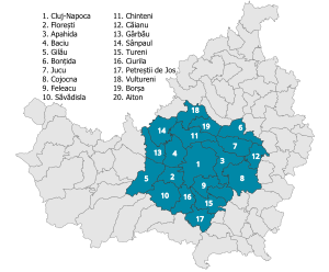
The Cluj metropolitan area is a metropolitan area in Cluj County, which includes Cluj-Napoca and 19 communes nearby: Aiton, Apahida, Baciu, Bonțida, Borșa, Căianu, Chinteni, Ciurila, Cojocna, Feleacu, Florești, Gilău, Gârbau, Jucu, Petreștii de Jos, Săvădisla, Sânpaul, Tureni, Vultureni. The total area of the metropolitan area is 1,603 km2 (619 sq mi), which comprises 24% of the territory of Cluj County. According to the 2021 census, the population of the 20 administrative units totals 425,130 people, of whom 286,598 live in Cluj-Napoca.

Zorilor
Distance: Approx. 567 meters
Latitude and longitude: 46.75138889,23.58555556
Zorilor is a southern district of Cluj-Napoca in Romania. It consists largely of blocks of flats ranging from 4 to 10 storeys. The district is home to the Observator student housing campus.

Tiberiu Popoviciu High School of Computer Science
High school
Distance: Approx. 1131 meters
Latitude and longitude: 46.7539967,23.59507075
Tiberiu Popoviciu High School of Computer Science (Romanian: Liceul de Informatică "Tiberiu Popoviciu") is located at 140–142 Calea Turzii in Cluj-Napoca, Romania. The high school was founded in 1971, together with three other similar high schools in Bucharest, Iași, and Timișoara. Since 1993 it holds the name of mathematician Tiberiu Popoviciu (1906–1975), known for establishing the academic field of computer science in Romania.

Napoca (castra)
Distance: Approx. 2273 meters
Latitude and longitude: 46.76666667,23.58333333
Napoca was a Roman castra (fort) in the province of Dacia.

Dico și Țigănaș
Distance: Approx. 1206 meters
Latitude and longitude: 46.75444444,23.59583333
Dico și Țigănaș is an architectural firm based in Cluj-Napoca, Romania since March 1997. The practice is led by its founders, engineer Florin Dico and architect Șerban Țigănaș, who is currently also the president of the Romanian Order of Architects. The firm deals in creation of architectural, construction and installation designs for apartment buildings, office buildings, administrative buildings, stadiums and industrial buildings.

Church on the Hill (Cluj-Napoca)
Heritage site in Cluj County, Romania
Distance: Approx. 2135 meters
Latitude and longitude: 46.76532,23.58895
The Church on the Hill (Romanian: Biserica din Deal) is a Romanian Orthodox church located at 10 Bisericii Ortodoxe Street, Cluj-Napoca, Romania. It is dedicated to the Holy Trinity.
Weather in this IP's area
clear sky
13 Celsius
11 Celsius
13 Celsius
13 Celsius
1025 hPa
38 %
1025 hPa
968 hPa
10000 meters
4.12 m/s
100 degree
07:49:06
18:31:43