185.197.221.76 - IP Lookup: Free IP Address Lookup, Postal Code Lookup, IP Location Lookup, IP ASN, Public IP
Country:
Region:
City:
Location:
Time Zone:
Postal Code:
IP information under different IP Channel
ip-api
Country
Region
City
ASN
Time Zone
ISP
Blacklist
Proxy
Latitude
Longitude
Postal
Route
Luminati
Country
Region
46
City
selje
ASN
Time Zone
Europe/Oslo
ISP
Enivest AS
Latitude
Longitude
Postal
IPinfo
Country
Region
City
ASN
Time Zone
ISP
Blacklist
Proxy
Latitude
Longitude
Postal
Route
IP2Location
185.197.221.76Country
Region
vestland
City
sandane
Time Zone
Europe/Oslo
ISP
Language
User-Agent
Latitude
Longitude
Postal
db-ip
Country
Region
City
ASN
Time Zone
ISP
Blacklist
Proxy
Latitude
Longitude
Postal
Route
ipdata
Country
Region
City
ASN
Time Zone
ISP
Blacklist
Proxy
Latitude
Longitude
Postal
Route
Popular places and events near this IP address

Gloppen
Municipality in Vestland, Norway
Distance: Approx. 3980 meters
Latitude and longitude: 61.74388889,6.17055556
Gloppen is a municipality in the county of Vestland, Norway. It is located in the traditional district of Nordfjord. Gloppen is generally subdivided into three areas: Hyen in the west, Gloppen in the center, and Breim in the east.

Sandane
Village in Western Norway, Norway
Distance: Approx. 462 meters
Latitude and longitude: 61.7769,6.2164
Sandane is the administrative centre of the municipality of Gloppen in Vestland county, Norway. It is located at the end of the Gloppefjorden, along the European route E39 highway. Sandane is 20 kilometres (12 mi) south of the village of Nordfjordeid and about 16 kilometres (9.9 mi) west of the village of Byrkjelo.

Sandane Airport
Airport in Gloppen, Norway
Distance: Approx. 8574 meters
Latitude and longitude: 61.83,6.10583333
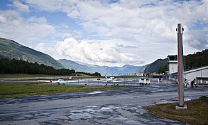
Sandane Airport (Norwegian: Sandane lufthavn; IATA: SDN, ICAO: ENSD) is a regional airport serving the village of Sandane in Vestland county, Norway. It perpendicularly straddles the Anda peninsula in Gloppen Municipality between the Nordfjorden and Gloppefjorden. The airport has an asphalt runway measuring 970 by 30 meters (3,182 by 98 ft) and aligned 08/26.

Firda Upper Secondary School
Distance: Approx. 0 meters
Latitude and longitude: 61.7728,6.215
Firda Upper Secondary School (Norwegian: Firda vidaregåande skule) is a school located in the town of Sandane in the municipality of Gloppen in Sogn og Fjordane county, Norway. The highway E39 passes just north of the school. The school features in the NRK series Lovleg.

Sørstranda, Vestland
Village in Western Norway, Norway
Distance: Approx. 3632 meters
Latitude and longitude: 61.7675,6.14694444
Sørstranda or Rygg is a village in Gloppen Municipality in Vestland county, Norway. The village is located on the southwestern shore of the Gloppefjorden. The village sits about 5 kilometres (3.1 mi) west of the municipal centre of Sandane.

Vereide
Village in Western Norway, Norway
Distance: Approx. 6023 meters
Latitude and longitude: 61.81333333,6.13916667
Vereide is a village in Gloppen Municipality in Vestland county, Norway. The village is located along the central part of the eastern shore of the Gloppefjorden, along the European route E39 highway. It sits about 6 kilometres (3.7 mi) northwest of the municipal center of Sandane and about 4 kilometres (2.5 mi) southeast of Sandane Airport, Anda.

Gloppefjorden
Fjord in Gloppen, Norway
Distance: Approx. 6379 meters
Latitude and longitude: 61.8027,6.1116
Gloppefjorden or Gloppenfjorden is a fjord in Gloppen Municipality in Vestland county, Norway. The 12-kilometre (7.5 mi) long fjord flows from the village of Sandane in the southeast to its mouth at the Nordfjorden in the northwest. The river Gloppeelva is the primary inflow on the fjord.

Gimmestad Church
Church in Vestland, Norway
Distance: Approx. 3071 meters
Latitude and longitude: 61.7719088,6.15671173
Gimmestad Church (Norwegian: Gimmestad kyrkje) is a parish church of the Church of Norway in Gloppen Municipality in Vestland county, Norway. It is located in the village of Sørstranda, right along the shore of the Gloppefjorden. It is one of the four churches for the Gloppen parish which is part of the Nordfjord prosti (deanery) in the Diocese of Bjørgvin.

Old Gimmestad Church
Church in Vestland, Norway
Distance: Approx. 3744 meters
Latitude and longitude: 61.77228876,6.14389077
Old Gimmestad Church (Norwegian: Gimmestad gamle kyrkje) is a former parish church of the Church of Norway in Gloppen Municipality in Vestland county, Norway. It is located in the village of Sørstranda. Previously, it served as the church for the Gimmestad parish, which is part of the Nordfjord prosti (deanery) in the Diocese of Bjørgvin, but now it primarily functions as a museum.

Sandane Church
Church in Vestland, Norway
Distance: Approx. 637 meters
Latitude and longitude: 61.76946657,6.22483045
Sandane Church (Norwegian: Sandane kyrkje) is a parish church of the Church of Norway in Gloppen Municipality in Vestland county, Norway. It is located in the village of Sandane at the southern end of the Gloppefjorden. It is one of the four churches for the Gloppen parish which is part of the Nordfjord prosti (deanery) in the Diocese of Bjørgvin.

Vereide Church
Church in Vestland, Norway
Distance: Approx. 5489 meters
Latitude and longitude: 61.80800359,6.14195046
Vereide Church (Norwegian: Vereide kyrkje) is a medieval parish church of the Church of Norway in Gloppen Municipality in Vestland county, Norway. It is the only stone church in the Nordfjord region. It is located in the village of Vereide, along the eastern coast of the Gloppefjorden.
Weather in this IP's area
overcast clouds
-2 Celsius
-2 Celsius
-2 Celsius
1 Celsius
986 hPa
86 %
986 hPa
978 hPa
10000 meters
100 %