185.195.81.131 - IP Lookup: Free IP Address Lookup, Postal Code Lookup, IP Location Lookup, IP ASN, Public IP
Country:
Region:
City:
Location:
Time Zone:
Postal Code:
IP information under different IP Channel
ip-api
Country
Region
City
ASN
Time Zone
ISP
Blacklist
Proxy
Latitude
Longitude
Postal
Route
Luminati
Country
ASN
Time Zone
America/Chicago
ISP
Internet TV, Inc.
Latitude
Longitude
Postal
IPinfo
Country
Region
City
ASN
Time Zone
ISP
Blacklist
Proxy
Latitude
Longitude
Postal
Route
IP2Location
185.195.81.131Country
Region
hessen
City
frankfurt am main
Time Zone
Europe/Berlin
ISP
Language
User-Agent
Latitude
Longitude
Postal
db-ip
Country
Region
City
ASN
Time Zone
ISP
Blacklist
Proxy
Latitude
Longitude
Postal
Route
ipdata
Country
Region
City
ASN
Time Zone
ISP
Blacklist
Proxy
Latitude
Longitude
Postal
Route
Popular places and events near this IP address

Frankfurt
Largest city in Hesse, Germany
Distance: Approx. 41 meters
Latitude and longitude: 50.11055556,8.68222222
Frankfurt am Main (; German: [ˈfʁaŋkfʊʁt ʔam ˈmaɪn] ; lit. "Frank ford on the Main") is the most populous city in the German state of Hesse. Its 773,068 inhabitants as of 2022 make it the fifth-most populous city in Germany.

St. Paul's Church, Frankfurt am Main
Church and national assembly hall in Germany
Distance: Approx. 87 meters
Latitude and longitude: 50.11111111,8.68083333
St Paul's Church (German: Paulskirche) in Frankfurt am Main is a former church building used as an exhibition, memorial and meeting place. It was built between 1789 and 1833 to replace the medieval "Barfüßerkirche", which was demolished in 1786, and served as Frankfurt's main Protestant-Lutheran church until 1944, when it was replaced by St Catherine's Church. From 1848 to 1849, the delegates of the Frankfurt National Assembly, the first parliament for the whole of Germany, met in the neoclassical circular building designed by architect Johann Friedrich Christian Hess.

Römer
City Hall of Frankfurt
Distance: Approx. 73 meters
Latitude and longitude: 50.11027778,8.68166667
The Römer (German surname, "Roman") is a medieval building in the Altstadt of Frankfurt am Main, Germany, and one of the city's most important landmarks. The Römer is located opposite the Old St. Nicholas Church and has been the city hall (Rathaus) of Frankfurt for over 600 years.

Frankfurter Kunstverein
Distance: Approx. 61 meters
Latitude and longitude: 50.1107,8.6828
The Frankfurter Kunstverein e. V. in Frankfurt am Main is a non-profit organisation dedicated to the promotion of contemporary art and culture. It is one of the oldest German art associations.

Free City of Frankfurt
Former city-state of Germany
Distance: Approx. 71 meters
Latitude and longitude: 50.11027778,8.68222222
Frankfurt was a major city of the Holy Roman Empire, being the seat of imperial elections since 885 and the city for imperial coronations from 1562 (previously in Free Imperial City of Aachen) until 1792. Frankfurt was declared an Imperial Free City (Freie und Reichsstadt) in 1372, making the city an entity of Imperial immediacy, meaning immediately subordinate to the Holy Roman Emperor and not to a regional ruler or a local nobleman. Due to its imperial significance, Frankfurt survived mediatisation in 1803.

Römerberg (Frankfurt)
Public square in Frankfurt, Germany
Distance: Approx. 71 meters
Latitude and longitude: 50.11027778,8.68222222
Römerberg (also spelled as Roemerberg, lit. 'Roman Mountain') is a public space in Frankfurt, Germany. It is located in front of the Römer building complex, seat of the Frankfurt city administration since the 15th century. As the site of numerous imperial coronations, trade fairs and Christmas markets, the square is the historic heart of the medieval Altstadt (old town) and a popular tourist destination.

Old St. Nicholas Church
Distance: Approx. 101 meters
Latitude and longitude: 50.11,8.68222222
The Old St. Nicholas Church (in German: Alte Nikolaikirche) in Frankfurt, Germany, is a medieval Lutheran church. It is located near the Römer city hall in Frankfurt's old town called Altstadt.

New Frankfurt Old Town
Quarter between Dom and Römer in Frankfurt, Germany
Distance: Approx. 82 meters
Latitude and longitude: 50.11109,8.68311
The New Frankfurt Old Town (also known as the Dom-Römer Quarter) is the centre of the old town of Frankfurt am Main, Germany, which was reconstructed from 2012 to 2018 as part of a major urban development project called the Dom-Römer Project (German: Dom-Römer-Projekt).

Paulsplatz
Public square in Frankfurt, Germany
Distance: Approx. 48 meters
Latitude and longitude: 50.1111,8.6814
Paulsplatz (St. Paul's Square) is a historic square in the heart of Frankfurt, Germany. St Paul's Church is located here, dominating the square.
Berliner Straße (Frankfurt am Main)
Thoroughfare in Frankfurt, Germany
Distance: Approx. 100 meters
Latitude and longitude: 50.1118,8.6821
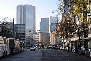
Berliner Straße is a major street in the city centre of Frankfurt am Main. It was built after the Bombing of Frankfurt am Main in World War II along the route of the old Schnurgasse.

Bendergasse
Former major street in the old town of Frankfurt
Distance: Approx. 105 meters
Latitude and longitude: 50.11027778,8.68311111
The Bendergasse was a former major street in the old town of Frankfurt. It ran from near Frankfurt Cathedral to the Römerberg square. From the Middle Ages till the destruction in the air raid on 22 March 1944, it formed one of the main streets in the old town centre.

Salzhaus
Distance: Approx. 13 meters
Latitude and longitude: 50.1108,8.6819
The Salzhaus (English: Salt House) is a historic building in the German city Frankfurt am Main. It forms the northeastern part of the Frankfurt City Hall complex (Römer), on the Römerberg square in the centre of the Altstadt (old town). The Salzhaus was originally built around 1600.
Weather in this IP's area
moderate rain
4 Celsius
-0 Celsius
3 Celsius
5 Celsius
1021 hPa
85 %
1021 hPa
1003 hPa
10000 meters
5.14 m/s
180 degree
100 %
