185.194.169.115 - IP Lookup: Free IP Address Lookup, Postal Code Lookup, IP Location Lookup, IP ASN, Public IP
Country:
Region:
City:
Location:
Time Zone:
Postal Code:
IP information under different IP Channel
ip-api
Country
Region
City
ASN
Time Zone
ISP
Blacklist
Proxy
Latitude
Longitude
Postal
Route
Luminati
Country
ASN
Time Zone
Europe/London
ISP
Space Data Centres Ltd
Latitude
Longitude
Postal
IPinfo
Country
Region
City
ASN
Time Zone
ISP
Blacklist
Proxy
Latitude
Longitude
Postal
Route
IP2Location
185.194.169.115Country
Region
england
City
bulwell
Time Zone
Europe/London
ISP
Language
User-Agent
Latitude
Longitude
Postal
db-ip
Country
Region
City
ASN
Time Zone
ISP
Blacklist
Proxy
Latitude
Longitude
Postal
Route
ipdata
Country
Region
City
ASN
Time Zone
ISP
Blacklist
Proxy
Latitude
Longitude
Postal
Route
Popular places and events near this IP address

Nottingham North (UK Parliament constituency)
Parliamentary constituency in the United Kingdom, 1955-2024
Distance: Approx. 491 meters
Latitude and longitude: 53,-1.19
Nottingham North was a constituency represented in the House of Commons of the UK Parliament. Under the 2023 Periodic Review of Westminster constituencies, the constituency was abolished. Subject to major boundary changes - including gaining the communities of Kimberley and Nuthall in the Borough of Broxtowe, the Nottingham City ward of Leen Valley ward from Nottingham South, and losing Bilborough ward in exchange - it was reformed as Nottingham North and Kimberley, which was first contested in the 2024 general election.

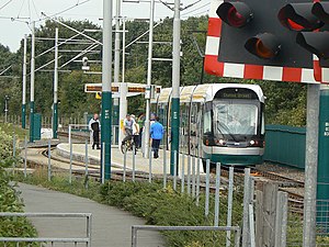
Bulwell station
Railway station and tram stop in Bulwell, Nottinghamshire, England
Distance: Approx. 122 meters
Latitude and longitude: 52.9993,-1.1954
Bulwell station, previously known as Bulwell Market station, is a railway station and tram stop serving the town of Bulwell, in Nottinghamshire, England. It is located on the Robin Hood Line and the Hucknall branch of the Nottingham Express Transit (NET).

Bulwell
Human settlement in England
Distance: Approx. 234 meters
Latitude and longitude: 53.001,-1.197
Bulwell is a market town and former civil parish in the Nottingham district, in the ceremonial county of Nottinghamshire, England. It is 3 miles (5 km) south-west of Hucknall and 4.5 miles (7 km) to the north-west of Nottingham. The United Kingdom Census 2011 recorded the population of Bulwell at 29,771 which amounted to over 10 per cent of Nottingham city's population.

Leen Valley
Distance: Approx. 833 meters
Latitude and longitude: 53.0058,-1.1923
The Leen Valley is the wide valley formed by the River Leen within the county of Nottinghamshire. The Leen Valley was once an important centre for hosiery and coal mining industries. Today, although light manufacturing continues, the valley is increasingly becoming part of the commuter belt for Nottingham.
Henry Mellish School and Specialist Sports College
Secondary school in Bulwell, Nottingham, Nottinghamshire, England
Distance: Approx. 855 meters
Latitude and longitude: 52.9934,-1.1882
Henry Mellish School and Specialist Sports College was a small, non-denominational secondary school in Bulwell, Nottingham, England, situated in an area of high social deprivation.

Church of St Mary the Virgin and All Souls, Bulwell
Church in Nottinghamshire, England
Distance: Approx. 235 meters
Latitude and longitude: 52.999932,-1.194034
The Church of St Mary the Virgin and All Souls, Bulwell is a parish church of the Church of England in Nottinghamshire, England. The church is Grade II listed by the Department for Digital, Culture, Media and Sport as it is a building of special architectural or historic interest.

Church of St John the Divine, Bulwell
Church
Distance: Approx. 577 meters
Latitude and longitude: 53.00388889,-1.19944444
The Church of St John the Divine, Bulwell is a parish church in the Church of England. The church is Grade II listed by the Department for Digital, Culture, Media and Sport as it is a building of special architectural or historic interest.
The Bulwell Academy
Academy in Bulwell, Nottingham, Nottinghamshire, England
Distance: Approx. 833 meters
Latitude and longitude: 53.0062,-1.1944
The Bulwell Academy (formerly Riverleen School and Henry Mellish School) is a large academy situated in Bulwell, Nottingham, England. The Bulwell Academy has 1250 places for 11- to 16-year-olds with up to a further 250 places for post-16 students.
Keuper Waterstones
Distance: Approx. 230 meters
Latitude and longitude: 53,-1.2
The Keuper Waterstones is a geologic formation in England. It preserves ichnofossils of Varanopus aff. curvidactylus, Swinnertonichnus mapperleyensis, Deuterotetrapous plancus, Chirotherium swinnertoni, Microsauropus acutipes and Erpetopus willistoni dating back to the Middle Triassic (Anisian) period.

Bulwell Forest tram stop
Nottingham Express Transit tram stop
Distance: Approx. 901 meters
Latitude and longitude: 53.005876,-1.190277
Bulwell Forest is a tram stop on the Nottingham Express Transit (NET) light rail system in the city of Nottingham in the suburb of Bulwell. It is part of the NET's initial system, and is situated on the long single line section between Bulwell and Hucknall tram stops that runs alongside the Robin Hood railway line. Like all the other intermediate stops on this section, the stop has a passing loop with an island platform situated between the two tracks of the loop.

Highbury Vale
Human settlement in England
Distance: Approx. 596 meters
Latitude and longitude: 52.995,-1.191
Highbury Vale is an area located in the city of Nottingham, and is located in the Bulwell Forest ward (which includes Rise Park and the western area of Top Valley). The area is located roughly 5.4 miles (8.7 km) from the City Centre, and about 1 mile (2 km) from Bulwell. Surrounding areas include Bulwell towards the North, Bestwood to the east, Hempshill Vale to the west and Cinderhill and Basford towards the south.

Old Town Hall, Bulwell
Municipal building in Bulwell, Nottinghamshire, England
Distance: Approx. 166 meters
Latitude and longitude: 53.0002,-1.1959
The Old Town Hall is a former municipal building in Bulwell, a town in Nottinghamshire, in England. The building, which is currently used as a furniture showroom on the ground floor and as a concert hall on the first floor, is locally listed.
Weather in this IP's area
overcast clouds
10 Celsius
10 Celsius
9 Celsius
11 Celsius
1022 hPa
95 %
1022 hPa
1016 hPa
10000 meters
0.45 m/s
1.79 m/s
246 degree
99 %