Country:
 Netherlands
Region:
City:
Latitude and Longitude:
Time Zone:
Postal Code:
IP information under different IP Channel
ip-api
Country
Region
City
ASN
Time Zone
ISP
Blacklist
Proxy
Latitude
Longitude
Postal
Route
IPinfo
Country
Region
City
ASN
Time Zone
ISP
Blacklist
Proxy
Latitude
Longitude
Postal
Route
MaxMind
Country
Region
City
ASN
Time Zone
ISP
Blacklist
Proxy
Latitude
Longitude
Postal
Route
Luminati
Country
NLRegion
zh
City
rotterdam
ASN
Time Zone
Europe/Amsterdam
ISP
i3D.net B.V
Latitude
Longitude
Postal
db-ip
Country
Region
City
ASN
Time Zone
ISP
Blacklist
Proxy
Latitude
Longitude
Postal
Route
ipdata
Country
Region
City
ASN
Time Zone
ISP
Blacklist
Proxy
Latitude
Longitude
Postal
Route
Popular places and events near this IP address
Sparta Stadion Het Kasteel
Football stadium
Distance: Approx. 1247 meters
Latitude and longitude: 51.919485,4.433619
The Sparta Stadion, nicknamed Het Kasteel (Dutch pronunciation: [ət kɑsˈteːl]) (en. The Castle)) is a football stadium in Rotterdam, Netherlands. It is the home ground of Sparta Rotterdam.

Overschie
Distance: Approx. 972 meters
Latitude and longitude: 51.93333333,4.43333333
Overschie is a neighborhood of Rotterdam, Netherlands, formerly a separate village with its own municipality. The village of Overschie was located on the intersection of four rivers called "Schie": the Delftsche Schie, Schiedamsche Schie, Delfshavensche Schie, and Rotterdamsche Schie. It was a separate municipality between 1817 and 1941, when it merged with Rotterdam.

Schiedam Centrum station
Metro and railway station in Schiedam, Netherlands
Distance: Approx. 1072 meters
Latitude and longitude: 51.92194444,4.41
Schiedam Centrum is a railway station and metro station in Schiedam, just to the west of Rotterdam, Netherlands, on the railway line between The Hague and Rotterdam Centraal. Train services are operated by Nederlandse Spoorwegen, and metro, tram and bus services are operated by Rotterdamse Elektrische Tram.

Van Nelle Factory
Former industrial complex in Rotterdam
Distance: Approx. 993 meters
Latitude and longitude: 51.92277778,4.43361111
The former Van Nelle Factory (Dutch: Van Nellefabriek) on the Schie in Rotterdam, is considered a prime example of the modernist and functionalist architecture. It has been a designated UNESCO World Heritage Site since 2014. Soon after it was built, prominent architects described the factory as "the most beautiful spectacle of the modern age" (Le Corbusier in 1932) and "a poem in steel and glass" (Robertson in 1930).
Kleinpolder
Neighborhood of Rotterdam in South Holland, Netherlands
Distance: Approx. 847 meters
Latitude and longitude: 51.93416667,4.42944444
Kleinpolder (Dutch pronunciation: [klɛimˈpɔldər]) is a neighborhood of Rotterdam, Netherlands.
Nieuw-Mathenesse
Neighborhood of Rotterdam in South Holland, Netherlands
Distance: Approx. 1438 meters
Latitude and longitude: 51.91527778,4.41944444
Nieuw-Mathenesse is a neighborhood of Rotterdam, Netherlands.

Spaanse Polder
Neighborhood of Rotterdam in South Holland, Netherlands
Distance: Approx. 427 meters
Latitude and longitude: 51.93055556,4.41722222
Spaanse Polder is a neighborhood of Rotterdam, Netherlands.

Spangen
Neighbourhood of Rotterdam in South Holland, Netherlands
Distance: Approx. 1492 meters
Latitude and longitude: 51.91666667,4.43333333
Spangen is a neighborhood of Rotterdam, Netherlands. It is in the west of the city with about 10000 inhabitants. From the entrance of Spangen to the center is formed by the Mathenesserbrug across the Delfshavense Schie.

Witte Dorp
Neighborhood of Rotterdam in South Holland, Netherlands
Distance: Approx. 1518 meters
Latitude and longitude: 51.9147,4.4261
Witte Dorp is a neighborhood of Rotterdam, Netherlands.
Oud-Mathenesse
Neighborhood of Rotterdam in South Holland, Netherlands
Distance: Approx. 1242 meters
Latitude and longitude: 51.91694444,4.42222222
Oud-Mathenesse is a neighborhood of Rotterdam, Netherlands.
Sparta Youth Academy
Football club
Distance: Approx. 1247 meters
Latitude and longitude: 51.919485,4.433619
The Sparta Youth Academy is a football youth academy based in Rotterdam, Netherlands, from where the organization manages a total of 13 youth teams (ages 7–18). The academy is the primary youth clinic of Dutch football club Sparta Rotterdam, the oldest professional football club in the Netherlands. The Academy received the four star academic sports certification, the highest possible rating for sports academies in the Netherlands, having won the best National football academy award on several occasions.

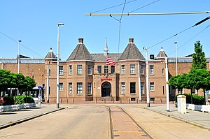
Spangen Castle
Distance: Approx. 238 meters
Latitude and longitude: 51.927328,4.425228
Spangen Castle (also known as ter Nesse) was a medieval castle near the village Overschie. It has disappeared completely. The Rotterdam city quarter Spangen was named for the castle.
Weather in this IP's area
scattered clouds
18 Celsius
18 Celsius
17 Celsius
19 Celsius
1008 hPa
92 %
1008 hPa
1008 hPa
10000 meters
4.63 m/s
180 degree
40 %
07:06:12
20:13:58