Country:
 country.xk
Region:
City:
Latitude and Longitude:
Time Zone:
Postal Code:
IP information under different IP Channel
ip-api
Country
Region
City
ASN
Time Zone
ISP
Blacklist
Proxy
Latitude
Longitude
Postal
Route
IPinfo
Country
Region
City
ASN
Time Zone
ISP
Blacklist
Proxy
Latitude
Longitude
Postal
Route
MaxMind
Country
Region
City
ASN
Time Zone
ISP
Blacklist
Proxy
Latitude
Longitude
Postal
Route
Luminati
Country
XKCity
pristina
ASN
Time Zone
Europe/Belgrade
ISP
TelKos L.L.C
Latitude
Longitude
Postal
db-ip
Country
Region
City
ASN
Time Zone
ISP
Blacklist
Proxy
Latitude
Longitude
Postal
Route
ipdata
Country
Region
City
ASN
Time Zone
ISP
Blacklist
Proxy
Latitude
Longitude
Postal
Route
Popular places and events near this IP address
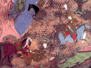
Battle of Kosovo (1448)
Part of the Ottoman wars in Europe and Ottoman-Hungarian Wars
Distance: Approx. 4251 meters
Latitude and longitude: 42.63,21.12
The Second Battle of Kosovo (Hungarian: második rigómezei csata, Turkish: İkinci Kosova Muharebesi) was a land battle between a Hungarian-led Crusader army and the Ottoman Empire at Kosovo field that took place from 17–20 October 1448. It was the culmination of a Hungarian offensive to avenge the defeat at the Battle of Varna four years earlier. In the three-day battle the Ottoman army under the command of Sultan Murad II defeated the Crusader army of regent John Hunyadi.
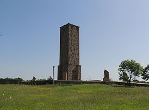
Gazimestan
Memorial site to the Battle of Kosovo (1389)
Distance: Approx. 3725 meters
Latitude and longitude: 42.69055556,21.12361111
Gazimestan (Serbian Cyrillic: Газиместан, Serbian pronunciation: [ɡaziměstaːn], Albanian: Gazimestani) is the name of a memorial site and monument commemorating the Battle of Kosovo (1389), situated about 6–7 kilometres southeast of the actual battlefield, known as the Kosovo field. Gazimestan is accessible from the Pristina–Mitrovica highway, on a 50-metre-high hill above the plain, ca. 5 km northwest of Pristina.
Gazimestan speech
June 1989 Slobodan Milošević speech
Distance: Approx. 3711 meters
Latitude and longitude: 42.69055556,21.12333333
The Gazimestan speech (Serbo-Croatian: Govor na Gazimestanu / Говор на Газиместану) was given on 28 June 1989 by Slobodan Milošević, then president of Serbia, at the Gazimestan monument on the Kosovo field. It was the centrepiece of a day-long event to mark the 600th anniversary of the Battle of Kosovo, which was fought at the site in 1389. The speech was delivered to a crowd of an estimated million or more attendees, and came against a backdrop of protracted ethnic tension between ethnic Serbs and Albanians in Kosovo and increasing political tensions between SR Serbia and the other constituent republics of the then SFR Yugoslavia caused by the anti-bureaucratic revolution.
Battle of Belaćevac Mine
Battle of the Kosovo War
Distance: Approx. 3270 meters
Latitude and longitude: 42.69,21.07777778
The Battle of Belaćevac Mine was a week-long clash between the Yugoslav Army (VJ), Serbian police (MUP) and the Kosovo Liberation Army (KLA) in June 1998, during the Kosovo War. It was fought over the Belaćevac coal mine, which powered two generating stations that supplied electricity to most of Kosovo. The KLA seized the mine on 22 June, taking nine Serb mineworkers hostage, converting the mine into a base of operations and taunting the Yugoslav authorities by sending daylight patrols within sight of the provincial capital, Pristina.

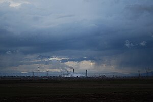
Kosovo A Power Station
Power station in Obiliq, Kosovo
Distance: Approx. 1642 meters
Latitude and longitude: 42.67527778,21.08333333
Kosovo A Power Station is a lignite power station with five units at Obiliq, Kosovo. It is the second largest power station in Kosovo with capacity of 650 MW after Kosovo B Power Station. It is described as the worst single-point source of pollution in Europe.

Church of the Nativity of the Theotokos, Obiliq
Distance: Approx. 3270 meters
Latitude and longitude: 42.69,21.07777778
The Church of the Nativity of the Most Holy Mother of God (Albanian: Kisha e Zonjushës; Serbian: Црква Мала Госпојина / Crkva Mala Gospojina) is a Serbian Orthodox Church in Obiliq, Kosovo. As of 2008, it serves some 2,200 Serbs in the municipality of Obiliq. It is ecclesiastically part of the Eparchy of Raška and Prizren.
Ugljare, Graçanicë
Village in Kosovo
Distance: Approx. 4047 meters
Latitude and longitude: 42.628388,21.106662
Ugljare (Serbian Cyrillic: Угљаре) or Uglara (Albanian: Uglarë), is a village in the Gračanica municipality of Kosovo. Ugljare was part of the Kosovo Polje municipality before the Gračanica Municipality was created. It is a Serb enclave; it has a supermajority of ethnic Serbs.

Kosovo Polje railway station
Railway station in Kosovo Polje, Kosovo
Distance: Approx. 3453 meters
Latitude and longitude: 42.6348,21.0815
Kosovo Polje railway station (Fushë Kosova railway station) is a station in the town of Kosovo Polje, Kosovo. It is the largest railway station in Kosovo and headquarters of Kosovo Railways. The station is situated in Pristina District, but the city of Pristina is served by Pristina railway station.
Bresje, Kosovo Polje
Village in Prishtinë, Kosovo
Distance: Approx. 4240 meters
Latitude and longitude: 42.62635,21.087411
Bresje (Serbian: Бресје, Ariljača; Albanian: Bresje) is a small town in the Municipality of Fushë Kosova, in Kosovo.

Mazgit
Village in Prishtinë, Kosovo
Distance: Approx. 2829 meters
Latitude and longitude: 42.689011,21.090821
Mazgit (Albanian: Mazgit, Serbian Cyrillic: Мазгит/Mazgit) is a village in the Obiliq municipality, Kosovo.

Embassy of the United Kingdom, Pristina
British diplomatic mission in Kosovo
Distance: Approx. 2981 meters
Latitude and longitude: 42.6466,21.1239
The British Embassy in Pristina (Albanian: Ambasada Britanike në Kosovë, Serbian: Британска амбасада у Косову) is the United Kingdom's diplomatic mission to Kosovo. It is located at 177 Lidhja e Pejës, Pristina, Kosovo. The embassy also represents the British Overseas Territories in Kosovo.

Ministry of Defence (Kosovo)
Ministry of the Kosovo government
Distance: Approx. 3668 meters
Latitude and longitude: 42.65511111,21.13927778
The Ministry of Defence (Albanian: Ministria e Mbrojtjes) is a department of the government of Kosovo responsible for the defence policy and management of the Kosovo Security Force. The ministry has its headquarters in Pristina, with Ejup Maqedonci as the incumbent defence minister in the second cabinet of Albin Kurti.
Weather in this IP's area
light rain
15 Celsius
14 Celsius
14 Celsius
15 Celsius
1018 hPa
89 %
1018 hPa
953 hPa
10000 meters
0.51 m/s
75 %
06:21:00
18:37:02