185.191.157.236 - IP Lookup: Free IP Address Lookup, Postal Code Lookup, IP Location Lookup, IP ASN, Public IP
Country:
Region:
City:
Location:
Time Zone:
Postal Code:
ISP:
ASN:
language:
User-Agent:
Proxy IP:
Blacklist:
IP information under different IP Channel
ip-api
Country
Region
City
ASN
Time Zone
ISP
Blacklist
Proxy
Latitude
Longitude
Postal
Route
db-ip
Country
Region
City
ASN
Time Zone
ISP
Blacklist
Proxy
Latitude
Longitude
Postal
Route
IPinfo
Country
Region
City
ASN
Time Zone
ISP
Blacklist
Proxy
Latitude
Longitude
Postal
Route
IP2Location
185.191.157.236Country
Region
limerick
City
abbeyfeale
Time Zone
Europe/Dublin
ISP
Language
User-Agent
Latitude
Longitude
Postal
ipdata
Country
Region
City
ASN
Time Zone
ISP
Blacklist
Proxy
Latitude
Longitude
Postal
Route
Popular places and events near this IP address

Abbeyfeale
Town in County Limerick, Ireland
Distance: Approx. 772 meters
Latitude and longitude: 52.386,-9.294
Abbeyfeale (; Irish: Mainistir na Féile, meaning 'abbey of the Feale') is a historic market town in County Limerick, Ireland, near the border with County Kerry. The town is on the N21 road from Limerick to Tralee, some 21 kilometres (13 miles) south-west of Newcastle West and 16 kilometres (10 miles) south-east of Listowel and 38 kilometres (24 miles) north-east of Tralee. The town is in a civil parish of the same name.
Brosna, County Kerry
Village in County Kerry, Ireland
Distance: Approx. 8094 meters
Latitude and longitude: 52.312,-9.267
Brosna (Irish: Brosnach) is a village and parish situated in the Sliabh Luachra area of County Kerry, Ireland. It lies 16 km (9.9 mi) from the town of Castleisland. The civil parish of Brosna consists of the village and a number of townlands.
Knocknagoshel
Village in County Kerry, Ireland
Distance: Approx. 7730 meters
Latitude and longitude: 52.33133,-9.38128
Knocknagoshel, officially Knocknagashel (Irish: Cnoc na gCaiseal, meaning 'hill of the stone ringforts'), is a village in County Kerry, Ireland. It is around 15 km south east of Listowel. According to the 2011 census, the population of the Knocknagashel Electoral Division (which includes the village and approximately 40 km2 of the surrounding rural hinterland) was 697 (down from 721 as of 2006).
Duagh
Village in County Kerry, Ireland
Distance: Approx. 7082 meters
Latitude and longitude: 52.416,-9.39
Duagh (Irish: Dubháth, meaning 'black ford') is a village in County Kerry, Ireland, located approximately 7 km southeast of Listowel and 7 km northwest of Abbeyfeale on the R555 road. It is also a civil parish and townland. Duagh is a dormitory village for Listowel and Abbeyfeale and a local service centre for the rural hinterland.
Templeglantine
Village in County Limerick, Ireland
Distance: Approx. 8190 meters
Latitude and longitude: 52.392931,-9.183449
Templeglantine (pronounced "Temple-glan-tin"), officially Templeglentan (Irish: Teampall an Ghleanntáin, meaning 'church of the little glen'), is a village in west County Limerick, Ireland between Newcastle West and Abbeyfeale on the N21 national primary route – the main road from Limerick to Tralee. The village is approximately 55 kilometres southwest of Limerick City and roughly 45 kilometres east of Tralee. Templeglantine is often simply referred to as 'Glantine' by natives and other west Limerick locals.
Abbeyfeale railway station
Former railway station in Ireland
Distance: Approx. 1405 meters
Latitude and longitude: 52.394,-9.3012
Abbeyfeale railway station served the market town of Abbeyfeale in County Limerick, Ireland.
Purt Castle
Castle in County Limerick, Ireland
Distance: Approx. 2333 meters
Latitude and longitude: 52.3995,-9.3198
Purt Castle or Port Castle (Irish: Caisleán Phort Trí Namhad) is a ruined Geraldine castle near Abbeyfeale, County Limerick, Ireland. The castle is known variously as 'Purt Castle', 'Port Castle', or 'Portrinard Castle' in sources. The remains of the castle are situated in the townland of Port (Irish: Port Trí Namhad) about 2 km northwest of the town of Abbeyfeale, on the north bank of the River Feale.
Father Casey's GAA
Sports club in Abbeyfeale, County Limerick, Ireland
Distance: Approx. 836 meters
Latitude and longitude: 52.38887222,-9.30375
Fr. Caseys GAA Club is an Irish Gaelic Athletic Association club based in Abbeyfeale on the border of counties Kerry and Limerick. Gaelic football is the club's main sport.
Ahane, County Kerry
Townland in Ireland
Distance: Approx. 4984 meters
Latitude and longitude: 52.359,-9.366
Ahane (Irish: Áthán) is a small townland approximately 8 kilometres (5 mi) west/northwest of Brosna village in County Kerry. It is close to the border with County Limerick. The area consists mostly of dairy farms.
Coláiste Íde agus Iosef
School in County Limerick, Ireland
Distance: Approx. 772 meters
Latitude and longitude: 52.3875,-9.2971
Coláiste Íde agus Iosef (colloquially referred to as CII) is a public secondary school in Abbeyfeale, County Limerick, Ireland. It was founded as a community college in 2011 and its catchment area extends into the counties of Limerick, Kerry and Cork.

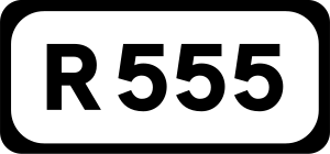
R555 road (Ireland)
Road in Ireland
Distance: Approx. 961 meters
Latitude and longitude: 52.389,-9.309201
The R555 road is a regional road in Ireland, located in County Kerry and County Limerick.
Abbeyfeale Aerodrome
Airport in Abbeyfeale, Ireland
Distance: Approx. 3028 meters
Latitude and longitude: 52.39583333,-9.34027778
Abbeyfeale Aerodrome is a recreational airfield serving Abbeyfeale, a town in County Limerick in Ireland. It is 3 kilometres (2 mi) west-northwest of Abbeyfeale. The runway has a 30 metres (98 ft) displaced threshold on each end.
Weather in this IP's area
overcast clouds
4 Celsius
3 Celsius
4 Celsius
4 Celsius
1006 hPa
95 %
1006 hPa
988 hPa
10000 meters
1.41 m/s
1.34 m/s
233 degree
89 %
