185.190.54.86 - IP Lookup: Free IP Address Lookup, Postal Code Lookup, IP Location Lookup, IP ASN, Public IP
Country:
Region:
City:
Location:
Time Zone:
Postal Code:
ISP:
ASN:
language:
User-Agent:
Proxy IP:
Blacklist:
IP information under different IP Channel
ip-api
Country
Region
City
ASN
Time Zone
ISP
Blacklist
Proxy
Latitude
Longitude
Postal
Route
db-ip
Country
Region
City
ASN
Time Zone
ISP
Blacklist
Proxy
Latitude
Longitude
Postal
Route
IPinfo
Country
Region
City
ASN
Time Zone
ISP
Blacklist
Proxy
Latitude
Longitude
Postal
Route
IP2Location
185.190.54.86Country
Region
nordrhein-westfalen
City
vreden
Time Zone
Europe/Berlin
ISP
Language
User-Agent
Latitude
Longitude
Postal
ipdata
Country
Region
City
ASN
Time Zone
ISP
Blacklist
Proxy
Latitude
Longitude
Postal
Route
Popular places and events near this IP address
Stadtlohn
Town in North Rhine-Westphalia, Germany
Distance: Approx. 7815 meters
Latitude and longitude: 51.9925,6.915
Stadtlohn (Low German: Stadlaun) is a city in western Münsterland in the northwest of North Rhine-Westphalia, and is a district town of the Borken administrative district. The city had a population of 20,746 inhabitants as of 2020. The River Berkel flows through the city on its way to the Netherlands.

Rekken
Village in Gelderland, Netherlands
Distance: Approx. 9589 meters
Latitude and longitude: 52.09611111,6.72472222
Rekken is a village in the Dutch municipality of Berkelland. It lies in the most northeast corner of the province of Gelderland, about half a mile from the German border. The river Berkel enters The Netherlands east of Rekken.

Battle of Stadtlohn
1623 battle of the Thirty Years' War
Distance: Approx. 8376 meters
Latitude and longitude: 52.01972222,6.94666667
The Battle of Stadtlohn was fought on 6 August 1623 between the armies of the Electoral Palatinate and of the Catholic League during the Thirty Years' War. The League's forces were led by Johann Tserclaes, Count of Tilly, the Protestants by Christian of Brunswick. The battle resulted in a resounding Catholic victory that largely ended the military resistance of the Palatinate forces and thus marked the end of the first phase of the Thirty Years' War.

Vreden
Town in North Rhine-Westphalia, Germany
Distance: Approx. 626 meters
Latitude and longitude: 52.03333333,6.83333333
Vreden is a small town in North Rhine-Westphalia, Germany near the Dutch border. The town is located near the river Berkel. The first mentioning of the town is proven for the year 839.

Stadtlohn-Vreden Airport
Airport in Stadtlohn
Distance: Approx. 4860 meters
Latitude and longitude: 51.99527778,6.84333333
Stadtlohn-Vreden Airport (German: Flugplatz Stadtlohn-Vreden) (ICAO: EDLS) is an airfield located 2.8 NM (5.2 km; 3.2 mi) west of Stadtlohn, in the Borken district, Germany. Its runway lays adjacent to the Dutch border. The airfield is used for general aviation, as well for gliding and skydiving.
Ölbach (Berkel)
River in Germany
Distance: Approx. 4274 meters
Latitude and longitude: 52.0631,6.7809
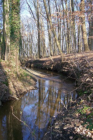
Ölbach is a river of North Rhine-Westphalia, Germany. It is a right tributary of the Berkel near Vreden. The Ölbach is one of the few outcrops of this region due to the topographic nature (gentle hills and flat land) of the Münsterland and is known for its numerous finds of belemnites.
Weather in this IP's area
few clouds
-1 Celsius
-5 Celsius
-1 Celsius
-1 Celsius
1020 hPa
93 %
1020 hPa
1014 hPa
10000 meters
2.52 m/s
3.58 m/s
261 degree
22 %

