Country:
Region:
City:
Latitude and Longitude:
Time Zone:
Postal Code:
IP information under different IP Channel
ip-api
Country
Region
City
ASN
Time Zone
ISP
Blacklist
Proxy
Latitude
Longitude
Postal
Route
Luminati
Country
ASN
Time Zone
Europe/Berlin
ISP
Deutsche Telekom AG
Latitude
Longitude
Postal
IPinfo
Country
Region
City
ASN
Time Zone
ISP
Blacklist
Proxy
Latitude
Longitude
Postal
Route
db-ip
Country
Region
City
ASN
Time Zone
ISP
Blacklist
Proxy
Latitude
Longitude
Postal
Route
ipdata
Country
Region
City
ASN
Time Zone
ISP
Blacklist
Proxy
Latitude
Longitude
Postal
Route
Popular places and events near this IP address
Main-Kinzig-Kreis
District in Hesse, Germany
Distance: Approx. 3240 meters
Latitude and longitude: 50.25,9.3
Main-Kinzig-Kreis is a Kreis (district) in the east of Hesse, Germany. Neighboring districts are Wetteraukreis, Vogelsbergkreis, Fulda, Bad Kissingen, Main-Spessart, Aschaffenburg, Offenbach and the district-free cities of Offenbach and Frankfurt.
Coleman Kaserne
US Army base in Hessen, Germany, 1933–1992
Distance: Approx. 7625 meters
Latitude and longitude: 50.20777778,9.17222222
Coleman Kaserne (original German name: Kaserne Gelnhausen) was a United States Army base located in the German city of Gelnhausen, located in the state of Hessen. Coleman Kaserne should not be confused with the U.S. Army "Coleman Barracks" which is located in Mannheim. Kaserne is a German word for barracks.

Wächtersbach
Town in Hesse, Germany
Distance: Approx. 3464 meters
Latitude and longitude: 50.25472222,9.29194444
The town of Wächtersbach is part of the Main-Kinzig-Kreis in Hesse, Germany. In 1982, the town hosted the 22nd Hessentag state festival.

Bad Orb
Town in Hesse, Germany
Distance: Approx. 5383 meters
Latitude and longitude: 50.21666667,9.35
Bad Orb (German: [baːt ˈɔʁp] ; "Thermae on the Orb River") is a spa town in the Main-Kinzig-Kreis district of Hesse, Germany. It is situated 32 kilometres (20 mi) east of Hanau between the forested hills of the Spessart. Bad Orb has a population of over 10,000.
Biebergemünd
Municipality in Hesse, Germany
Distance: Approx. 2075 meters
Latitude and longitude: 50.20694444,9.27972222
Biebergemünd is a municipality in the Main-Kinzig district, in Hesse, Germany. It has a population of over 8,000 and lies in the wooded hills of the Spessart.

Linsengericht
Municipality in Hesse, Germany
Distance: Approx. 7774 meters
Latitude and longitude: 50.16666667,9.21666667
Linsengericht is a municipality in the Main-Kinzig district, in Hesse, Germany.

Wintersberg (Spessart)
Distance: Approx. 6935 meters
Latitude and longitude: 50.22083333,9.37277778
Wintersberg is a wooded hill of Hesse, Germany. It lies in the Mittelgebirge Spessart, in the district of Main-Kinzig near the town of Bad Orb. The highest elevation is 434 meters above NHN. Wintersberg divides the valley of the Hasel from that of the Orb.
Bracht (river)
River in Germany
Distance: Approx. 3746 meters
Latitude and longitude: 50.25387,9.30372
The Bracht is a river of Hesse, Germany. It is a right-bank tributary of the Kinzig, into which it flows in Wächtersbach. In large sections, it formed the border between the former Grand Duchy of Hesse-Darmstadt, on the right bank, and the Kingdom of Prussia on the left bank.
Hasel (Orb)
River in Germany
Distance: Approx. 5201 meters
Latitude and longitude: 50.2278,9.3486
Hasel (also called Haselbach) is a river of Hesse, Germany. It is a right tributary of the Orb in Bad Orb.

Gelnhausen station
Railway station in Gelnhausen, Germany
Distance: Approx. 6928 meters
Latitude and longitude: 50.196617,9.189453
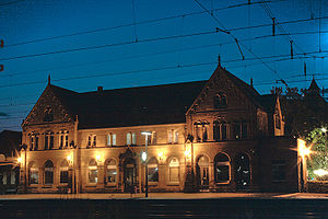
Gelnhausen station is the station of the town of Gelnhausen on the Frankfurt–Göttingen railway in the German state of Hesse.

Wächtersbach station
Railway station in Wächtersbach, Germany
Distance: Approx. 3610 meters
Latitude and longitude: 50.255,9.29638889
Wächtersbach station is a station in the town of Wächtersbach in the German state of Hesse on the Frankfurt–Göttingen railway. The former Bad Orb Light Railway (Bad Orber Kleinbahn) branches off at the station. It was originally standard gauge, but has been converted to narrow gauge.

Imperial Palace, Gelnhausen
Palace in Gelnhausen, Germany
Distance: Approx. 6369 meters
Latitude and longitude: 50.2,9.19555556
The Imperial Palace at Gelnhausen (called in German Kaiserpfalz Gelnhausen, Pfalz Gelnhausen or Barbarossaburg) is located on a former island in the Kinzig river in Gelnhausen, Hesse, Germany.
Weather in this IP's area
broken clouds
6 Celsius
3 Celsius
5 Celsius
6 Celsius
1014 hPa
93 %
1014 hPa
996 hPa
10000 meters
4.05 m/s
10.74 m/s
259 degree
72 %
07:40:16
16:35:52


