Country:
Region:
City:
Latitude and Longitude:
Time Zone:
Postal Code:
IP information under different IP Channel
ip-api
Country
Region
City
ASN
Time Zone
ISP
Blacklist
Proxy
Latitude
Longitude
Postal
Route
Luminati
Country
City
pristina
ASN
Time Zone
Europe/Belgrade
ISP
N.P.SH ISP - Broadcast
Latitude
Longitude
Postal
IPinfo
Country
Region
City
ASN
Time Zone
ISP
Blacklist
Proxy
Latitude
Longitude
Postal
Route
db-ip
Country
Region
City
ASN
Time Zone
ISP
Blacklist
Proxy
Latitude
Longitude
Postal
Route
ipdata
Country
Region
City
ASN
Time Zone
ISP
Blacklist
Proxy
Latitude
Longitude
Postal
Route
Popular places and events near this IP address

Albania
Country in Southeast Europe
Distance: Approx. 3557 meters
Latitude and longitude: 41,20
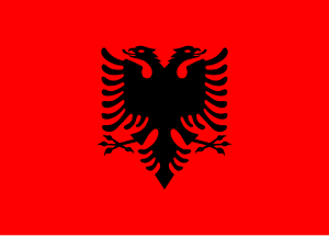
Albania ( a(w)l-BAY-nee-ə; Albanian: Shqipëri or Shqipëria), officially the Republic of Albania (Albanian: Republika e Shqipërisë), is a country in Southeast Europe. It is located in the Balkans, on the Adriatic and Ionian Seas within the Mediterranean Sea, and shares land borders with Montenegro to the northwest, Kosovo to the northeast, North Macedonia to the east and Greece to the south. With an area of 28,748 km2 (11,100 sq mi), it has a varied range of climatic, geological, hydrological and morphological conditions.

Albanian Kingdom (1928–1939)
Kingdom in Europe between 1928 and 1939
Distance: Approx. 3557 meters
Latitude and longitude: 41,20
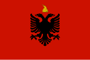
The Albanian Kingdom (Tosk Albanian: Mbretëria Shqiptare) was the official name of Albania between 1928 and 1939. Albania was declared a monarchy by the Constituent Assembly, and President Ahmet Bej Zogu was declared King Zog I. The kingdom was supported by the fascist regime in Italy, and the two countries maintained close relations until Italy's sudden invasion of the country in 1939. Zog fled into exile and never saw his country again.

Albanian Republic (1925–1928)
Republic in Europe between 1925 and 1928
Distance: Approx. 3557 meters
Latitude and longitude: 41,20
The Albanian Republic (Albanian: Republika Shqiptare) was the official name of Albania as enshrined in the Constitution of 1925. Albania came into an alliance with the Kingdom of Italy after signing the Treaties of Tirana, which gave Italy a monopoly on shipping and trade concessions. Albania was declared a constitutional monarchy in 1928.
Banjë Hydro Power Plant
Dam in Banjë
Distance: Approx. 4931 meters
Latitude and longitude: 40.964,20.068
Banjë Hydro Power Plant is a large hydroelectricity plant on the river Devoll situated near the village of Banjë, Albania. It was built by Devoll Hydropower, an Albanian company owned by Norwegian power company Statkraft. The project consists of a large power plant with a nominal capacity of 70 MW and an average annual production of 242 GWh.
Tregan
Municipal unit in Elbasan, Albania
Distance: Approx. 8623 meters
Latitude and longitude: 41.03333333,20.06666667
Tregan is a village and a former municipality in the Elbasan County, central Albania. At the 2015 local government reform it became a subdivision of the municipality Elbasan. The population at the 2011 census was 3,036.
Gostimë
Municipal unit in Elbasan, Albania
Distance: Approx. 3511 meters
Latitude and longitude: 41,20.01666667
Gostimë is a village and a former municipality in the Elbasan County, central Albania. At the 2015 local government reform it became a subdivision of the municipality Cërrik. The population at the 2011 census was 8,116.
Klos, Elbasan
Municipal unit in Elbasan, Albania
Distance: Approx. 2184 meters
Latitude and longitude: 40.95,20.01666667
Klos is a village and a former municipality in Elbasan County, central Albania. At the 2015 local government reform it became a subdivision of the municipality Cërrik. The population at the 2011 census was 3,262.
Mollas, Elbasan
Municipal unit in Elbasan, Albania
Distance: Approx. 4042 meters
Latitude and longitude: 40.93333333,20
Mollas is a village and a former municipality in the Elbasan County, central Albania. At the 2015 local government reform it became a subdivision of the municipality Cërrik. The population at the 2011 census was 5,530.
Shalës
Municipal unit in Elbasan, Albania
Distance: Approx. 6095 meters
Latitude and longitude: 41,19.95
Shalës is a village and a former municipality in the Elbasan County, central Albania. At the 2015 local government reform it became a subdivision of the municipality Cërrik. The population at the 2011 census was 3,842.
Grekan
Municipal unit in Elbasan, Albania
Distance: Approx. 6393 meters
Latitude and longitude: 40.93333333,19.95
Grekan is a village and a former municipality in the Elbasan County, central Albania. At the 2015 local government reform it became a subdivision of the municipality Belsh. The population at the 2011 census was 3,138.
Floq, Cërrik
Village in Elbasan, Albania
Distance: Approx. 5231 meters
Latitude and longitude: 40.95,20.06666667
Floq is a village in the former municipality of Klos, Elbasan County, central Albania. At the 2015 local government reform it became part of the municipality Cërrik. Floq contains vast amount of land which its residents use for produce such as grapes, corn, wheat, apple, plumb, cherry & fig trees, along with other various produce.
Nexhip Trungu Stadium
Multi-use stadium in Elbasan County, Albania
Distance: Approx. 6957 meters
Latitude and longitude: 41.03027778,19.99411111
Nexhip Trungu Stadium (Albanian: Stadiumi Nexhip Trungu) is a multi-use stadium in Cërrik, Elbasan County, Albania which is used as the home ground of local football club Turbina Cërrik. In 2015, Turbina Cërrik were promoted to the Albanian First Division, the second tier of Albanian football, and Cërrik Municipality made minor improvements to the stadium which included the installation of 350 new seats in the main stand as well as a renovation of the changing rooms.
Weather in this IP's area
clear sky
16 Celsius
15 Celsius
16 Celsius
16 Celsius
1018 hPa
46 %
1018 hPa
1007 hPa
10000 meters
1.94 m/s
2.36 m/s
50 degree
06:28:57
16:20:53