Country:
Region:
City:
Latitude and Longitude:
Time Zone:
Postal Code:
IP information under different IP Channel
ip-api
Country
Region
City
ASN
Time Zone
ISP
Blacklist
Proxy
Latitude
Longitude
Postal
Route
Luminati
Country
Region
hdf
City
laventie
ASN
Time Zone
Europe/Paris
ISP
Scalair SAS
Latitude
Longitude
Postal
IPinfo
Country
Region
City
ASN
Time Zone
ISP
Blacklist
Proxy
Latitude
Longitude
Postal
Route
db-ip
Country
Region
City
ASN
Time Zone
ISP
Blacklist
Proxy
Latitude
Longitude
Postal
Route
ipdata
Country
Region
City
ASN
Time Zone
ISP
Blacklist
Proxy
Latitude
Longitude
Postal
Route
Popular places and events near this IP address
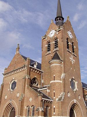
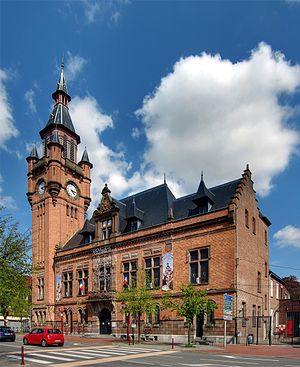
Laventie
Commune in Hauts-de-France, France
Distance: Approx. 350 meters
Latitude and longitude: 50.6283,2.7719
Laventie (French pronunciation: [lavɑ̃ti]; West Flemish: Wentie) is a commune in the Pas-de-Calais department in the Hauts-de-France region of France.

George McElroy
World War I flying ace (1893–1918)
Distance: Approx. 547 meters
Latitude and longitude: 50.63611111,2.77361111
Captain George Edward Henry McElroy MC & Two Bars, DFC & Bar (14 May 1893 – 31 July 1918) was a leading Irish fighter pilot of the Royal Flying Corps and Royal Air Force during World War I. He was credited with 47 aerial victories.

Fleurbaix
Commune in Hauts-de-France, France
Distance: Approx. 4875 meters
Latitude and longitude: 50.6531,2.8336
Fleurbaix (French pronunciation: [flœʁbɛ]; West Flemish: Vloerbeek) is a commune in the Pas-de-Calais department in the Hauts-de-France region of France.
Sailly-sur-la-Lys
Commune in Hauts-de-France, France
Distance: Approx. 3024 meters
Latitude and longitude: 50.6583,2.7708
Sailly-sur-la-Lys (French pronunciation: [saji syʁ la lis], literally Sailly on the Lys; West Flemish: Zelleken) is a commune in the Pas-de-Calais department in the Hauts-de-France region of France.
Canton of Laventie
Distance: Approx. 345 meters
Latitude and longitude: 50.628334,2.771945
The Canton of Laventie was one of the 14 cantons of the arrondissement of Béthune, in the Pas-de-Calais department, in northern France. It had 18,792 inhabitants in 2012. It was disbanded following the French canton reorganisation which came into effect in March 2015.

Estaires
Commune in Hauts-de-France, France
Distance: Approx. 3837 meters
Latitude and longitude: 50.6444,2.7236
Estaires (French pronunciation: [etɛʁ]; West Flemish: Stegers) is a commune in the Nord department of the Hauts-de-France region in northern France. The town gives its name to a type of chicken bred in the area: the Estaires chicken.

La Gorgue
Commune in Hauts-de-France, France
Distance: Approx. 4042 meters
Latitude and longitude: 50.6378,2.7175
La Gorgue (French pronunciation: [la ɡɔʁɡ]) is a town in northern France. It is a commune in the Nord department. The population of La Gorgue in 2019 was 5,639.
Lawe
River in France
Distance: Approx. 4969 meters
Latitude and longitude: 50.63972222,2.70472222
The Lawe (French pronunciation: [lav] ) is a river of northern France, and a right tributary of the Lys. It is 41 km (25 mi) long. Its source is near Magnicourt-en-Comte.

Ernest Deane
Irish rugby union player
Distance: Approx. 3014 meters
Latitude and longitude: 50.60436,2.76823
Ernest Cotton Deane (4 May 1887 – 25 September 1915) was a medical officer of the British Indian Army and an Irish international rugby player. Born in the city of Limerick, Ireland, he went to school in Kingstown (present day Dún Laoghaire) in County Dublin and then studied medicine at the Royal College of Surgeons in Ireland (RCSI), graduating in 1909. He was selected to play rugby for Ireland in one match, against England in February 1909.

V.C. Corner Australian Cemetery and Memorial
WWI CWGC cemetery in Nord, France
Distance: Approx. 4432 meters
Latitude and longitude: 50.61972222,2.83388889
The V.C. Corner Australian Cemetery and Memorial is a Commonwealth War Graves Commission (CWGC) World War I cemetery and memorial. It is in the commune of Fromelles, in the Nord departement of France, about 2 kilometres (1.2 mi) northwest of the village of Fromelles on the D22C road (rue Delval).
Le Trou Aid Post Cemetery
Cemetery located in Pas-de-Calais, in France
Distance: Approx. 3802 meters
Latitude and longitude: 50.62388889,2.82638889
The Le Trou Aid Post Cemetery is a World War I cemetery located in the commune of Fleurbaix, in the Pas-de-Calais departement of France, about 3 kilometres (1.9 mi) south of the village of Fleurbaix on the D175 road (rue de Pétillon). British soldiers of the 19th Infantry Brigade made the earliest burials at the site in October 1914 during the First Battle of Ypres. By the end of the war, the cemetery contained 123 graves.
Rue-du-Bois Military Cemetery
Cemetery in Pas-de-Calais, France
Distance: Approx. 3446 meters
Latitude and longitude: 50.62916667,2.8225
The Rue-du-Bois Military Cemetery is a World War I cemetery located in the commune of Fleurbaix, in the Pas-de-Calais departement of France, about 3 kilometres (1.9 mi) southwest of the village of Fleurbaix on the D171 road (rue Louis Bouquet), just before the hamlet of Pétillon. Of the 845 graves, 395 are of unknown soldiers.
Weather in this IP's area
overcast clouds
4 Celsius
3 Celsius
4 Celsius
6 Celsius
1034 hPa
94 %
1034 hPa
1032 hPa
10000 meters
2.15 m/s
4.38 m/s
46 degree
100 %
08:01:06
17:05:34


