Country:
 France
Region:
City:
Latitude and Longitude:
Time Zone:
Postal Code:
IP information under different IP Channel
ip-api
Country
Region
City
ASN
Time Zone
ISP
Blacklist
Proxy
Latitude
Longitude
Postal
Route
IPinfo
Country
Region
City
ASN
Time Zone
ISP
Blacklist
Proxy
Latitude
Longitude
Postal
Route
MaxMind
Country
Region
City
ASN
Time Zone
ISP
Blacklist
Proxy
Latitude
Longitude
Postal
Route
Luminati
Country
FRRegion
hdf
City
douvrin
ASN
Time Zone
Europe/Paris
ISP
Scalair SAS
Latitude
Longitude
Postal
db-ip
Country
Region
City
ASN
Time Zone
ISP
Blacklist
Proxy
Latitude
Longitude
Postal
Route
ipdata
Country
Region
City
ASN
Time Zone
ISP
Blacklist
Proxy
Latitude
Longitude
Postal
Route
Popular places and events near this IP address

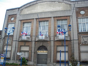
Douvrin
Commune in Hauts-de-France, France
Distance: Approx. 272 meters
Latitude and longitude: 50.5106,2.8322
Douvrin (French pronunciation: [duvʁɛ̃]; West Flemish: Doverin) is a commune in the Pas-de-Calais department in the Hauts-de-France region of France.

Bénifontaine
Commune in Hauts-de-France, France
Distance: Approx. 2377 meters
Latitude and longitude: 50.4878,2.8311
Bénifontaine (French pronunciation: [benifɔ̃tɛn]) is a commune in the Pas-de-Calais department in the Hauts-de-France region in northern France.

Billy-Berclau
Commune in Hauts-de-France, France
Distance: Approx. 2635 meters
Latitude and longitude: 50.5197,2.8683
Billy-Berclau (French pronunciation: [bili bɛʁklo]; Picard: Bili-Bérclo) is a commune in the Pas-de-Calais department in the Hauts-de-France region in northern France.
Wingles
Commune in Hauts-de-France, France
Distance: Approx. 2178 meters
Latitude and longitude: 50.4947,2.8561
Wingles (French pronunciation: [vɛ̃ɡl]) is a commune of the Pas-de-Calais department in the Hauts-de-France region of France.

Canton of Douvrin
Canton in Hauts-de-France, France
Distance: Approx. 2259 meters
Latitude and longitude: 50.52083333,2.80916667
The Canton of Douvrin is one of the cantons of the arrondissement of Béthune, in the Pas-de-Calais department, in northern France. Its seat is the town Douvrin.

Canton of Wingles
Canton in Hauts-de-France, France
Distance: Approx. 2765 meters
Latitude and longitude: 50.48694444,2.85305556
The Canton of Wingles is a canton of France, located in the Pas-de-Calais department, in the Hauts-de-France region.
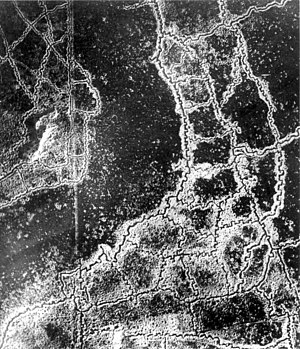
Gas attacks at Hulluch
Distance: Approx. 2781 meters
Latitude and longitude: 50.48666667,2.8175
The Gas Attacks at Hulluch were two German cloud gas attacks on British troops during World War I, from 27 to 29 April 1916, near the village of Hulluch, 1 mi (1.6 km) north of Loos in northern France. The gas attacks were part of an engagement between divisions of the II Royal Bavarian Corps and divisions of the British I Corps. Just before dawn on 27 April, the 16th (Irish) Division and part of the 15th (Scottish) Division were subjected to a cloud gas attack near Hulluch.

La Bassée
Commune in Hauts-de-France, France
Distance: Approx. 3394 meters
Latitude and longitude: 50.5342,2.8081
La Bassée (French pronunciation: [la bas'e]) is a commune in the Nord department in northern France.

Hulluch
Commune in Hauts-de-France, France
Distance: Approx. 2778 meters
Latitude and longitude: 50.4867,2.8175
Hulluch (French pronunciation: [yly]) is a commune in the Pas-de-Calais department in the Hauts-de-France region of France.

Haisnes
Commune in Hauts-de-France, France
Distance: Approx. 2308 meters
Latitude and longitude: 50.5086,2.8025
Haisnes (French pronunciation: [ɛn]) is a commune in the Pas-de-Calais department in the Hauts-de-France region of France.
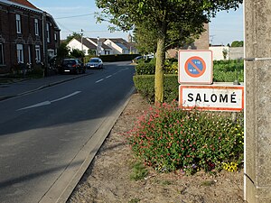
Salomé, Nord
Commune in Hauts-de-France, France
Distance: Approx. 2981 meters
Latitude and longitude: 50.5356,2.84
Salomé (French pronunciation: [salɔme]) is a commune in the Nord department in northern France. It is part of the Métropole Européenne de Lille.

Battle of La Bassée
Battle during the First World War
Distance: Approx. 3393 meters
Latitude and longitude: 50.53416667,2.80805556
The Battle of La Bassée was fought by German and Franco-British forces in northern France in October 1914, during reciprocal attempts by the contending armies to envelop the northern flank of their opponent, which has been called the Race to the Sea. The 6th Army took Lille before a British force could secure the town and the 4th Army attacked the exposed British flank further north at Ypres. The British were driven back and the German army occupied La Bassée and Neuve Chapelle.
Weather in this IP's area
clear sky
24 Celsius
24 Celsius
23 Celsius
25 Celsius
1017 hPa
60 %
1017 hPa
1014 hPa
10000 meters
2.06 m/s
140 degree
07:33:49
19:49:31