Country:
Region:
City:
Latitude and Longitude:
Time Zone:
Postal Code:
IP information under different IP Channel
ip-api
Country
Region
City
ASN
Time Zone
ISP
Blacklist
Proxy
Latitude
Longitude
Postal
Route
Luminati
Country
ASN
Time Zone
Europe/Berlin
ISP
Droptop GmbH
Latitude
Longitude
Postal
IPinfo
Country
Region
City
ASN
Time Zone
ISP
Blacklist
Proxy
Latitude
Longitude
Postal
Route
db-ip
Country
Region
City
ASN
Time Zone
ISP
Blacklist
Proxy
Latitude
Longitude
Postal
Route
ipdata
Country
Region
City
ASN
Time Zone
ISP
Blacklist
Proxy
Latitude
Longitude
Postal
Route
Popular places and events near this IP address

Brandenburg
State in Germany
Distance: Approx. 3459 meters
Latitude and longitude: 52.36194444,13.00805556
Brandenburg, officially the State of Brandenburg (see Names), is a state in northeastern Germany. Brandenburg borders Poland and the states of Berlin, Mecklenburg-Vorpommern, Lower Saxony, Saxony-Anhalt, and Saxony. It is the fifth-largest German state by area and the tenth-most populous, with 2.5 million residents.

Werder (Havel)
Town in Brandenburg, Germany
Distance: Approx. 2785 meters
Latitude and longitude: 52.38333333,12.93333333
Werder (Havel) (official name derived from Werder an der Havel ("Werder upon Havel"), colloquially just Werder) is a town in the state of Brandenburg, Germany, located on the Havel river in the Potsdam-Mittelmark district, west of the state's capital Potsdam. Werder has a long and rich history and is a nationally recognized Erholungsort – a government designation given to regions of Germany that have been recognized and must be continuously re-certified as having air and climate qualities which provide a healthful environment to visitors. Werder is also famous for hosting a Cherry Blossom Festival, the Baumblütenfest, every May.

Schwielowsee (municipality)
Municipality in Brandenburg, Germany
Distance: Approx. 3365 meters
Latitude and longitude: 52.33333333,12.96666667
Schwielowsee (German pronunciation: [ˈʃviːloːˌzeː] ) is a municipality in the Potsdam-Mittelmark district, in Brandenburg, Germany. It is situated on the shore of the Schwielowsee lake, through which the River Havel flows. The municipality was founded on December 31, 2002 in merger of the three villages Caputh, Geltow and Ferch.
Tiene (container)
Container for transporting wine and fruit in Germany
Distance: Approx. 1817 meters
Latitude and longitude: 52.36923333,12.9325
A Tiene (plural: Tienen), sometimes also called Tine or Obsttiene (Obst is German for fruit), was a special container for transporting wine and fruit. These were used until shortly after the First World War, mostly in the Brandenburg city of Werder in northern Germany. Normally the wooden tubs were carried on people's backs to small boats and shipped on the Havel River to market stalls in Berlin.

Caputh, Brandenburg
Ortsteil of Schwielowsee in Brandenburg, Germany
Distance: Approx. 3015 meters
Latitude and longitude: 52.34388889,12.98861111
Caputh (also known as Kaputh) is a village in the municipality of Schwielowsee, Potsdam-Mittelmark, Brandenburg, Germany. Caputh got a railway station in 1904. Since the early 20th century it was seen as a remote residential area by wealthy urban people.

Caputh Ferry
Distance: Approx. 2574 meters
Latitude and longitude: 52.347498,12.985282
The Caputh Ferry is a vehicular cable ferry in the municipality of Schwielowsee of the state of Brandenburg, Germany. It crosses the River Havel at its outlet from the Templiner See to the Schwielowsee, and crosses between the villages of Caputh and Geltow.

Werderaner Wachtelberg
Vineyard in Brandenburg, Germany
Distance: Approx. 1787 meters
Latitude and longitude: 52.36972222,12.93333333
The Werderaner Wachtelberg is a 6.2 hectares (15 acres) vineyard in the town of Werder (Havel) in Brandenburg. As the northernmost outpost of the Saale-Unstrut wine region, it is the most northern registered location for QbA quality wine in Germany.

Schwielowsee
Distance: Approx. 2815 meters
Latitude and longitude: 52.337752,12.954941
Schwielowsee (German pronunciation: [ˈʃviːloːˌzeː] ) is a lake in the state of Brandenburg, Germany. It is situated to the south and west of the city of Potsdam. The villages of Caputh, Ferch and Geltow, on the banks of the lake, form the municipality of Schwielowsee.

Kommando Landstreitkräfte
Military unit
Distance: Approx. 2756 meters
Latitude and longitude: 52.38627778,12.97102778
The Kommando Landstreitkräfte (short: Kdo LaSK or Kommando LaSK) was the Army staff — and simultaneously the Army command of the National People's Army (NPA) Land Forces of the former GDR.

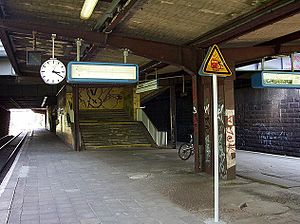
Potsdam Pirschheide station
Railway station in Potsdam, Germany
Distance: Approx. 3823 meters
Latitude and longitude: 52.37277778,13.01111111
Potsdam Pirschheide station is a station on the Berlin outer ring. It was opened in 1958 as Potsdam Süd (south) station and was called Potsdam Hauptbahnhof (main station) from 1961 to 1993. In this period it was the most important station on the outer ring after Berlin Schönefeld Flughafen station.
Caputh-Schwielowsee station
Railway station in Brandenburg, Germany
Distance: Approx. 2904 meters
Latitude and longitude: 52.34112,12.98046
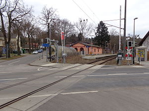
Caputh-Schwielowsee station is a railway station in Caputh, district of the municipality Schwielowsee located in the district of Potsdam-Mittelmark, Brandenburg, Germany.

Caputh-Geltow station
Train station in Potsdam-Mittelmark, Brandenburg, Germany
Distance: Approx. 2336 meters
Latitude and longitude: 52.35048,12.98478
Caputh-Geltow station is a railway station in Geltow, district of the municipality Schwielowsee located in the district of Potsdam-Mittelmark, Brandenburg, Germany.
Weather in this IP's area
overcast clouds
10 Celsius
9 Celsius
9 Celsius
11 Celsius
1030 hPa
97 %
1030 hPa
1027 hPa
10000 meters
1.64 m/s
2.38 m/s
132 degree
100 %
07:09:58
16:33:29

