185.185.253.107 - IP Lookup: Free IP Address Lookup, Postal Code Lookup, IP Location Lookup, IP ASN, Public IP
Country:
Region:
City:
Location:
Time Zone:
Postal Code:
ISP:
ASN:
language:
User-Agent:
Proxy IP:
Blacklist:
IP information under different IP Channel
ip-api
Country
Region
City
ASN
Time Zone
ISP
Blacklist
Proxy
Latitude
Longitude
Postal
Route
db-ip
Country
Region
City
ASN
Time Zone
ISP
Blacklist
Proxy
Latitude
Longitude
Postal
Route
IPinfo
Country
Region
City
ASN
Time Zone
ISP
Blacklist
Proxy
Latitude
Longitude
Postal
Route
IP2Location
185.185.253.107Country
Region
kyivska oblast
City
khotiv
Time Zone
Europe/Kiev
ISP
Language
User-Agent
Latitude
Longitude
Postal
ipdata
Country
Region
City
ASN
Time Zone
ISP
Blacklist
Proxy
Latitude
Longitude
Postal
Route
Popular places and events near this IP address

National Museum of Folk Architecture and Folkways of Ukraine
Open-air museum in Kyiv, Ukraine
Distance: Approx. 4091 meters
Latitude and longitude: 50.35453889,30.51223056
National Museum of Folk Architecture and Folkways of Ukraine (Ukrainian: Національний музей народної архітектури та побуту України), is a 133.5 hectare open-air museum located at 1 Akademika Tronka Street, in the Pyrohiv neighbourhood of Holosiivskyi District, Kyiv, Ukraine. An architectural and landscape complex representing the major historical and ethnographic regions of Ukraine, it is dedicated to the preservation and study of regional Ukrainian folkways.

Feofaniia
Historical neighborhood near Kyiv, Ukraine
Distance: Approx. 1735 meters
Latitude and longitude: 50.34083333,30.48694444
Feofaniia or Teofaniia (Ukrainian: Феофáнія, Теофáнія; also called Theophania) is a park located in the historical neighborhood on a tract near the southern outskirts of Kyiv, the capital of Ukraine. The neighborhood is located in the administrative Holosiiv Raion (district) amidst the neighborhoods of Holosiiv, Teremky, Pyrohiv and Khotiv. The park's total area is about 1.5 km2 (0.58 sq mi).

Khotiv
Rural locality in Kyiv Oblast, Ukraine
Distance: Approx. 318 meters
Latitude and longitude: 50.33333333,30.46666667
Khotiv is a village in Obukhiv Raion of Kyiv Oblast, Ukraine. It hosts the administration of Feodosiivska rural hromada, one of the hromadas of Ukraine. Khotiv adjoins the boundary of Kyiv in its southwestern outskirts (Feofaniia, Holosiivskyi District).

St. Panteleimon's Cathedral
Cathedral in Ukraine
Distance: Approx. 2085 meters
Latitude and longitude: 50.34472222,30.48786111
The Cathedral of St. Panteleimon (St. Pantaleon) is a large Eastern Orthodox cathedral in the Kyivan neighbourhood of Feofaniia.
Academy of Technological Sciences of Ukraine
Distance: Approx. 3986 meters
Latitude and longitude: 50.3623,30.442
The Academy of Technological Sciences of Ukraine (ATS of Ukraine, ATSU) is a Ukrainian national academy, a public organization aiming at the consolidation of the intellectual and industrial-technological potential of applied scientists, technologists, and other experts in Ukraine.

Chabany
Rural locality in Kyiv Oblast, Ukraine
Distance: Approx. 3412 meters
Latitude and longitude: 50.34027778,30.42277778
Chabany (Ukrainian: Чабани) is a rural settlement in Fastiv Raion of Kyiv Oblast (province), located on the southern border of Kyiv. It hosts the administration of Chabany settlement hromada, one of the hromadas of Ukraine. Population: 5,334 (2022 estimate).
Ipodrom (Kyiv Metro)
Kyiv Metro Station
Distance: Approx. 5086 meters
Latitude and longitude: 50.37638889,30.46888889
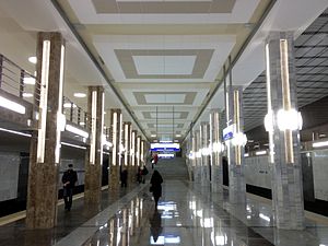
Ipodrom (Ukrainian: Іподром, ) is a station on the Kyiv Metro's Obolonsko–Teremkivska Line that opened on 25 October 2012. It is located towards the southern end of the line, located just after the Vystavkovyi Tsentr station, opened a year earlier in late 2011, and before the Teremky station which opened on 6 November 2013. Ipodrom is named after Kyiv's horse racetrack and equestrian park which is located a short distance from the station.
Teremky (Kyiv Metro)
Kyiv Metro Station
Distance: Approx. 4170 meters
Latitude and longitude: 50.36704444,30.45420278
Teremky (Ukrainian: Теремки, ) is a station on the Kyiv Metro's Obolonsko–Teremkivska Line opened on 6 November 2013. It is the southern end of the line, located just after the Ipodrom station. The station is named after the Teremky neighborhood of Kyiv.
Feofaniya Clinical Hospital
Hospital in Kyiv, Ukraine
Distance: Approx. 3748 meters
Latitude and longitude: 50.36215,30.487254
Feofaniya Clinical Hospital (Ukrainian: Клінічна Лікарня "Феофанія") is a hospital of State Management of Affairs of Ukraine which designated to provide medical service to Ukrainian officials. It is located on the southern outskirts of Kyiv next to village of Novosilky of Fastiv Raion. Next to the hospital also is located the Main Astronomical Observatory of the National Academy of Sciences of Ukraine.

Teremky
Neighborhood of Kyiv in Holosiivskyi District, Ukraine
Distance: Approx. 4159 meters
Latitude and longitude: 50.36694444,30.45416667
Teremky (Ukrainian: Теремки pronounced [teremˈkɪ]) is a neighborhood located in the Holosiivskyi district of Kyiv, the capital of Ukraine. It is located in the southern part of the city, in between the city's Holosiiv, Feofaniia, and Zhuliany neighborhoods. The National Expocenter of Ukraine and Kyiv's Ipodrom horse racetrack are located in the neighborhood.

Khotiv hillfort
Historic site
Distance: Approx. 1415 meters
Latitude and longitude: 50.33361111,30.48777778
Khotiv hillfort is a hillfort of early Iron Age (Scythian times, 6 century BC) in the village of Khotiv, Ukraine. The hillfort adjoins the southern part of Kyiv, namely Feofaniya Park. It occupies a rhombic plateau 1000x700 m wide, bordered by valleys of the streams.

Odesa Square
Street in Kyiv, Ukraine
Distance: Approx. 4430 meters
Latitude and longitude: 50.37,30.45861111
Odesa Square (or Odeska Square; Ukrainian: Одеська площа, romanized: Odeska ploshcha, pronounced [ɔˈdɛsʲkɐ ˈpɫɔʃt͡ʃɐ]) is one of the squares of Kyiv, Ukraine. It is located in the neighborhood Teremky in the Holosiiv Raion of Kyiv. It was named after big Ukrainian city port Odesa.
Weather in this IP's area
clear sky
1 Celsius
-3 Celsius
1 Celsius
1 Celsius
1025 hPa
90 %
1025 hPa
1008 hPa
10000 meters
3.02 m/s
8.09 m/s
292 degree


