185.184.220.153 - IP Lookup: Free IP Address Lookup, Postal Code Lookup, IP Location Lookup, IP ASN, Public IP
Country:
Region:
City:
Location:
Time Zone:
Postal Code:
IP information under different IP Channel
ip-api
Country
Region
City
ASN
Time Zone
ISP
Blacklist
Proxy
Latitude
Longitude
Postal
Route
Luminati
Country
ASN
Time Zone
Europe/Berlin
ISP
xTom GmbH
Latitude
Longitude
Postal
IPinfo
Country
Region
City
ASN
Time Zone
ISP
Blacklist
Proxy
Latitude
Longitude
Postal
Route
IP2Location
185.184.220.153Country
Region
noord-holland
City
duivendrecht
Time Zone
Europe/Amsterdam
ISP
Language
User-Agent
Latitude
Longitude
Postal
db-ip
Country
Region
City
ASN
Time Zone
ISP
Blacklist
Proxy
Latitude
Longitude
Postal
Route
ipdata
Country
Region
City
ASN
Time Zone
ISP
Blacklist
Proxy
Latitude
Longitude
Postal
Route
Popular places and events near this IP address
Duivendrecht
Village in North Holland, Netherlands
Distance: Approx. 611 meters
Latitude and longitude: 52.33333333,4.93333333
Duivendrecht (Dutch pronunciation: [ˈdœyvə(n)ˌdrɛxt]) is a village in the Dutch province of North Holland. It is a part of the municipality of Ouder-Amstel, and lies about 6 km southeast of Amsterdam’s city centre. It is a suburb of Amsterdam.

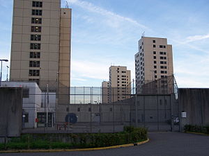
Bijlmerbajes
Prison complex in Amsterdam, the Netherlands
Distance: Approx. 1457 meters
Latitude and longitude: 52.3385,4.9242
The Bijlmerbajes was a prison complex (which was permanently closed in June 2016) in Amsterdam, the Netherlands, near the Amsterdam Amstel railway station. The official name is Penitentiaire Inrichting Over-Amstel, although it is also known as Penitentiaire Inrichting De Stadspoort or Penitentiaire Inrichtingen Amsterdam. Bijlmerbajes is part of the Custodial Institutions Agency (Dienst Justitiële Inrichtingen, DJI) of the Dutch Ministry of Justice within the Dutch criminal justice system.
Utrechtboog
Railway line in the Netherlands
Distance: Approx. 1052 meters
Latitude and longitude: 52.32055556,4.93416667
The Utrechtboog is a flyover railway line in the south-east of Amsterdam, completed in March 2006, that directly connects Utrecht and Schiphol. After completion, it reduced journey times between the two by seven minutes. Prior to its construction, passengers travelling this route were required to change trains at Duivendrecht railway station.

Duivendrecht station
Railway station in Duivendrecht, Netherlands
Distance: Approx. 710 meters
Latitude and longitude: 52.32333333,4.93638889
Duivendrecht station (DVD) is a combined rail and metro station in Duivendrecht, Netherlands. The station opened on 23 May 1993 as part of the extension of the Zuidtak of the Amsterdam Ringspoorbaan, between Amsterdam RAI and Weesp. This station allows for the interchange between two grade-separated railways: the Amsterdam–Arnhem railway on the upper floor, consisting of two island platforms with the outer sides serving heavy rail and the inner sides serving the Amsterdam Metro, which runs in between the tracks of the main railway.

Diemen Zuid station
Railway and metro station in Diemen, Netherlands
Distance: Approx. 1146 meters
Latitude and longitude: 52.33027778,4.95638889
Diemen Zuid (Dutch pronunciation: [ˈdimə(n) ˈzœyt]; abbreviation: Dmnz) is a railway station is located in Diemen, a city to the southeast of Amsterdam. The railway station is served by Nederlandse Spoorwegen (NS) services as well as line 53 of the Amsterdam Metro. The station was first used as only a metro station operated by GVB in 1977.

Betondorp
Neighbourhood of Amsterdam in North Holland, Netherlands
Distance: Approx. 1234 meters
Latitude and longitude: 52.34027778,4.94305556
Betondorp (Dutch pronunciation: [bəˈtɔndɔr(ə)p]; Concrete Village) is a neighbourhood of Amsterdam, Netherlands. It was built in the 1920s as an experiment in building affordable housing with new, cheap building materials, chiefly concrete. The houses are built in a sober, minimalist form of Art Deco.
Venserpolder
Neighborhood of Amsterdam in North Holland, Netherlands
Distance: Approx. 992 meters
Latitude and longitude: 52.32083333,4.94361111
Venserpolder is a neighborhood of Amsterdam, Netherlands.

Van der Madeweg metro station
Metro station in Duivendrecht, Netherlands
Distance: Approx. 635 meters
Latitude and longitude: 52.32972222,4.93027778
Van der Madeweg is an Amsterdam Metro station in Duivendrecht, Netherlands.

Strandvliet metro station
Metro station in Amsterdam, Netherlands
Distance: Approx. 1207 meters
Latitude and longitude: 52.31861111,4.94138889
Strandvliet is an Amsterdam Metro station in the Venserpolder area of Amsterdam, Netherlands. The station opened in 1977 and is served by 2 lines, the 50 (Isolatorweg - Gein) and 54 (Amsterdam Centraal - Gein). The metro station is only accessible with an OV-chipkaart or GVB Travel Pass.

Venserpolder metro station
Metro station in Amsterdam
Distance: Approx. 569 meters
Latitude and longitude: 52.32666667,4.94666667
Venserpolder is an Amsterdam Metro station in Amsterdam, Netherlands.
JOS Watergraafsmeer
Dutch football club
Distance: Approx. 1418 meters
Latitude and longitude: 52.34111111,4.93138889
JOS Watergraafsmeer is an association football club from the Amsterdam district Watergraafsmeer. In 2010 the club had around 500 registered members. The Saturday team plays in the Derde Klasse, while the Sunday team competes in the Vierde Divisie.
Halte Amsterdam ArenA
Railway station in Amsterdam, Netherlands
Distance: Approx. 1495 meters
Latitude and longitude: 52.31611111,4.94277778
Halte Amsterdam ArenA (Asdar) is a single rail train halt in the Bijlmermeer neighbourhood of stadsdeel (borough) Amsterdam-Zuidoost in Amsterdam, Netherlands. Situated right at the Johan Cruyff Arena, a football stadium which was previously known as the Amsterdam Arena, the station is specially built for supporter trains deployed during football matches that are considered high risk to the public, such as when local football club AFC Ajax face either Feyenoord, FC Utrecht, PSV or ADO Den Haag. In away matches supporters arrive and depart via this rail station.
Weather in this IP's area
broken clouds
5 Celsius
2 Celsius
3 Celsius
6 Celsius
1023 hPa
79 %
1023 hPa
1023 hPa
10000 meters
3.6 m/s
220 degree
75 %
