Country:
Region:
City:
Latitude and Longitude:
Time Zone:
Postal Code:
IP information under different IP Channel
ip-api
Country
Region
City
ASN
Time Zone
ISP
Blacklist
Proxy
Latitude
Longitude
Postal
Route
Luminati
Country
Region
zh
City
stafa
ASN
Time Zone
Europe/Zurich
ISP
Init7 (Switzerland) Ltd.
Latitude
Longitude
Postal
IPinfo
Country
Region
City
ASN
Time Zone
ISP
Blacklist
Proxy
Latitude
Longitude
Postal
Route
db-ip
Country
Region
City
ASN
Time Zone
ISP
Blacklist
Proxy
Latitude
Longitude
Postal
Route
ipdata
Country
Region
City
ASN
Time Zone
ISP
Blacklist
Proxy
Latitude
Longitude
Postal
Route
Popular places and events near this IP address

Lake Zurich
Major lake in Switzerland
Distance: Approx. 3371 meters
Latitude and longitude: 47.2475,8.6775
Lake Zurich (German: Zürichsee; Alemannic German: Zürisee) is a lake in Switzerland, extending southeast of the city of Zurich. Depending on the context, Lake Zurich or Zürichsee can be used to describe the lake as a whole, or just that part of the lake downstream of the Hurden peninsula and Seedamm causeway (between Pfäffikon and Rapperswil). In the latter case, the upstream part of the lake is called Obersee (lit. 'Upper Lake'), whilst the lower part is sometimes also referred to as the Lower Lake (unterer Zürichsee), respectively.
Männedorf
Municipality in Zurich, Switzerland
Distance: Approx. 3074 meters
Latitude and longitude: 47.25,8.68333333
Männedorf (High Alemannic: Mänidoorf) is a municipality in the district of Meilen in the canton of Zürich in Switzerland.

Uerikon
Distance: Approx. 2344 meters
Latitude and longitude: 47.23333333,8.75
Uerikon (also spelled Ürikon) is a village near Rapperswil, Switzerland.
Kehlhof
Distance: Approx. 1472 meters
Latitude and longitude: 47.2343,8.7385
Kehlhof is a village near Rapperswil, Switzerland. It is located on the north bank of the lake of Zurich and is part of the political municipality of Stäfa. In the local dialect it is called Chälhof.
Stäfa
Municipality in Zurich, Switzerland
Distance: Approx. 834 meters
Latitude and longitude: 47.24,8.73
Stäfa is a municipality in the district of Meilen in the canton of Zürich in Switzerland.
Richterswil
Municipality in Zürich, Switzerland
Distance: Approx. 2752 meters
Latitude and longitude: 47.21666667,8.7
Richterswil (Swiss German: Richtischwiil ) is a municipality in the district of Horgen in the canton of Zürich in Switzerland.

Oetwil am See
Municipality in Zurich, Switzerland
Distance: Approx. 3254 meters
Latitude and longitude: 47.26666667,8.71666667
Oetwil am See is a municipality in the district of Meilen in the canton of Zürich in Switzerland. It is located in the Pfannenstiel region.
Seeweidsee
Distance: Approx. 2949 meters
Latitude and longitude: 47.25694444,8.74611111
Seeweidsee is a lake in the municipality of Hombrechtikon, in the Canton of Zurich, Switzerland. Its surface area is 1.2 ha (3.0 acres). Lake has grass floating mat at it shores.
Mutzmalen
Distance: Approx. 1283 meters
Latitude and longitude: 47.24805556,8.71277778
Muttzmalen is a small village between Stäfa and Männedorf, in the canton of Zürich in Switzerland.

Männedorf railway station
Railway station in Switzerland
Distance: Approx. 2721 meters
Latitude and longitude: 47.253474,8.692353
Männedorf is a railway station in the Swiss canton of Zurich, situated in the municipality of Männedorf. The station is located on the Lake Zurich right bank railway line.

Uerikon railway station
Railway station in Canton of Zürich, Switzerland
Distance: Approx. 2464 meters
Latitude and longitude: 47.23588889,8.75211111
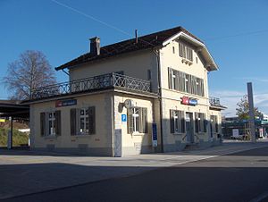
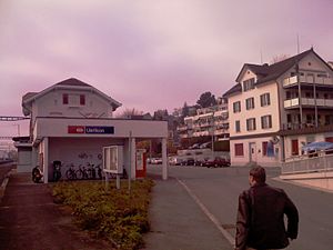
Uerikon railway station (German: Bahnhof Uerikon) is a railway station in Switzerland, situated near the village of Uerikon in the municipality of Stäfa. The station is located on the Lake Zurich right-bank line. Uerikon station was also the junction for the former Uerikon–Bauma railway (UeBB), which between 1901 and 1948 linked Uerikon with Hombrechtikon, Bubikon, Hinwil, Bäretswil and Bauma.

Stäfa railway station
Railway station in Stäfa, Switzerland
Distance: Approx. 327 meters
Latitude and longitude: 47.240383,8.72043
Stäfa is a railway station in Switzerland, situated in the municipality of Stäfa. The station is located on the Lake Zurich right-bank line.
Weather in this IP's area
overcast clouds
9 Celsius
8 Celsius
8 Celsius
11 Celsius
1016 hPa
77 %
1016 hPa
967 hPa
10000 meters
2.57 m/s
340 degree
100 %
07:32:35
16:47:59


