185.181.222.166 - IP Lookup: Free IP Address Lookup, Postal Code Lookup, IP Location Lookup, IP ASN, Public IP
Country:
Region:
City:
Location:
Time Zone:
Postal Code:
IP information under different IP Channel
ip-api
Country
Region
City
ASN
Time Zone
ISP
Blacklist
Proxy
Latitude
Longitude
Postal
Route
Luminati
Country
Region
84
City
rodovremunicipality
ASN
Time Zone
Europe/Copenhagen
ISP
Hiper A/S
Latitude
Longitude
Postal
IPinfo
Country
Region
City
ASN
Time Zone
ISP
Blacklist
Proxy
Latitude
Longitude
Postal
Route
IP2Location
185.181.222.166Country
Region
hovedstaden
City
skibby
Time Zone
Europe/Copenhagen
ISP
Language
User-Agent
Latitude
Longitude
Postal
db-ip
Country
Region
City
ASN
Time Zone
ISP
Blacklist
Proxy
Latitude
Longitude
Postal
Route
ipdata
Country
Region
City
ASN
Time Zone
ISP
Blacklist
Proxy
Latitude
Longitude
Postal
Route
Popular places and events near this IP address

Skibby
Town in Region Hovedstaden, Denmark
Distance: Approx. 271 meters
Latitude and longitude: 55.75305556,11.96361111
Skibby is a town with a population of 3,165 (1 January 2024), situated in Frederikssund Municipality, Region Hovedstaden on the northern part of the island of Zealand (Sjælland) in eastern Denmark. It was the municipal seat of the former Skibby Municipality (Danish, Skibby Kommune), until 1 January 2007.

Jyllinge
Town in Zealand, Denmark
Distance: Approx. 9121 meters
Latitude and longitude: 55.75111111,12.10638889
Jyllinge is a town located on the eastern shores of Roskilde Fjord, midway between Roskilde and Frederikssund, Roskilde Municipality, some 40 km west of Copenhagen, Denmark. The original fishing village is surrounded by large areas of Single-family detached homes. As of 1 January 2024, it had a population of 10,781.
Svanholm
State in Copenhagen, Denmark
Distance: Approx. 3857 meters
Latitude and longitude: 55.78365278,11.93924444
Svanholm is a country estate and former manor 55 kilometres (34 mi) west of Copenhagen, Denmark. In 1978 an association of over 100 persons bought the estate to create Denmark's largest intentional community. The Svanholm collective grows its own food and was one of the pioneers of organic farming in Denmark.

Hornsherred
Distance: Approx. 5961 meters
Latitude and longitude: 55.8,12
Hornsherred (Danish pronunciation: [ˈhoɐ̯ˀnsˌhɛɐ̯ð̩]) is a peninsula between Roskilde Fjord and Isefjord on the island of Zealand in eastern Denmark. It falls within the expanded Frederikssund municipality and includes Jægerspris and Skibby and before 1 January 2007 a part of Bramsnæs Municipality, now a part of Lejre Municipality. It is connected to Frederikssund by the Kronprins Frederik bridge which was built in 1935.

Skuldelev ships
Viking ships recovered from Peberrenden
Distance: Approx. 8251 meters
Latitude and longitude: 55.801,12.0584
The Skuldelev ships are five original Viking ships recovered from the waterway of Peberrenden at Skuldelev, c. 20 km (12 mi) north of Roskilde in Denmark. In 1962, the remains of the submerged ships were excavated in the course of four months. The recovered pieces constitute five types of Viking ships and have all been dated to the 11th century.

Selsø
Manor house in Frederikssund Municipality, Denmark
Distance: Approx. 3314 meters
Latitude and longitude: 55.74111111,12.01055556
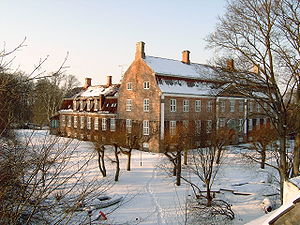
Selsø (Selsø Slot) is a historic manor house located near Skibby, on the Hornsherred peninsula, Frederikssund Municipality, some 50 km (31 mi) west of Copenhagen, Denmark. The estate traces its history back to the 13th century. The current main building dates from 1576 but was renovated in the Baroque style in 1734.

Eskilsø
Distance: Approx. 7679 meters
Latitude and longitude: 55.73333333,12.07916667
Eskilsø is a small Danish island located in the Roskilde fjord, Frederikssund Municipality, northern Zealand. In the 12th century, there was an Augustinian monastery, Eskilsø Monastery, on the island. The ruins of the monastery church are still visible.

Krabbesholm, Lejre Municipality
Manor house near Skibby, Denmark
Distance: Approx. 2455 meters
Latitude and longitude: 55.73,11.95
Krabbesholm is a manor house and estate located on the Hornsherred peninsula, between Skibby and Sæby, Lejre Municipality, some 50 kilometres west of Copenhagen, Denmark. The manor was detached from Egholm by Oluf Rosenkrantz in 1783 but the two estates had the same owners until 1806. The Gothic Revival style main building, the first on the estate, was built for Lars Trolle in 18.

Sæby Church, Lejre Municipality
Church building in Lejre Municipality, Denmark
Distance: Approx. 5365 meters
Latitude and longitude: 55.70461111,11.93888889
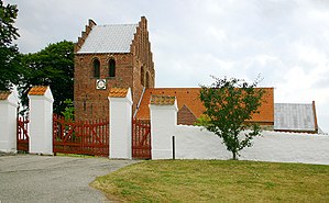
Sæby Church (Danish: Sæby Kirke) is located in the small village of Sæby on the Hornsherred peninsula, Lejre Municipality, some 50 km west of Copenhagen, Denmark. Originating in a Romanesgue church from the 13th century, later expanded with a Gothic tower, it owes its current appearance to a renovation undertaken by Jørgen Hansen Koch in 1824.

Skuldelev
Village in Capital, Denmark
Distance: Approx. 4902 meters
Latitude and longitude: 55.78138889,12.01777778
Skuldelev is a town in the Frederikssund Municipality in North Zealand, Denmark. It is located 5 km northeast of Skibby, 11 km south of Jægerspris and 11 km southwest of Frederikssund. As of 2024, it has a population of 858.

Gerlev
Village in Capital, Denmark
Distance: Approx. 8399 meters
Latitude and longitude: 55.82055556,12.01361111
Gerlev is a town in the Frederikssund Municipality in North Zealand, Denmark. It is located on Hornsherred, five kilometers south of Jægerspris and six kilometers southwest of Frederikssund. As of 2024, it has a population of 1,036.

Eskilsø Monastery
Early medieval monastery in Denmark
Distance: Approx. 7467 meters
Latitude and longitude: 55.7382,12.0777
Eskilsø Monastery (Danish: Eskilsø Kloster) was an Augustinian monastery on Eskilsø Island in Roskilde Fjord.
Weather in this IP's area
overcast clouds
7 Celsius
4 Celsius
7 Celsius
8 Celsius
1030 hPa
89 %
1030 hPa
1026 hPa
10000 meters
4.09 m/s
8.31 m/s
220 degree
100 %
