185.181.129.150 - IP Lookup: Free IP Address Lookup, Postal Code Lookup, IP Location Lookup, IP ASN, Public IP
Country:
Region:
City:
Location:
Time Zone:
Postal Code:
ISP:
ASN:
language:
User-Agent:
Proxy IP:
Blacklist:
IP information under different IP Channel
ip-api
Country
Region
City
ASN
Time Zone
ISP
Blacklist
Proxy
Latitude
Longitude
Postal
Route
db-ip
Country
Region
City
ASN
Time Zone
ISP
Blacklist
Proxy
Latitude
Longitude
Postal
Route
IPinfo
Country
Region
City
ASN
Time Zone
ISP
Blacklist
Proxy
Latitude
Longitude
Postal
Route
IP2Location
185.181.129.150Country
Region
schleswig-holstein
City
elmshorn
Time Zone
Europe/Berlin
ISP
Language
User-Agent
Latitude
Longitude
Postal
ipdata
Country
Region
City
ASN
Time Zone
ISP
Blacklist
Proxy
Latitude
Longitude
Postal
Route
Popular places and events near this IP address
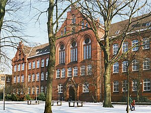
Elmshorn
Town in Schleswig-Holstein, Germany
Distance: Approx. 244 meters
Latitude and longitude: 53.75194444,9.65111111
Elmshorn (German pronunciation: [ɛlmsˈhɔʁn] ; Low German: Elmshoorn) is a town in the district of Pinneberg in Schleswig-Holstein in Germany. It is 30 km north of Hamburg on the small river Krückau, a tributary of the Elbe, and with about 50,000 inhabitants is the sixth-largest town in the state of Schleswig-Holstein, Germany. It is the birthplace of writer and editor Hermann Schlüter (1851–1919), the mathematician Hermann Weyl (1885–1955) and the medievalist Heinz Woehlk (1944- ).
Erich Kästner Gemeinschaftsschule Elmshorn
School in Elmshorn, Germany
Distance: Approx. 1855 meters
Latitude and longitude: 53.74241,9.67322
Erich Kästner Gemeinschaftsschule Elmshorn (KGSE), formerly known as Kooperative Gesamtschule Elmshorn, is a German Cooperative Comprehensive School in Elmshorn-Hainholz. The KGSE is a Gesamtschule (comprehensive school) situated in Elmshorn; as such, allowing pupils to study alongside each other for one of the three German major school qualifications: Hauptschulabschluss, Realschulabschluss (roughly equivalent to GCSEs in the UK) and Abitur (equivalent of A-Levels in the UK).
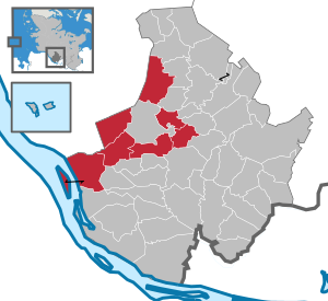
Elmshorn-Land
Amt in Germany
Distance: Approx. 244 meters
Latitude and longitude: 53.75194444,9.65111111
Elmshorn-Land is an Amt ("collective municipality") in the district of Pinneberg, in Schleswig-Holstein, Germany. It is situated around Elmshorn, which is the seat of the Amt, but not part of it.

Bokholt-Hanredder
Municipality in Schleswig-Holstein, Germany
Distance: Approx. 5560 meters
Latitude and longitude: 53.78583333,9.71777778
Bokholt-Hanredder is a municipality in the district of Pinneberg, in Schleswig-Holstein, Germany. Bokholt-Hanredder consists of the four districts Voßloch, Bokholt, Hanredder and Offenau, which are symbolically represented in the coat of arms (created in 1982). The fox represents Voßloch, the Offenau creek separates the district of the same name from the rest of the municipality.
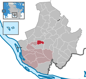
Heidgraben
Municipality in Schleswig-Holstein, Germany
Distance: Approx. 5772 meters
Latitude and longitude: 53.705,9.68194444
Heidgraben is a municipality in the district of Pinneberg, in Schleswig-Holstein, Germany. The number of citizens working in agriculture or in tree nurseries is only small. The majority commutes to surrounding places or to Hamburg.

Klein Nordende
Municipality in Schleswig-Holstein, Germany
Distance: Approx. 4149 meters
Latitude and longitude: 53.71666667,9.65
Klein Nordende is a municipality in the district of Pinneberg, in Schleswig-Holstein, Germany.

Klein Offenseth-Sparrieshoop
Municipality in Schleswig-Holstein, Germany
Distance: Approx. 5736 meters
Latitude and longitude: 53.79722222,9.7
Klein Offenseth-Sparrieshoop is a municipality in the district of Pinneberg, in Schleswig-Holstein, Germany.

Kölln-Reisiek
Municipality in Schleswig-Holstein, Germany
Distance: Approx. 2994 meters
Latitude and longitude: 53.75888889,9.6975
Kölln-Reisiek is a municipality in the district of Pinneberg, in Schleswig-Holstein, Germany.

Raa-Besenbek
Municipality in Schleswig-Holstein, Germany
Distance: Approx. 3754 meters
Latitude and longitude: 53.76666667,9.6
Raa-Besenbek is a municipality in the district of Pinneberg, in Schleswig-Holstein, Germany.
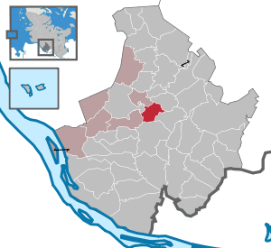
Seeth-Ekholt
Municipality in Schleswig-Holstein, Germany
Distance: Approx. 5112 meters
Latitude and longitude: 53.74555556,9.72916667
Seeth-Ekholt is a municipality in the district of Pinneberg, in Schleswig-Holstein, Germany.
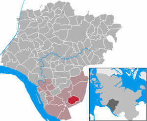
Kiebitzreihe
Municipality in Schleswig-Holstein, Germany
Distance: Approx. 4048 meters
Latitude and longitude: 53.78333333,9.61666667
Kiebitzreihe is a municipality in the district of Steinburg, in Schleswig-Holstein, Germany.
Neuendorf Church
Distance: Approx. 5766 meters
Latitude and longitude: 53.737,9.57
Neuendorf Church (German: Neuendorfkirche) was a Protestant church in the Rzhevskoye Microdistrict of Königsberg, Germany. The originally Roman Catholic church was built in the second half of the 14th century by the Teutonic Order. Although Königsberg was located within the Bishopric of Samland, its suburbs south of the Pregel, such as Neuendorf, were disputed by the Bishopric of Ermland.
Weather in this IP's area
scattered clouds
4 Celsius
3 Celsius
4 Celsius
5 Celsius
1036 hPa
98 %
1036 hPa
1035 hPa
10000 meters
1.34 m/s
4.02 m/s
210 degree
30 %