185.178.0.163 - IP Lookup: Free IP Address Lookup, Postal Code Lookup, IP Location Lookup, IP ASN, Public IP
Country:
Region:
City:
Location:
Time Zone:
Postal Code:
ISP:
ASN:
language:
User-Agent:
Proxy IP:
Blacklist:
IP information under different IP Channel
ip-api
Country
Region
City
ASN
Time Zone
ISP
Blacklist
Proxy
Latitude
Longitude
Postal
Route
db-ip
Country
Region
City
ASN
Time Zone
ISP
Blacklist
Proxy
Latitude
Longitude
Postal
Route
IPinfo
Country
Region
City
ASN
Time Zone
ISP
Blacklist
Proxy
Latitude
Longitude
Postal
Route
IP2Location
185.178.0.163Country
Region
steiermark
City
murzzuschlag
Time Zone
Europe/Vienna
ISP
Language
User-Agent
Latitude
Longitude
Postal
ipdata
Country
Region
City
ASN
Time Zone
ISP
Blacklist
Proxy
Latitude
Longitude
Postal
Route
Popular places and events near this IP address

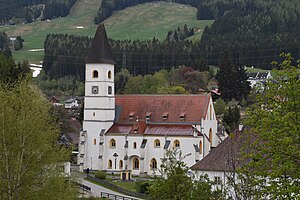
Mürzzuschlag
Municipality in Styria, Austria
Distance: Approx. 3 meters
Latitude and longitude: 47.6075,15.67305556
Mürzzuschlag (German: [myɐ̯t͡sˈt͡suːʃlak]) is a town in northeastern Styria, Austria, the capital of the former Mürzzuschlag District. It is located on the Mürz river near the Semmering Pass, the border with the state of Lower Austria, about 85 km (53 mi) southwest of Vienna. The population is 8,684 (1 January 2016).
Langenwang
Municipality in Styria, Austria
Distance: Approx. 6019 meters
Latitude and longitude: 47.5675,15.61916667
Langenwang is a small town in the Austrian state of Styria.

Rax
Mountain in the Northern Limestone Alps in Austria
Distance: Approx. 9163 meters
Latitude and longitude: 47.68916667,15.68833333
The Rax is a mountain range in the Northern Limestone Alps on the border of the Austrian federal provinces of Lower Austria and Styria. Its highest peak is the Heukuppe (2,007 m). The Rax, together with the nearby Schneeberg, are a traditional mountaineering and mountain walking area, and are called the Wiener Hausberge (Vienna's local mountains).

Neuberg Abbey
Distance: Approx. 9407 meters
Latitude and longitude: 47.66305556,15.57861111
Neuberg Abbey (German: Stift Neuberg) is a former Cistercian monastery in Neuberg an der Mürz in Styria, Austria, and is one of the few extant set of monastic buildings in Austria to have retained its medieval character to any great extent.

Mürzzuschlag District
District in Styria, Austria
Distance: Approx. 9134 meters
Latitude and longitude: 47.579,15.559
Bezirk Mürzzuschlag is a former district of the state of Styria in Austria. Mürzzuschlag merged with the district of Bruck an der Mur to form the new district Bruck-Mürzzuschlag on January 1, 2013.
Preiner Gscheid Pass
Mountain pass in the Austrian Alps
Distance: Approx. 7353 meters
Latitude and longitude: 47.66666667,15.71666667
Preiner Gscheid Pass (el. 1070 m.) is a high mountain pass in the Austrian Alps in the Bundesland of Lower Austria. The pass connects Kapellen and Reichenau an der Rax.

Ganz, Styria
Former municipality in Styria, Austria
Distance: Approx. 2900 meters
Latitude and longitude: 47.58166667,15.67805556
Ganz was a municipality in Austria which merged in January 2015 with Mürzzuschlag in the district of Bruck-Mürzzuschlag in Styria, Austria.

Kapellen, Styria
Former municipality in Styria, Austria
Distance: Approx. 5490 meters
Latitude and longitude: 47.64722222,15.62972222
Kapellen is a former municipality in the district of Bruck-Mürzzuschlag in Styria, Austria. Since the 2015 Styria municipal structural reform, it is part of the municipality Neuberg an der Mürz.

Altenberg an der Rax
Former municipality in Styria, Austria
Distance: Approx. 8089 meters
Latitude and longitude: 47.6775,15.64416667
Altenberg an der Rax was a municipality (before 2015) in the district of Bruck-Mürzzuschlag in Styria, Austria, part of Neuberg an der Mürz.

Spital am Semmering
Municipality in Styria, Austria
Distance: Approx. 6138 meters
Latitude and longitude: 47.61611111,15.75388889
Spital am Semmering, in the Semmering Pass, is a municipality in the district of Bruck-Mürzzuschlag in Styria, Austria. It is home to the Stuhleck ski hill. Spital was largely endowed in 1160 by seven of the Margrave of Styria's ministeriales.

Hohenwang Castle
Distance: Approx. 7022 meters
Latitude and longitude: 47.5553,15.6206
Hohenwang is a ruined castle in Municipality of Langenwang, Styria, Austria. It stands on a hill at an elevation of 650 metres above sea level. The castle, whose core dates back to the 12th century, is the symbol of Langenwang, and because of its exceptional length one of the largest castles in Styria.

Brahms Museum, Mürzzuschlag
Building in Mürzzuschlag, Austria
Distance: Approx. 223 meters
Latitude and longitude: 47.60561111,15.67211111
The Brahms Museum, in Mürzzuschlag, in Styria, Austria, is dedicated to the composer Johannes Brahms. He lived here during the summers of 1884 and 1885.
Weather in this IP's area
overcast clouds
7 Celsius
5 Celsius
7 Celsius
7 Celsius
1033 hPa
26 %
1033 hPa
905 hPa
10000 meters
2.26 m/s
2.74 m/s
321 degree
99 %
