Country:
Region:
City:
Latitude and Longitude:
Time Zone:
Postal Code:
IP information under different IP Channel
ip-api
Country
Region
City
ASN
Time Zone
ISP
Blacklist
Proxy
Latitude
Longitude
Postal
Route
Luminati
Country
ASN
Time Zone
Europe/Moscow
ISP
LLC Vpsville
Latitude
Longitude
Postal
IPinfo
Country
Region
City
ASN
Time Zone
ISP
Blacklist
Proxy
Latitude
Longitude
Postal
Route
db-ip
Country
Region
City
ASN
Time Zone
ISP
Blacklist
Proxy
Latitude
Longitude
Postal
Route
ipdata
Country
Region
City
ASN
Time Zone
ISP
Blacklist
Proxy
Latitude
Longitude
Postal
Route
Popular places and events near this IP address
Ostafyevo International Business Airport
Airport in Moscow, Russia
Distance: Approx. 2010 meters
Latitude and longitude: 55.51166667,37.50722222
Ostafyevo (Russian: Остафьево) (IATA: OSF, ICAO: UUMO) is a "B" class international airport, located 14 km (8.7 mi) to the south of Moscow Ring Road in Novomoskovsky administrative okrug of Moscow. The airport is owned by Gazpromavia company, a division of Gazprom. It was renovated and opened for civilian flights in 2000 on the grounds of a former military airbase.

Battle of Molodi
Battle in 1572 between Russians and Crimeans
Distance: Approx. 3544 meters
Latitude and longitude: 55.5,37.53333333
The Battle of Molodi (Russian: Би́тва при Мóлодях) was one of the key battles of Ivan the Terrible's reign. It was fought near the village of Molodi, 40 miles (64 km) south of Moscow, in July–August 1572 between the 120,000 horde of Devlet I Giray of Crimea and about 60,000–70,000 Russians led by Prince Mikhail Vorotynsky. The Crimeans had burned Moscow the previous year, but this time they were thoroughly defeated.
Russo-Crimean Wars
Conflicts between the Tsardom of Russia and the Crimean Khanate in the 16th century
Distance: Approx. 3544 meters
Latitude and longitude: 55.5,37.53333333
The Russo-Crimean Wars were fought between the forces of the Tsardom of Russia and the Crimean Khanate during the 16th century over the region around the Volga River. In the 16th century, the Wild Steppes in Russia were exposed to the Khanate. During the wars, the Crimean Khanate (supported by the Turkish army) invaded central Russia, devastated Ryazan, and burned Moscow.
Yuzhnoye Butovo District
District in Moscow, Russia
Distance: Approx. 2734 meters
Latitude and longitude: 55.54611111,37.54416667
Yuzhnoye Butovo District (Southern Butovo, Russian: Ю́жное Бу́тово) is the biggest residential district in South-Western Administrative Okrug of Moscow, Russia. The district's history dates back to 1612, and it is named after a Don Cossack Butov. The area of the district is 27 square kilometres (10 sq mi).

Ulitsa Skobelevskaya
Moscow Metro station
Distance: Approx. 3379 meters
Latitude and longitude: 55.5481,37.5546
Ulitsa Skobelevskaya (Russian: У́лица Ско́белевская) is a station on the Butovskaya Line of the Moscow Metro system in Moscow, Russia. Opened on 27 December 2003 along with four other stations, it is named after the street that it serves, dedicated to Russian-Turkish war hero Mikhail Skobelev. Two of the station's lobbies are located on Admiral Ushakov Boulevard and on Skobelev street.

Buninskaya Alleya
Moscow Metro station
Distance: Approx. 973 meters
Latitude and longitude: 55.538,37.5158
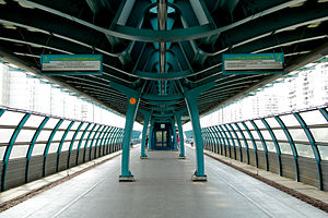
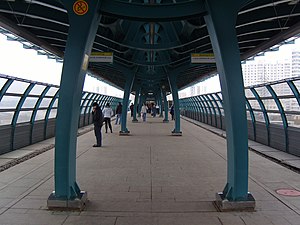
Buninskaya Alleya (Russian: Бу́нинская алле́я) is the southern terminus of the Butovskaya Line of the Moscow Metro, and the southernmost station of the entire system. It was opened on 27 December 2003. Like most other stations of the line, it is located above the ground.

Bulvar Admirala Ushakova
Moscow Metro station
Distance: Approx. 2634 meters
Latitude and longitude: 55.5455,37.543
Bulvar Admirala Ushakova (Russian: Бульва́р Адмира́ла Ушако́ва) is a station on the Butovskaya Line of the Moscow Metro system in Moscow, Russia. It was opened on 27 December 2003 along with four other stations. The station is located in Yuzhnoye Butovo District, between two other stations of the same line, Ulitsa Skobelevskaya and Ulitsa Gorchakova.

Ulitsa Gorchakova
Moscow Metro station
Distance: Approx. 1802 meters
Latitude and longitude: 55.5418,37.5308
Ulitsa Gorchakova (Russian: У́лица Горчако́ва) is a station on the Butovskaya Line of the Moscow Metro system in Moscow, Russia. It was opened on 27 December 2003 along with four other stations. The station is located in Yuzhnoye Butovo District, between two other stations of the same line, Bulvar Admirala Ushakova and Buninskaya Alleya.

Novomoskovskaya (Sokolnicheskaya line)
Moscow Metro station
Distance: Approx. 4371 meters
Latitude and longitude: 55.5605,37.4696
Novomoskovskaya (Russian: Новомоско́вская), formerly known as Kommunarka (Russian: Коммунарка) is a Moscow Metro station on the Sokolnicheskaya line. It was opened on 20 June 2019, along with Filatov Lug, Prokshino, and Olkhovaya., is located between Olkhovaya and Potapovo stations. Novomoskovskaya became the 232nd station of the Moscow Metro.

Prokshino (Moscow Metro)
Moscow Metro station
Distance: Approx. 4371 meters
Latitude and longitude: 55.5605,37.4696
Prokshino is a Moscow Metro station on the Sokolnicheskaya line. It was opened on 20 June 2019, as part of an extension that included Kommunarka (now Novomoskovskaya), Filatov Lug, and Olkhovaya. It is in the Kommunarka area of Sosenskoye Settlement in the Novomoskovsky Administrative Okrug southwest of Moscow.

Shcherbinka railway station
Railway station in Moscow, Russia
Distance: Approx. 3820 meters
Latitude and longitude: 55.5101,37.5622
Shcherbinka is a railway station of Line D2 of the Moscow Central Diameters in Moscow. It was opened in 1895 and will be rebuilt soon.

Potapovo (Moscow Metro)
Planned Moscow Metro station, Line 1
Distance: Approx. 2839 meters
Latitude and longitude: 55.5526,37.4931
Potapovo (Russian: Потапово) is a station on the Sokolnicheskaya line of the Moscow Metro, in the Sosenskoye Settlement of the Novomoskovsky Administrative Okrug. The station is being constructed one stop past Novomoskovskaya, the former southwestern terminus of the Sokolnicheskaya line. It is the new southwestern terminus of the line.
Weather in this IP's area
scattered clouds
1 Celsius
-3 Celsius
-1 Celsius
2 Celsius
1031 hPa
69 %
1031 hPa
1010 hPa
10000 meters
3 m/s
310 degree
40 %
07:54:32
16:33:21

