185.176.235.195 - IP Lookup: Free IP Address Lookup, Postal Code Lookup, IP Location Lookup, IP ASN, Public IP
Country:
Region:
City:
Location:
Time Zone:
Postal Code:
IP information under different IP Channel
ip-api
Country
Region
City
ASN
Time Zone
ISP
Blacklist
Proxy
Latitude
Longitude
Postal
Route
Luminati
Country
Region
occ
City
baziege
ASN
Time Zone
Europe/Paris
ISP
Altsysnet.com SAS
Latitude
Longitude
Postal
IPinfo
Country
Region
City
ASN
Time Zone
ISP
Blacklist
Proxy
Latitude
Longitude
Postal
Route
IP2Location
185.176.235.195Country
Region
occitanie
City
cazeres
Time Zone
Europe/Paris
ISP
Language
User-Agent
Latitude
Longitude
Postal
db-ip
Country
Region
City
ASN
Time Zone
ISP
Blacklist
Proxy
Latitude
Longitude
Postal
Route
ipdata
Country
Region
City
ASN
Time Zone
ISP
Blacklist
Proxy
Latitude
Longitude
Postal
Route
Popular places and events near this IP address
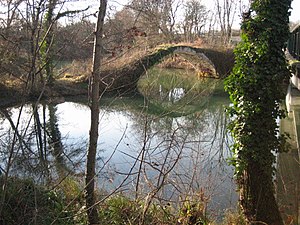
Volp
River in France
Distance: Approx. 1957 meters
Latitude and longitude: 43.2054,1.1103
The Volp is a 40-kilometre-long (25 mi) river of southwestern France. It is a right tributary of the Garonne, which it joins upstream of Cazères, Haute-Garonne. A flood in 1993 ruined a marginal amount of cropland.
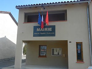
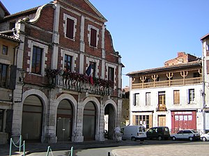
Cazères
Commune in Occitania, France
Distance: Approx. 34 meters
Latitude and longitude: 43.2072,1.0867
Cazères (French pronunciation: [kazɛʁ]; Occitan: Casèras), or sometimes locally called as Cazères-sur-Garonne, is a small town and commune in the Haute-Garonne department in southwestern France. Cazères station has rail connections to Toulouse, Pau and Tarbes. It is the seat (capital) of the canton of Cazères.
Saint-Christaud, Haute-Garonne
Commune in Occitania, France
Distance: Approx. 3988 meters
Latitude and longitude: 43.1903,1.1297
Saint-Christaud (French pronunciation: [sɛ̃ kʁisto]; Occitan: Sent Cristau) is a commune in the Haute-Garonne department in southwestern France.

Couladère
Commune in Occitania, France
Distance: Approx. 633 meters
Latitude and longitude: 43.2028,1.0914
Couladère (French pronunciation: [kuladɛʁ]; Occitan: Coladèra) is a commune in the Haute-Garonne department in southwestern France.

Gensac-sur-Garonne
Commune in Occitania, France
Distance: Approx. 3889 meters
Latitude and longitude: 43.2183,1.1317
Gensac-sur-Garonne (French pronunciation: [ʒɑ̃sak syʁ ɡaʁɔn], literally Gensac on Garonne; Occitan: Gençac de Garona) is a commune in the Haute-Garonne department in southwestern France.
Mauran
Commune in Occitania, France
Distance: Approx. 4812 meters
Latitude and longitude: 43.1894,1.0322
Mauran (French pronunciation: [moʁɑ̃]) is a commune in the Haute-Garonne department of southwestern France.

Mondavezan
Commune in Occitania, France
Distance: Approx. 5547 meters
Latitude and longitude: 43.2403,1.0353
Mondavezan (French pronunciation: [mɔ̃davzɑ̃]; Occitan: Montdavesan) is a commune in the Haute-Garonne department in southwestern France.

Palaminy
Commune in Occitania, France
Distance: Approx. 1379 meters
Latitude and longitude: 43.2036,1.07
Palaminy (French pronunciation: [palamini]; Occitan: Palamenic) is a commune in the Haute-Garonne department in southwestern France.

Le Plan
Commune in Occitania, France
Distance: Approx. 5207 meters
Latitude and longitude: 43.1678,1.1211
Le Plan (French pronunciation: [lə plɑ̃]) is a commune in the Haute-Garonne department in southwestern France.
Saint-Michel, Haute-Garonne
Commune in Occitania, France
Distance: Approx. 4320 meters
Latitude and longitude: 43.1683,1.0856
Saint-Michel (French pronunciation: [sɛ̃ miʃɛl] ; Occitan: Sent Miquèu) is a commune in the Haute-Garonne department in southwestern France.

Cazères station
Railway station in Cazères, France
Distance: Approx. 676 meters
Latitude and longitude: 43.21277778,1.08333333
Cazères is a railway station in Cazères, Occitanie, France. The station is on the Toulouse–Bayonne railway. The station is served by TER (local) services operated by the SNCF. The fastest journey time by train from Cazères to Toulouse-Matabiau station is 39 minutes.
Canton of Cazères
Distance: Approx. 441 meters
Latitude and longitude: 43.21,1.09
The canton of Cazères is an administrative division of the Haute-Garonne department, southern France. Its borders were modified at the French canton reorganisation which came into effect in March 2015. Its seat is in Cazères.
Weather in this IP's area
clear sky
-3 Celsius
-6 Celsius
-3 Celsius
-1 Celsius
1035 hPa
95 %
1035 hPa
995 hPa
10000 meters
1.88 m/s
4.21 m/s
261 degree
6 %


