Country:
 Germany
Region:
City:
Latitude and Longitude:
Time Zone:
Postal Code:
IP information under different IP Channel
ip-api
Country
Region
City
ASN
Time Zone
ISP
Blacklist
Proxy
Latitude
Longitude
Postal
Route
IPinfo
Country
Region
City
ASN
Time Zone
ISP
Blacklist
Proxy
Latitude
Longitude
Postal
Route
MaxMind
Country
Region
City
ASN
Time Zone
ISP
Blacklist
Proxy
Latitude
Longitude
Postal
Route
Luminati
Country
DERegion
nw
City
essen
ASN
Time Zone
Europe/Berlin
ISP
ahd GmbH & Co. KG
Latitude
Longitude
Postal
db-ip
Country
Region
City
ASN
Time Zone
ISP
Blacklist
Proxy
Latitude
Longitude
Postal
Route
ipdata
Country
Region
City
ASN
Time Zone
ISP
Blacklist
Proxy
Latitude
Longitude
Postal
Route
Popular places and events near this IP address

Arcen en Velden
Former Municipality in Limburg, Netherlands
Distance: Approx. 5089 meters
Latitude and longitude: 51.45,6.18333333
Arcen en Velden (Dutch: [ˈɑrsə(n) ɛn ˈvɛldə(n)] ; Limburgish: Árse en Velde) is a former town and former municipality in the southeastern Netherlands, now part of the municipality and city of Venlo. It is situated in the province of Limburg.

Venlo incident
1939 capture of British MI6 agents by Nazi intelligence services outside Venlo, Netherlands
Distance: Approx. 6838 meters
Latitude and longitude: 51.38187222,6.21700278
The Venlo incident, was a covert operation carried out by the German Nazi Party's Sicherheitsdienst (SD) on 9 November 1939, which resulted in the capture of two British Secret Intelligence Service agents five metres (16 ft) from the German border, on the outskirts of the Dutch city of Venlo.: 14–47 The incident was later used by the German government to link Britain to Georg Elser's failed assassination attempt on Adolf Hitler at the Bürgerbräukeller in Munich, on 8 November 1939, and to help justify Germany's invasion of the Netherlands (then a neutral country) on 10 May 1940.

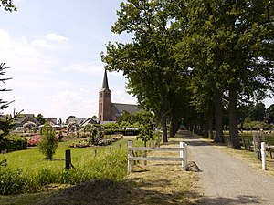
Wachtendonk
Municipality in North Rhine-Westphalia, Germany
Distance: Approx. 6656 meters
Latitude and longitude: 51.40916667,6.33777778
Wachtendonk at the confluence of Niers River and Nette River is a municipality in the district of Kleve in North Rhine-Westphalia, Germany. It is located west of the Rhine halfway between Duisburg and Venlo at the Dutch border. Its name means 'bailiff's Donk'.

Wankum
Distance: Approx. 5346 meters
Latitude and longitude: 51.4,6.3
Wankum is a part of Wachtendonk in North Rhine-Westphalia, Germany. Its location, near the A40 autobahn close to the border with The Netherlands, is infamous with British motorists who pass the sign to the Wankum exit shortly after entering Germany and view the name with amusement (sometimes photographing it) due to its two syllables in written appearance. The first is a British slang term for masturbation and the second may be delivered in speech as a colloquial version of them.

Nette (Niers)
River in Germany
Distance: Approx. 5519 meters
Latitude and longitude: 51.4144,6.3237
The Nette is a small river in North Rhine-Westphalia, Germany, a left tributary of the Niers. It rises near Dülken, a borough of Viersen. The Nette flows through Viersen-Boisheim and Nettetal before reaching the Niers in Wachtendonk.

Arcen
Dorp in Limburg, Netherlands
Distance: Approx. 6616 meters
Latitude and longitude: 51.4765,6.1808
Arcen (Dutch: [ˈɑrsə(n)] ; Limburgish: Árse) is a village in the Dutch province of Limburg. In 2010, it became part of the municipality of Venlo. Previously, it had been part of the municipality of Arcen en Velden and the seat of the town hall (gemeentehuis).

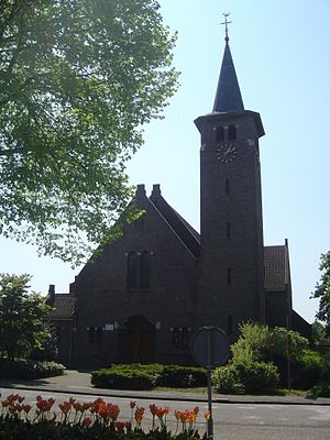
Straelen
Town in North Rhine-Westphalia, Germany
Distance: Approx. 1519 meters
Latitude and longitude: 51.45,6.26666667
Straelen (German pronunciation: [ˈʃtʁaːlən]; Low Rhenish: Strale) is a municipality in the district of Cleves, in North Rhine-Westphalia, Germany. It is located near the border with the Netherlands, approx. 10 km north-east of Venlo.

Velden, Limburg
Dorp in Limburg, Netherlands
Distance: Approx. 6724 meters
Latitude and longitude: 51.41166667,6.16777778
Velden (Dutch: [ˈvɛldə(n)] ; Limburgish: Velde) is a village in the municipality of Venlo (5,085 inhabitants) in Limburg, Netherlands.
Lomm
Dorp in Limburg, Netherlands
Distance: Approx. 5865 meters
Latitude and longitude: 51.4487,6.1714
Lomm (Dutch: [ˈlɔm]; Limburgish: Lóm [ˈlʊm]) is a small village in the municipality of Venlo, the Netherlands, seven kilometres to the north of Venlo. There were 1,035 inhabitants in 2021.
Hasselt, Venlo
Hamlet near Velden in Venlo, Netherlands
Distance: Approx. 6611 meters
Latitude and longitude: 51.42666667,6.16111111
Hasselt is a hamlet in the Dutch province of Limburg. It is located in the municipality of Venlo, about 2 km north of the village of Velden (Limburg).
Bong, Velden
Distance: Approx. 5649 meters
Latitude and longitude: 51.4325,6.17361111
Bong (Dutch pronunciation: [ˈbɔŋ], Limburgish: [ˈbɔŋ]) is a hamlet in the Dutch province of Limburg. It is located in the municipality of Venlo, about 2 km north of Velden, Limburg.
Lottum
Village in Limburg, Netherlands
Distance: Approx. 6994 meters
Latitude and longitude: 51.46027778,6.15972222
Lottum (Dutch pronunciation: [ˈlɔtʏm]) is a village in the Dutch province of Limburg. It is located in the municipality of Horst aan de Maas.
Weather in this IP's area
clear sky
15 Celsius
15 Celsius
14 Celsius
16 Celsius
1024 hPa
96 %
1024 hPa
1019 hPa
6000 meters
2.57 m/s
30 degree
3 %
07:16:46
19:40:42