Country:
Region:
City:
Latitude and Longitude:
Time Zone:
Postal Code:
IP information under different IP Channel
ip-api
Country
Region
City
ASN
Time Zone
ISP
Blacklist
Proxy
Latitude
Longitude
Postal
Route
Luminati
Country
Region
cm
City
canadadeagra
ASN
Time Zone
Europe/Madrid
ISP
Free Technologies Excom S.L.
Latitude
Longitude
Postal
IPinfo
Country
Region
City
ASN
Time Zone
ISP
Blacklist
Proxy
Latitude
Longitude
Postal
Route
db-ip
Country
Region
City
ASN
Time Zone
ISP
Blacklist
Proxy
Latitude
Longitude
Postal
Route
ipdata
Country
Region
City
ASN
Time Zone
ISP
Blacklist
Proxy
Latitude
Longitude
Postal
Route
Popular places and events near this IP address

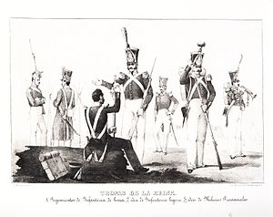
Battle of Villarrobledo
Battle of the First Carlist War
Distance: Approx. 669 meters
Latitude and longitude: 39.2667,-2.6
The Battle of Villarrobledo took place during the First Carlist War on September 20, 1836, south of Villarrobledo at a campground called Vega de San Cristóbal, which lies near a hermitage of the same name. However, there were also casualties reported in Villarrobledo proper. The battle was a major defeat for the Carlist general Miguel Gómez Damas, and his forces suffered large casualties, as well as the loss of large amounts of munitions.

Council House of Villarrobledo
Historic site in Villarrobledo, Spain
Distance: Approx. 828 meters
Latitude and longitude: 39.264166,-2.604442
The Council House of Villarrobledo (Spanish: Casa consistorial de Villarrobledo) is a council house located in Villarrobledo, Spain. It was declared Bien de Interés Cultural in 1991.

Church of San Blas (Villarrobledo)
Historic site in Villarrobledo, Spain
Distance: Approx. 858 meters
Latitude and longitude: 39.263905,-2.603884
The Church of San Blas (Spanish: Iglesia de San Blas) is a church located in Villarrobledo, Spain. It was declared Bien de Interés Cultural in 1977. The original church was built in mid-15th-century Gothic-style, but later refurbishments add different styles.

Old Square (Villarrobledo)
Historic site in Villarrobledo, Spain
Distance: Approx. 862 meters
Latitude and longitude: 39.263859,-2.604335
The Old Square (Spanish: Plaza Vieja) is a square located in Villarrobledo, Spain. It was declared Bien de Interés Cultural in 1972.

La Jaraba (Vino de Pago)
Spanish winery in Castilla–La Mancha
Distance: Approx. 9168 meters
Latitude and longitude: 39.33441667,-2.53566667
Pago de La Jaraba is a Spanish winery in Castilla–La Mancha, Spain. The winery uses the Vino de Pago wine appellation, a classification for Spanish wine applied to individual vineyards or wine estates, unlike the Denominación de Origen Protegida (DOP) or Denominación de Origen Calificada (DOCa) which is applied to an entire wine region. The Pago de La Jaraba winery was formed as a Vino de Pago in 2019, and geographically it lies within the extent of the La Mancha DOP. The winery also produces artisan Manchego cheese under the D.O.P. queso manchego appellation.
Weather in this IP's area
overcast clouds
12 Celsius
12 Celsius
12 Celsius
12 Celsius
1019 hPa
88 %
1019 hPa
935 hPa
10000 meters
7.8 m/s
12.55 m/s
107 degree
100 %
07:54:21
17:56:01