185.175.0.91 - IP Lookup: Free IP Address Lookup, Postal Code Lookup, IP Location Lookup, IP ASN, Public IP
Country:
Region:
City:
Location:
Time Zone:
Postal Code:
IP information under different IP Channel
ip-api
Country
Region
City
ASN
Time Zone
ISP
Blacklist
Proxy
Latitude
Longitude
Postal
Route
Luminati
Country
ASN
Time Zone
Europe/Ljubljana
ISP
SOFTNET d.o.o.
Latitude
Longitude
Postal
IPinfo
Country
Region
City
ASN
Time Zone
ISP
Blacklist
Proxy
Latitude
Longitude
Postal
Route
IP2Location
185.175.0.91Country
Region
komenda
City
komenda
Time Zone
Europe/Ljubljana
ISP
Language
User-Agent
Latitude
Longitude
Postal
db-ip
Country
Region
City
ASN
Time Zone
ISP
Blacklist
Proxy
Latitude
Longitude
Postal
Route
ipdata
Country
Region
City
ASN
Time Zone
ISP
Blacklist
Proxy
Latitude
Longitude
Postal
Route
Popular places and events near this IP address

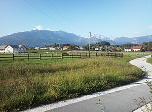
Komenda
Place in Upper Carniola, Slovenia
Distance: Approx. 280 meters
Latitude and longitude: 46.20727778,14.53904167
Komenda (pronounced [kɔˈmɛːnda]; German: Commenda) is a village in the Upper Carniola region of Slovenia. It is the seat of the Municipality of Komenda. It includes the formerly independent settlement of Kaplja Vas (Slovene: Kapla vas, German: Kaplawas).

Žeje pri Komendi
Place in Upper Carniola, Slovenia
Distance: Approx. 1370 meters
Latitude and longitude: 46.1926,14.53605278
Žeje pri Komendi (pronounced [ˈʒɛːjɛ pɾi kɔˈmɛːndi] or [ˈʒeːjɛ pɾi kɔˈmɛːndi]; German: Scheje) is a village in the Municipality of Komenda in the Upper Carniola region of Slovenia.

Gmajnica
Place in Upper Carniola, Slovenia
Distance: Approx. 626 meters
Latitude and longitude: 46.20820278,14.54486667
Gmajnica (pronounced [ˈɡmaːi̯nitsa]) is a settlement in the Municipality of Komenda in the Upper Carniola region of Slovenia.

Gora pri Komendi
Place in Upper Carniola, Slovenia
Distance: Approx. 930 meters
Latitude and longitude: 46.20660278,14.55019167
Gora pri Komendi (pronounced [ˈɡɔːɾa pɾi kɔˈmɛːndi]) is a settlement east of Komenda in the Upper Carniola region of Slovenia. The Slovene writer and editor Ivo Zorman was born in the village in 1926.

Klanec, Komenda
Place in Upper Carniola, Slovenia
Distance: Approx. 1034 meters
Latitude and longitude: 46.21264444,14.53121944
Klanec (pronounced [ˈklaːnəts]; German: Klanz) is a small village in the Municipality of Komenda in the Upper Carniola region of Slovenia. The cyclist Tadej Pogačar comes from Klanec.

Mlaka, Komenda
Place in Upper Carniola, Slovenia
Distance: Approx. 1223 meters
Latitude and longitude: 46.21209167,14.55027778
Mlaka (pronounced [ˈmlaːka]) is a settlement in the Municipality of Komenda in the Upper Carniola region of Slovenia.

Podboršt pri Komendi
Place in Upper Carniola, Slovenia
Distance: Approx. 983 meters
Latitude and longitude: 46.21296389,14.54327222
Podboršt pri Komendi (pronounced [pɔdˈbɔɾʃt pɾi kɔˈmɛːndi]) is a settlement immediately north of Komenda in the Upper Carniola region of Slovenia.

Potok pri Komendi
Place in Upper Carniola, Slovenia
Distance: Approx. 849 meters
Latitude and longitude: 46.20759444,14.52815278
Potok pri Komendi (pronounced [ˈpɔːtɔk pɾi kɔˈmɛːndi]) is a small settlement next to Komenda in the Upper Carniola region of Slovenia.

Municipality of Komenda
Municipality of Slovenia
Distance: Approx. 662 meters
Latitude and longitude: 46.2,14.53333333
The Municipality of Komenda (pronounced [kɔˈmɛːnda]; Slovene: Občina Komenda) is a municipality in the Upper Carniola region of Slovenia. The seat of the municipality is the village of Komenda.

Kaplja Vas, Komenda
Place in Upper Carniola, Slovenia
Distance: Approx. 648 meters
Latitude and longitude: 46.19992222,14.54298056
Kaplja Vas (pronounced [ˈkaːplja ˈʋaːs]; Slovene: Kaplja vas, frequently also Kapla vas, German: Kaplawas) is a formerly independent settlement in the southern part of the village of Komenda in central Slovenia. It belongs to the Municipality of Komenda. It is part of the traditional region of Upper Carniola and is now included with the rest of the municipality in the Central Slovenia Statistical Region.
Reka (Pšata)
River in Slovenia
Distance: Approx. 245 meters
Latitude and longitude: 46.2043,14.5415
Reka (also known as Brnik Creek) is a right tributary of the Pšata River in Slovenia. It is formed by the confluence of two smaller creeks flowing from the Luknja Gorge (Slovene: Lukenjski graben) and Brezovec Gorge (Slovene: Brezovški graben) below Mount Krvavec. It flows south through Cerklje na Gorenjskem.
Tunjščica
River in Slovenia
Distance: Approx. 1307 meters
Latitude and longitude: 46.1948,14.5473
Tunjščica Creek (also known locally as Tunjica Creek) is a left tributary of the Pšata River in Slovenia. It is about 14 kilometers (8.7 mi) long and has its origin at 750 meters (2,460 ft) above sea level on the south slope of Mount Krvavec in the Kamnik–Savinja Alps above the hamlet of Senožeti in Sveti Lenart. It flows past or through Sidraž, Laniše, Tunjice, Tunjiška Mlaka, and Gora pri Komendi before emptying into the Pšata at Moste.
Weather in this IP's area
snow
0 Celsius
0 Celsius
-0 Celsius
1 Celsius
1004 hPa
97 %
1004 hPa
933 hPa
2000 meters
0.51 m/s
310 degree
100 %

