Country:
Region:
City:
Latitude and Longitude:
Time Zone:
Postal Code:
IP information under different IP Channel
ip-api
Country
Region
City
ASN
Time Zone
ISP
Blacklist
Proxy
Latitude
Longitude
Postal
Route
Luminati
Country
Region
18
City
espoo
ASN
Time Zone
Europe/Helsinki
ISP
DNA Oyj
Latitude
Longitude
Postal
IPinfo
Country
Region
City
ASN
Time Zone
ISP
Blacklist
Proxy
Latitude
Longitude
Postal
Route
db-ip
Country
Region
City
ASN
Time Zone
ISP
Blacklist
Proxy
Latitude
Longitude
Postal
Route
ipdata
Country
Region
City
ASN
Time Zone
ISP
Blacklist
Proxy
Latitude
Longitude
Postal
Route
Popular places and events near this IP address

Mankkaa
District of Espoo in Finland
Distance: Approx. 418 meters
Latitude and longitude: 60.2,24.76666667
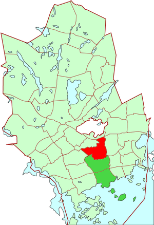
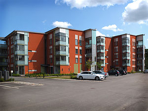
Mankkaa (Finnish) or Mankans (Swedish) is a suburb of Espoo, located between Tapiola and Kauniainen, with a population of 8,468 (2023), of which 555 speak Swedish as a first language (2023). Most of Mankkaa falls under the postal code 02180, with 02630 being the code of the areas situated near the Helsinki-Turku freeway in the north. The area under postal code 02180 has one of the highest wage incomes in whole of Finland.

Tapiolan urheilupuisto
Sports complex in Espoo, Finland
Distance: Approx. 2180 meters
Latitude and longitude: 60.17911111,24.78130556
Tapiolan urheilupuisto (Swedish: Hagalunds idrottspark, 'Tapiola Sports Park') is a sports park in the Tapiola district of Espoo, Finland. The park includes several sports halls and football pitches, as well as the multipurpose Espoo Metro Areena. The Urheilupuisto metro station, which connects the park to the Länsimetro, was opened in 2017.

Laajalahti
District of Espoo in Finland
Distance: Approx. 1713 meters
Latitude and longitude: 60.2,24.80416667
Laajalahti (Swedish: Bredvik) is a district of Espoo, a city in Finland. It belongs to the area of Suur-Tapiola together with Westend, Tapiola, Pohjois-Tapiola, Otaniemi, Niittykumpu, Mankkaa, and Haukilahti. It gets its name from the bay on which it is located.

Pohjois-Tapiola
District of Espoo in Uusimaa, Finland
Distance: Approx. 1047 meters
Latitude and longitude: 60.19583333,24.79166667
Pohjois-Tapiola (Swedish: Norra Hagalund) is a district of the municipality of Espoo, Finland.

Henttaa
District of Espoo in Finland
Distance: Approx. 2225 meters
Latitude and longitude: 60.2,24.73333333
Henttaa (Swedish: Hemtans) is a district of Espoo, a city in Finland.

Kilo, Espoo
District of Espoo in Finland
Distance: Approx. 2117 meters
Latitude and longitude: 60.21666667,24.78333333
Kilo is a district of Espoo, a city in Finland. Kilo is a place of homes and small industry. The head police station of Espoo is located in Kilo.

Sepänkylä
District of Espoo in Finland
Distance: Approx. 2311 meters
Latitude and longitude: 60.20416667,24.73333333
Sepänkylä (Finnish) or Smedsby (Swedish) is a district of Espoo, a city in Finland.

Kilo railway station
Railway station in Espoo, Finland
Distance: Approx. 2203 meters
Latitude and longitude: 60.21774444,24.78083333
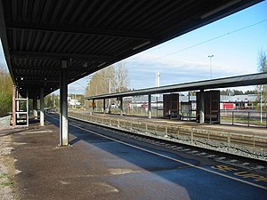
Kilo is a station on the VR commuter rail network on the Rantarata line located in Kilo, a district of the city of Espoo in Finland. It is situated between Leppävaara railway station and Kera railway station, approximately 13 kilometres (8.1 mi) northwest/west of Helsinki Central railway station.

Kera railway station
Railway station in Espoo, Finland
Distance: Approx. 2257 meters
Latitude and longitude: 60.21611111,24.75388889
Kera is a station on the Helsinki commuter rail network located in the neighborhood of the same name in the city of Espoo in Finland. It is situated between stations Kilo railway station and Kauniainen railway station. It is located about 15 kilometres (9.3 mi) to the northwest/west of Helsinki Central railway station.

Ring II
Road in Espoo, Finland
Distance: Approx. 1682 meters
Latitude and longitude: 60.19527778,24.74361111
Ring II (pronounced "ring two", Finnish: Kehä II, Swedish: Ring II; also known as Kilonväylä) in the city of Espoo is one of the major highways in Finland. The road runs north–south, connecting Turuntie in the north, to Länsiväylä in the south. Despite its name suggesting a circle, it has not been built as a true beltway yet, unlike the parallel Ring I and Ring III highways.
Espoo Metro Areena
Multi-purpose stadium in Espoo, Finland
Distance: Approx. 2386 meters
Latitude and longitude: 60.17777778,24.78583333
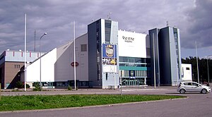
Espoo Metro Areena (known from 1999 to January 2009 as LänsiAuto Areena, and from 2009 to October 2015 as Barona Areena) is an arena in the Tapiola District of Espoo, Finland. The arena is sponsored by Hesburger, Finland's largest fast food hamburger chain and is part of the Tapiolan Urheilupuisto (Tapiola Sports Park). It was inaugurated in 1999 and holds 6,982 people for ice-hockey games or up to 8,000 for concerts.

Suurpelto
Area of Espoo, Finland
Distance: Approx. 2405 meters
Latitude and longitude: 60.18471944,24.73958889
Suurpelto (Swedish: Storåker) is an area under construction in Espoo, Finland, between the districts of Henttaa, Mankkaa and Olari. The original plan for the completion of Suurpelto was from 2010 to 2015. There are a total of seven zoning areas, of which some have a confirmed zoning plan.
Weather in this IP's area
clear sky
5 Celsius
3 Celsius
4 Celsius
6 Celsius
1018 hPa
95 %
1018 hPa
1015 hPa
10000 meters
2.06 m/s
250 degree
07:54:54
16:14:06
