Country:
 Czech Republic
Region:
City:
Latitude and Longitude:
Time Zone:
Postal Code:
IP information under different IP Channel
ip-api
Country
Region
City
ASN
Time Zone
ISP
Blacklist
Proxy
Latitude
Longitude
Postal
Route
IPinfo
Country
Region
City
ASN
Time Zone
ISP
Blacklist
Proxy
Latitude
Longitude
Postal
Route
MaxMind
Country
Region
City
ASN
Time Zone
ISP
Blacklist
Proxy
Latitude
Longitude
Postal
Route
Luminati
Country
CZASN
Time Zone
Europe/Prague
ISP
Treboradice.net z.s.
Latitude
Longitude
Postal
db-ip
Country
Region
City
ASN
Time Zone
ISP
Blacklist
Proxy
Latitude
Longitude
Postal
Route
ipdata
Country
Region
City
ASN
Time Zone
ISP
Blacklist
Proxy
Latitude
Longitude
Postal
Route
Popular places and events near this IP address

Letňany
Municipal area of Prague, Czech Republic
Distance: Approx. 3040 meters
Latitude and longitude: 50.13333333,14.51666667
Letňany is an area of Prague, Czech Republic. It was founded in 1307, and became part of Prague in 1968. It has been part of the Prague 9 administrative district since 2001, having previously been in the local government district of Prague 18, and it has its own cadastral area (also called "Prague 18").

Letov Kbely
Distance: Approx. 3057 meters
Latitude and longitude: 50.13303889,14.52046389
Letov is an aircraft company located in Letňany, Prague, Czech Republic. It is the oldest aircraft company in the region.

Hovorčovice
Municipality in Central Bohemian, Czech Republic
Distance: Approx. 2027 meters
Latitude and longitude: 50.17861111,14.51805556
Hovorčovice is a municipality and village in Prague-East District in the Central Bohemian Region of the Czech Republic. It has about 2,600 inhabitants.
Veleň
Municipality in Central Bohemian, Czech Republic
Distance: Approx. 2763 meters
Latitude and longitude: 50.17333333,14.55416667
Veleň is a municipality and village in Prague-East District in the Central Bohemian Region of the Czech Republic. It has about 2,000 inhabitants.

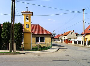
Třeboradice
Distance: Approx. 90 meters
Latitude and longitude: 50.16,14.52
Třeboradice is a cadastral district in the municipal part Čakovice in the administrative district Prague 18 in Prague, Czech Republic, with a population of c. 700 people.
Prague 18
Place in Czech Republic
Distance: Approx. 2826 meters
Latitude and longitude: 50.13611111,14.51
Prague 18 is a municipal district (městská část) in Prague. It is located in the north-eastern part of the city. It is formed by one cadastre Letňany.

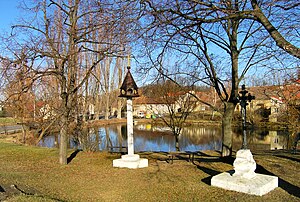
Březiněves
Neighborhood of Prague 8
Distance: Approx. 2635 meters
Latitude and longitude: 50.16583333,14.485
Březiněves is a municipal district (městská část) and cadastral area (katastrální území) in Prague. It is located in the northern part of the city. As of 2018, there were 1576 inhabitants living in Březiněves.

Čakovice
Place in Czech Republic
Distance: Approx. 1078 meters
Latitude and longitude: 50.15111111,14.52472222
Čakovice (German Tschakowitz) is a municipal district (městská část) in Prague. It is located in the north-eastern part of the city. As of 2021, there were 11,984 inhabitants living in Čakovice.
Ďáblice
Place in Czech Republic
Distance: Approx. 2818 meters
Latitude and longitude: 50.14861111,14.48611111
Ďáblice is a municipal district (městská část) and cadastral area (katastrální území) in Prague. It is located in the northern part of the city. As of 2021, there were 3,750 inhabitants living in Ďáblice.

Praha-Čakovice railway station
Railway station in Prague, Czech Republic
Distance: Approx. 1276 meters
Latitude and longitude: 50.14907,14.51961
Praha-Čakovice railway station (Czech: Železniční stanice Praha-Čakovice) is a station located in Čakovice, in the northern outer suburbs of Prague, on line 070 between Prague and Turnov. It serves as a passing loop on a mainly single-tracked section of the line for lines S3 and R3 of the Esko Prague system. In 2009 the station building was refurbished.
Obchodní centrum Letňany
Shopping mall in Prague, Czech Republic
Distance: Approx. 3001 meters
Latitude and longitude: 50.13651944,14.50178056
Obchodní centrum Letňany, also known as OC Letňany is a shopping mall located in the Letňany district of Prague, Czech Republic. With 130 shops and an area of 125,000 square metres (1,350,000 sq ft), it is the largest shopping centre in the Czech Republic. The complex was described by The Prague Post in 2001 as "one of the best malls in the city".
Miškovice
Cadastral area of Prague in Czech Republic
Distance: Approx. 1518 meters
Latitude and longitude: 50.15722222,14.54166667
Miškovice is a cadastral area in Prague, Czech Republic.
Weather in this IP's area
heavy intensity rain
15 Celsius
15 Celsius
14 Celsius
16 Celsius
1017 hPa
91 %
1017 hPa
989 hPa
8000 meters
6.69 m/s
350 degree
100 %
06:39:38
19:13:57