185.173.9.167 - IP Lookup: Free IP Address Lookup, Postal Code Lookup, IP Location Lookup, IP ASN, Public IP
Country:
Region:
City:
Location:
Time Zone:
Postal Code:
IP information under different IP Channel
ip-api
Country
Region
City
ASN
Time Zone
ISP
Blacklist
Proxy
Latitude
Longitude
Postal
Route
Luminati
Country
Region
sct
City
aberdeen
ASN
Time Zone
Europe/London
ISP
Grain Communications Limited
Latitude
Longitude
Postal
IPinfo
Country
Region
City
ASN
Time Zone
ISP
Blacklist
Proxy
Latitude
Longitude
Postal
Route
IP2Location
185.173.9.167Country
Region
scotland
City
milltimber
Time Zone
Europe/London
ISP
Language
User-Agent
Latitude
Longitude
Postal
db-ip
Country
Region
City
ASN
Time Zone
ISP
Blacklist
Proxy
Latitude
Longitude
Postal
Route
ipdata
Country
Region
City
ASN
Time Zone
ISP
Blacklist
Proxy
Latitude
Longitude
Postal
Route
Popular places and events near this IP address

Peterculter
Suburb of Aberdeen in Scotland
Distance: Approx. 1695 meters
Latitude and longitude: 57.097,-2.2657
Peterculter , also known as Culter, is an outer suburb of Aberdeen, Scotland, about eight miles (13 km) from the city centre. It lies on the north bank of the River Dee, at its confluence with the Culter Burn. Following the 1996 Scottish council boundary changes it became part of the Lower Deeside ward in the Aberdeen City council area.
Milltimber
Human settlement in Scotland
Distance: Approx. 609 meters
Latitude and longitude: 57.1052,-2.2311
Milltimber is a suburb of Aberdeen, Scotland, around 6 miles (10 km) west of Aberdeen city centre. From 1854 to 1937 the area was served by Milltimber railway station on the Aberdeen suburban railway. Along with the nearby settlements of Cults and Bieldside, it is home to some of the wealthiest residents of Aberdeen.

International School of Aberdeen
School in Aberdeen, United Kingdom
Distance: Approx. 275 meters
Latitude and longitude: 57.10277778,-2.24472222
The International School of Aberdeen (ISA) is a school in Pitfodels, Cults, Aberdeen, Scotland. It takes in students that come from other countries besides the UK, although British students are allowed to attend the school. It was formerly known as the American School in Aberdeen.

Deeside Way
Walking and cycling route following a disused railway line in Aberdeenshire, Scotland
Distance: Approx. 1055 meters
Latitude and longitude: 57.10472,-2.22357
The Deeside Way is a 41-mile (66 km) rail trail that follows, in part, the bed of the former Deeside Railway in Aberdeenshire. Forming part of the National Cycle Network (National Route 195) the trail leads from Aberdeen to Ballater.

Crynoch Burn
Stream in Aberdeenshire, Scotland
Distance: Approx. 1185 meters
Latitude and longitude: 57.09383,-2.2366
Crynoch Burn is a stream in Aberdeenshire that is a tributary to the River Dee. This stream rises somewhat above Netherley and flows near Netherley House; and thence into the Red Moss, a significant natural bog habitat; thence near the historic Lairhillock Inn; and finally by the village of Maryculter and through Oldman Wood before discharge to the Dee. Headwaters areas include the northern and western slopes of Meikle Carewe Hill and the northern slopes of Curlethney Hill.

Maryculter House
Historic house in Maryculter near Aberdeen in Scotland
Distance: Approx. 1947 meters
Latitude and longitude: 57.0897,-2.259
Maryculter House is a historic house in the village of Maryculter, or Kirkton of Maryculter, in the Lower Deeside area of Aberdeenshire, Scotland.
Lower Deeside
Distance: Approx. 1210 meters
Latitude and longitude: 57.097,-2.226
Lower Deeside is a region along the River Dee in Aberdeenshire and Aberdeen in Scotland. The boundaries of this area are subject to interpretation, since the usage has altered through historic times; however, the area is generally associated with the communities of Durris, Maryculter and Banchory-Devenick in the historic district of Kincardineshire and the communities of Peterculter, Milltimber, Bieldside and Cults in Aberdeen.
Kingcausie
Distance: Approx. 1675 meters
Latitude and longitude: 57.091,-2.2277
Kingcausie is an ancient estate in lower Deeside, Scotland. Once part of the Temple lands of the Knights Templar in Scotland, it passed in the 16th century into the ownership of the Irvine family.

Culter railway station
Disused railway station in Scotland
Distance: Approx. 1691 meters
Latitude and longitude: 57.0951,-2.2634
Culter railway station was opened on 8 September 1853 by the Deeside Railway and served the town of Peterculter that is locally known as Culter. The Deeside Railway was taken over by the GNoSR and in 1894 Culter was the terminus for the Aberdeen suburban service although a few trains continued to Banchory. Despite the 1937 closure of many other stations on the Aberdeen suburban service, Culter remained open until 1966 as an intermediate station on the Deeside Railway that ran from Aberdeen (Joint) to Ballater.

Murtle railway station
Railway station in Aberdeenshire, Scotland
Distance: Approx. 1759 meters
Latitude and longitude: 57.1074,-2.2125
Murtle railway station, later Murtle Halt railway station served Murtle and Beaconhill Houses and estates, the Mill of Murtle, Milton of Murtle, the local farms and the inhabitants of this rural area within the parish of Peterculter from 1853 to 1937 on the Deeside Railway that ran from Aberdeen (Joint) to Ballater.

Milltimber railway station
Former railway station in Scotland
Distance: Approx. 356 meters
Latitude and longitude: 57.1018,-2.2371
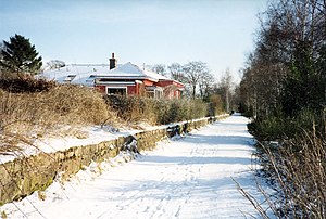
Milltimber railway station served the Milltimber area within the parish of Peterculter from 1854 to 1937 on the Deeside Railway that ran from Aberdeen (Joint) to Ballater. This area at that time had a number of mansion houses, estates, etc. such as Culter House, Fairgirth House, Camphill House, Avondow House, Glasterberry House, etc.

Tor-na-Dee Hospital
Hospital in Aberdeen, Scotland
Distance: Approx. 958 meters
Latitude and longitude: 57.1078,-2.2266
Tor-Na-Dee Hospital was a health facility at Milltimber, Aberdeen, Scotland.
Weather in this IP's area
snow
1 Celsius
-4 Celsius
-0 Celsius
1 Celsius
1013 hPa
80 %
1013 hPa
1004 hPa
10000 meters
5.66 m/s
290 degree
58 %