185.173.15.252 - IP Lookup: Free IP Address Lookup, Postal Code Lookup, IP Location Lookup, IP ASN, Public IP
Country:
 Netherlands
Region:
City:
Location:
Time Zone:
Postal Code:
ISP:
ASN:
language:
User-Agent:
Proxy IP:
Blacklist:
IP information under different IP Channel
ip-api
Country
Region
City
ASN
Time Zone
ISP
Blacklist
Proxy
Latitude
Longitude
Postal
Route
db-ip
Country
Region
City
ASN
Time Zone
ISP
Blacklist
Proxy
Latitude
Longitude
Postal
Route
IPinfo
Country
Region
City
ASN
Time Zone
ISP
Blacklist
Proxy
Latitude
Longitude
Postal
Route
IP2Location
185.173.15.252Country
nlRegion
zuid-holland
City
alphen aan den rijn
Time Zone
Europe/Amsterdam
ISP
Language
User-Agent
Latitude
Longitude
Postal
ipdata
Country
Region
City
ASN
Time Zone
ISP
Blacklist
Proxy
Latitude
Longitude
Postal
Route
Popular places and events near this IP address
Alphen aan den Rijn
Municipality in South Holland, Netherlands
Distance: Approx. 891 meters
Latitude and longitude: 52.13333333,4.66666667
Alphen aan den Rijn (Dutch pronunciation: [ˈɑlfə(n) aːn də(n) ˈrɛin] ; English: "Alphen upon Rhine" or "Alphen on the Rhine") is a city and municipality in the western Netherlands, in the province of South Holland. The city is situated on the banks of the river Oude Rijn (Old Rhine), where the river Gouwe branches off. The municipality had a population of 112,587 in 2021, and covers an area of 132.50 km2 (51.16 sq mi) of which 6.27 km2 (2.42 sq mi) is water.

Gnephoek
Hamlet in South Holland, Netherlands
Distance: Approx. 1583 meters
Latitude and longitude: 52.13333333,4.63333333
Gnephoek is a polder and a hamlet in the Dutch province of South Holland. It is a part of the municipality of Alphen aan den Rijn, and lies about 2 km west of Alphen aan den Rijn. The statistical area "Gnephoek", which also can include the surrounding countryside, has a population of around 250.

Ridderbuurt
Hamlet in South Holland, Netherlands
Distance: Approx. 3158 meters
Latitude and longitude: 52.155,4.67472222
Ridderbuurt is a hamlet in the Dutch province of South Holland. It is a part of the municipality of Alphen aan den Rijn, and lies about 2 km north of Alphen aan den Rijn. The statistical area "Ridderbuurt", which also can include the surrounding countryside, has a population of around 120.

Koudekerk aan den Rijn
Village in South Holland, Netherlands
Distance: Approx. 3711 meters
Latitude and longitude: 52.13472222,4.60194444
Koudekerk aan den Rijn (English: Cold Church upon Rhine) is a village located in the municipality of Alphen aan den Rijn, Netherlands. It is located about 4 km west of the urban centre, in the province of South Holland.

Groene Hart
Area of the Netherlands
Distance: Approx. 3613 meters
Latitude and longitude: 52.1125,4.70083333
The Groene Hart (Dutch pronunciation: [ˈɣrunə ˈɦɑrt]; "Green Heart") is a relatively thinly populated area of the Netherlands covering much of the middle portion of the Randstad megalopolis. The major Dutch cities of Rotterdam, The Hague, Leiden, Haarlem, Amsterdam, and Utrecht surround this area. Cities inside the Groene Hart include Zoetermeer, Alphen aan den Rijn, Gouda, Woerden, and the smaller cities of Schoonhoven, Oudewater, Haastrecht, Nieuwkoop, Montfoort, Waddinxveen, Bodegraven, and Boskoop.

Alphen, South Holland
Former municipality in the Netherlands
Distance: Approx. 164 meters
Latitude and longitude: 52.1283,4.6536
Alphen was a municipality in the Dutch province of South Holland. It consisted of the village of Alphen; now called Alphen aan den Rijn. That village was much smaller than the current town; the municipality only contained the part south of the Oude Rijn.
Oudshoorn
Distance: Approx. 891 meters
Latitude and longitude: 52.13333333,4.66666667
Oudshoorn is a former village in the Dutch province of South Holland. It was located on the Oude Rijn, opposite the village of Alphen, with which it merged to form the city of Alphen aan den Rijn. Oudshoorn was a separate municipality until 1918, when it became part of Alphen aan den Rijn.

Alphen aan den Rijn railway station
Railway station in the Netherlands
Distance: Approx. 547 meters
Latitude and longitude: 52.12444444,4.6575
Alphen a/d Rijn railway station is a railway station in Alphen aan den Rijn, Netherlands.
Vogelpark Avifauna
Zoo in South Holland, Netherlands
Distance: Approx. 1249 meters
Latitude and longitude: 52.13972222,4.64916667
Vogelpark Avifauna (English: Avifauna Bird Park) is a large bird park in Alphen aan den Rijn, in the western Netherlands. It was the first dedicated bird park in the world. The park has a lot of greenery and ponds, and also a restaurant and a children's playground.

Archeon, Netherlands
Open-air living museum in Alphen aan den Rijn, Netherlands
Distance: Approx. 1626 meters
Latitude and longitude: 52.114928,4.650462
Archeon is an archeological open air and living museum in Alphen aan den Rijn, Netherlands.
Albaniana (Roman fort)
Former Roman fort in The Netherlands
Distance: Approx. 403 meters
Latitude and longitude: 52.1292,4.6614
Albaniana was the name the ancient Romans gave a settlement on the southern banks of Rhine river, some 40 kilometers from its mouth in the North Sea, known as Alfen and modern-day Alphen aan den Rijn, Netherlands. They did build a military fort (Latin: castellum) there, as part of a range strategically built encampments, to protect and guard the river, frontier (limes) of the Roman Empire and main transport route of goods and troops. The historical map Tabula Peutingeriana situates the settlement in between Matilo (Leiden) and Praetorium Agrippinae (Valkenburg) downstream and Nigrum Pullum (Zwammerdam) and Fectio (Vechten) upstream.
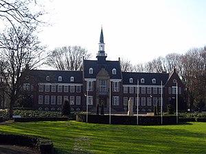
Ashram College
Catholic school in Netherlands
Distance: Approx. 1917 meters
Latitude and longitude: 52.146367,4.65337
The Ashram College is a Dutch high school located in Alphen aan den Rijn and Nieuwkoop. It was established in 1929. The school offers VWO excluding or including the classical languages Latin and Greek, HAVO and VMBO-T. Ashram College is a Catholic school.
Weather in this IP's area
heavy snow
0 Celsius
0 Celsius
-1 Celsius
1 Celsius
1028 hPa
88 %
1028 hPa
1029 hPa
10000 meters
0.89 m/s
1.79 m/s
96 degree