185.170.248.126 - IP Lookup: Free IP Address Lookup, Postal Code Lookup, IP Location Lookup, IP ASN, Public IP
Country:
Region:
City:
Location:
Time Zone:
Postal Code:
ISP:
ASN:
language:
User-Agent:
Proxy IP:
Blacklist:
IP information under different IP Channel
ip-api
Country
Region
City
ASN
Time Zone
ISP
Blacklist
Proxy
Latitude
Longitude
Postal
Route
db-ip
Country
Region
City
ASN
Time Zone
ISP
Blacklist
Proxy
Latitude
Longitude
Postal
Route
IPinfo
Country
Region
City
ASN
Time Zone
ISP
Blacklist
Proxy
Latitude
Longitude
Postal
Route
IP2Location
185.170.248.126Country
Region
nordland
City
rana
Time Zone
Europe/Oslo
ISP
Language
User-Agent
Latitude
Longitude
Postal
ipdata
Country
Region
City
ASN
Time Zone
ISP
Blacklist
Proxy
Latitude
Longitude
Postal
Route
Popular places and events near this IP address

HMS Hunter (H35)
1936 H-class destroyer
Distance: Approx. 9431 meters
Latitude and longitude: 68.41472222,17.17277778
HMS Hunter was a H-class destroyer built for the Royal Navy in the mid-1930s. During the Spanish Civil War of 1936–1939 the ship enforced the arms blockade imposed on both sides by Britain and France, until she struck a mine in May 1937. She was under repair for the next year and a half, after which she rejoined the Mediterranean Fleet.

HMS Hardy (H87)
British flotilla leader of H-class
Distance: Approx. 9257 meters
Latitude and longitude: 68.4,17.2
HMS Hardy was the flotilla leader for the H-class destroyers, built for the Royal Navy in the mid-1930s. During the Spanish Civil War of 1936–1939 the ship spent considerable time in Spanish waters, enforcing the arms blockade imposed by Britain and France on both sides of the conflict. Hardy was transferred to Freetown, Sierra Leone, in October 1939 to hunt for German commerce raiders in the South Atlantic with Force K. After returning to the United Kingdom in early 1940, the ship became flagship of the 2nd Destroyer Flotilla assigned to the Home Fleet.
Storvatnet (Narvik)
Lake in Nordland, Norway
Distance: Approx. 5164 meters
Latitude and longitude: 68.3096,17.0439
Storvatnet (Norwegian) or Ránujávri (Northern Sami) is a lake in Narvik Municipality in Nordland county, Norway. The 9.76-square-kilometre (3.77 sq mi) lake is located about 8 kilometres (5.0 mi) east of the village of Ballangen.
Vidrek
Village in Narvik Municipality, Norway
Distance: Approx. 6688 meters
Latitude and longitude: 68.3905,17.1416
Vidrek (Norwegian) or Vierák (Northern Sami) is a small village in Narvik Municipality in Nordland county, Norway. The village is located along the Ofotfjorden, just east of the Skjomen fjord. The population of the village is about 70.

Ballangen Church
Church in Nordland, Norway
Distance: Approx. 8005 meters
Latitude and longitude: 68.3396157,16.8205806
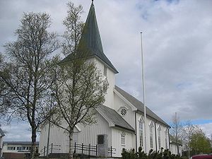
Ballangen Church (Norwegian: Ballangen kirke) is a parish church of the Church of Norway in Narvik Municipality in Nordland county, Norway. It is located in the village of Ballangen. It is one of the churches for the Ballangen parish which is part of the Ofoten prosti (deanery) in the Diocese of Sør-Hålogaland.
Ballangen (village)
Village in Narvik Municipality, Norway
Distance: Approx. 7499 meters
Latitude and longitude: 68.3429,16.8314
Ballangen (Norwegian) or Bálák (Northern Sami) is a village in Narvik Municipality in Nordland county, Norway. The village is located at the western end of the Ballangen fjord, a small branch off the main Ofotfjorden. The European route E06 highway runs through the village.
Ballangen Museum
Mining museum in Bjørkåsen, Norway
Distance: Approx. 9216 meters
Latitude and longitude: 68.33,16.79694444
The Ballangen Museum is a unit of Museum Nord, a Norwegian museum consortium. The museum is located at Syllaveien 36 in the village of Bjørkåsen in Narvik Municipality (before 2020 this area was part of Ballangen Municipality, hence the name). The museum is housed in the old administration building of Bjørkåsen Mines (Bjørkaasen Gruber), which was built in 1919.

Skoddebergvatnet
Lake in Troms, Norway
Distance: Approx. 5404 meters
Latitude and longitude: 68.3551,17.1429
Skoddebergvatnet (Norwegian) or Skoaberjávri (Northern Sami) is a lake that lies in Tjeldsund Municipality in Troms county, Norway. The 8.56-square-kilometre (3.31 sq mi) lake lies just north of the border with Nordland county, about 8 kilometres (5.0 mi) south of the village of Grov.
Weather in this IP's area
overcast clouds
-3 Celsius
-9 Celsius
-6 Celsius
-3 Celsius
1022 hPa
76 %
1022 hPa
966 hPa
10000 meters
4.91 m/s
8.08 m/s
139 degree
100 %