185.17.23.246 - IP Lookup: Free IP Address Lookup, Postal Code Lookup, IP Location Lookup, IP ASN, Public IP
Country:
Region:
City:
Location:
Time Zone:
Postal Code:
ISP:
ASN:
language:
User-Agent:
Proxy IP:
Blacklist:
IP information under different IP Channel
ip-api
Country
Region
City
ASN
Time Zone
ISP
Blacklist
Proxy
Latitude
Longitude
Postal
Route
db-ip
Country
Region
City
ASN
Time Zone
ISP
Blacklist
Proxy
Latitude
Longitude
Postal
Route
IPinfo
Country
Region
City
ASN
Time Zone
ISP
Blacklist
Proxy
Latitude
Longitude
Postal
Route
IP2Location
185.17.23.246Country
Region
sicilia
City
carini
Time Zone
Europe/Rome
ISP
Language
User-Agent
Latitude
Longitude
Postal
ipdata
Country
Region
City
ASN
Time Zone
ISP
Blacklist
Proxy
Latitude
Longitude
Postal
Route
Popular places and events near this IP address

Palermo Airport
International airport in Cinisi, Sicily, Italy
Distance: Approx. 7395 meters
Latitude and longitude: 38.18194444,13.09944444
Falcone Borsellino Airport (IATA: PMO, ICAO: LICJ) (Italian: Aeroporto Falcone Borsellino) or simply Palermo Airport, formerly Punta Raisi Airport, is an international airport located at Cinisi, 19 NM (35 km; 22 mi) west-northwest of Palermo, the capital city of the Italian island of Sicily. It is the second biggest airport in Sicily in terms of passengers after Catania-Fontanarossa Airport, with 7,118,087 passengers handled in 2022.

Terrasini
Comune in Sicily, Italy
Distance: Approx. 8285 meters
Latitude and longitude: 38.15,13.08333333
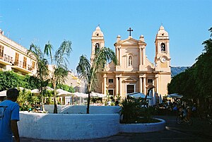
Terrasini is a town and comune in the Metropolitan City of Palermo on the island of Sicily in Italy.
Carini
Comune in Sicily, Italy
Distance: Approx. 2649 meters
Latitude and longitude: 38.13333333,13.18333333
Carini (Latin: Hyccara or Hyccarum, Ancient Greek: Ὕκαρα and Ὕκαρον) is a city and comune in the Metropolitan City of Palermo, Sicily, 19 kilometres (12 mi) by rail west-northwest of Palermo. It has a population of 37,752.
Torretta
Comune in Sicily, Italy
Distance: Approx. 5529 meters
Latitude and longitude: 38.13333333,13.23333333
Torretta (Sicilian: Turretta) is a comune in the Metropolitan City of Palermo located on the Mediterranean island of Sicily. This town is situated on a mountainous area overlooking Palermo. Olive production is Torretta's primary agriculture product and other industries include aluminum and marble.

Montelepre
Comune in Sicily, Italy
Distance: Approx. 6384 meters
Latitude and longitude: 38.1,13.16666667
Montelepre (Italian pronunciation: [monteˈleːpre]; Sicilian: Muncilebbri) is a town and comune in the Metropolitan City of Palermo, Sicily, Italy. It is known for having been the native city of Sicilian bandit Salvatore Giuliano, of architect Rosario Candela, as well as the ancestral homeland of the American singer, actor, and congressman Sonny Bono, whose father Santo Bono was born in the town.

Capaci
Comune in Sicily, Italy
Distance: Approx. 5003 meters
Latitude and longitude: 38.16666667,13.23333333
Capaci (Italian pronunciation: [kaˈpaːtʃi]) is a town and comune in the Metropolitan City of Palermo in Sicily, Italy. In 2011 the comune had a population of 11,045, with a density of 1,804.7 people per square kilometre. The A29 autostrada running from Palermo to Punta Raisi Airport, and to the west and south-west of the island, passes through the commune.
Cinisi
Comune in Sicily, Italy
Distance: Approx. 6882 meters
Latitude and longitude: 38.16666667,13.1
Cinisi (Italian: [ˈtʃiːnizi]; Sicilian: Cìnisi [ˈtʃiːnɪsɪ]) is a town and a comune in the Metropolitan City of Palermo in Sicily. As of 1 January 2022 it has a population of 11.846.

Isola delle Femmine
Comune in Sicily, Italy
Distance: Approx. 7581 meters
Latitude and longitude: 38.19722222,13.24722222
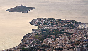
Isola delle Femmine (Sicilian: Isula dî Fìmmini) is an Italian town in northwestern Sicily, administratively part of the Metropolitan City of Palermo. Despite its name, which can be translated in English as "The Island of Females", the town is located in mainland Sicily. The name of the town was chosen after the name of the small island that sits just off shore from it when it became an independent municipality from the neighboring city of Capaci in 1854.

Alitalia Flight 112
1972 passenger plane crash near Palermo, Italy
Distance: Approx. 4552 meters
Latitude and longitude: 38.12305556,13.14805556
Alitalia Flight 112 was a scheduled flight from Leonardo da Vinci Airport, in Rome, Italy, to Palermo International Airport in Palermo, Italy, with 115 on board. On 5 May 1972, it crashed into Mount Longa, about 3 miles (4.8 km) southwest of Palermo while on approach to the airport, killing all 115 passengers and crew onboard. Investigators believe that the crew had three miles visibility and did not adhere to the established vectors issued by air traffic control.

Alitalia Flight 4128
1978 aviation accident
Distance: Approx. 8275 meters
Latitude and longitude: 38.20777778,13.10888889
Alitalia Flight 4128 was a scheduled flight from Leonardo da Vinci Airport, in Rome, Italy, to Palermo International Airport in Palermo, Italy, with 129 on board. On 23 December 1978, it crashed into the Tyrrhenian Sea about 3 km (1.9 mi) north of Palermo while on approach. The accident was attributed to the flight deck crew believing they were nearer to the runway than they were, and therefore making a premature descent.

Palermo Aeroporto railway station
Railway station in Italy
Distance: Approx. 7205 meters
Latitude and longitude: 38.18722222,13.105
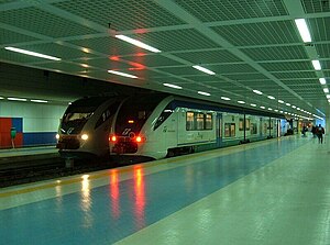
Palermo Aeroporto railway station (Italian: Stazione di Palermo Aeroporto), formerly known as Punta Raisi railway station, is located within Palermo Airport (Italian: Aeroporto di Palermo "Falcone e Borsellino") (IATA code: PMO) in Cinisi, near Palermo, Sicily, Italy. Opened in 2004, the station is the northwestern terminus of the Palermo Passante railway, and forms part of the Palermo Metro. The station is managed by Rete Ferroviaria Italiana (RFI).
Diamante Fondo Patti
Baseball stadium in Palermo, Italy
Distance: Approx. 5003 meters
Latitude and longitude: 38.11287,13.19021
The Diamante Fondo Patti is Palermo, Italy's main baseball stadium. Inaugurated in 1997, it has degraded since due to lack of care, even though the city had announced works to restore it in 2014.
Weather in this IP's area
overcast clouds
14 Celsius
14 Celsius
14 Celsius
14 Celsius
1015 hPa
84 %
1015 hPa
995 hPa
6783 meters
10.88 m/s
14.69 m/s
110 degree
100 %

