Country:
Region:
City:
Latitude and Longitude:
Time Zone:
Postal Code:
IP information under different IP Channel
ip-api
Country
Region
City
ASN
Time Zone
ISP
Blacklist
Proxy
Latitude
Longitude
Postal
Route
Luminati
Country
Region
vlg
City
willebroek
ASN
Time Zone
Europe/Brussels
ISP
Arcadiz Telecom NV
Latitude
Longitude
Postal
IPinfo
Country
Region
City
ASN
Time Zone
ISP
Blacklist
Proxy
Latitude
Longitude
Postal
Route
db-ip
Country
Region
City
ASN
Time Zone
ISP
Blacklist
Proxy
Latitude
Longitude
Postal
Route
ipdata
Country
Region
City
ASN
Time Zone
ISP
Blacklist
Proxy
Latitude
Longitude
Postal
Route
Popular places and events near this IP address

Borsbeek
Municipality in Flemish Community, Belgium
Distance: Approx. 490 meters
Latitude and longitude: 51.2,4.48333333
Borsbeek (Flemish pronunciation: [ˈbɔrzbeːk] ) is a municipality located in Flanders, one of the three regions of Belgium, and in the Flemish province of Antwerp. The municipality only comprises the town of Borsbeek proper. On 1 January 2021 Borsbeek had a total population of 11,076.
Wommelgem
Municipality in Flemish Community, Belgium
Distance: Approx. 2194 meters
Latitude and longitude: 51.2,4.51666667
Wommelgem (Dutch pronunciation: [ˈʋɔməlɣɛm]) is a municipality located in the Belgian province of Antwerp. The municipality only comprises the town of Wommelgem proper. In 2021, Wommelgem had a total population of 12,991.

Antwerp International Airport
International airport serving Antwerp, Belgium
Distance: Approx. 1927 meters
Latitude and longitude: 51.18944444,4.46027778
Antwerp International Airport (IATA: ANR, ICAO: EBAW), commonly known simply as Antwerp Airport, is a small international airport located 2.9 nautical miles (5.4 km; 3.3 mi) south of Antwerp, Belgium. The airport is used for some scheduled and charter flights, as well as business and general aviation, and served 239,517 passengers in 2022.

Sporthal Arena
Distance: Approx. 2197 meters
Latitude and longitude: 51.20661944,4.45945833
Sporthal Arena is an indoor arena in Deurne, Antwerp, Belgium. Built in 1966, it has a capacity for 2,100 people, 1,196 of which are seating capacity. An 800,000 Euro renovation works took place between April 2008-February 2009.
GTI Mortsel
Distance: Approx. 2989 meters
Latitude and longitude: 51.1773,4.455
GTI Mortsel is a vocational secondary school in Mortsel, Belgium.

Mortsel railway station
Railway station in Antwerp, Belgium
Distance: Approx. 2952 meters
Latitude and longitude: 51.18305556,4.44888889
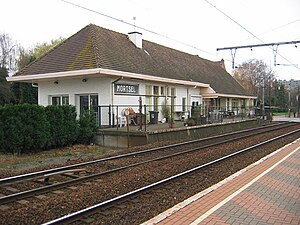
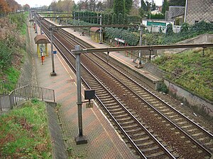
Mortsel is a railway station in Mortsel, just south of the city of Antwerp, Antwerp, Belgium. The station opened in 1895 on the Line 27. The station Mortsel-Deurnesteenweg is located just 100 m east of this station on the line towards Brussels.

Mortsel-Liersesteenweg railway station
Railway station in Antwerp, Belgium
Distance: Approx. 3204 meters
Latitude and longitude: 51.16916667,4.46888889
Mortsel-Liersesteenweg is a railway station in Mortsel, just south of the city of Antwerp, Antwerp, Belgium. The station opened in 1933 as Mortsel-Oude-God on Line 27. The station closed in 1939 and re-opened in December 2008.

Mortsel-Deurnesteenweg railway station
Railway station in Antwerp, Belgium
Distance: Approx. 3115 meters
Latitude and longitude: 51.18222222,4.44694444
Mortsel-Deurnesteenweg is a railway station in Mortsel, just south of the city of Antwerp, Antwerp, Belgium. The station opened in 1933 on the Line 25. The station Mortsel is located just 100m east of this station on the line towards Lier.

Sterckshof silver museum
Museum in Deurne, Antwerp, Belgium
Distance: Approx. 2668 meters
Latitude and longitude: 51.214992,4.462777
The Sterckshof silver museum of the province of Antwerp (Dutch: Zilvermuseum Sterckshof Provincie Antwerpen, French: Musée de l'Argenterie de Sterckshof) was a museum located in Sterckshof castle in Deurne, Province of Antwerp, Belgium, from 1994 to 2014. It then merged with the Antwerp Diamond Museum to form DIVA Museum for Diamonds, Jewellery and Silver, based in Antwerp city centre.

Sterckshof
Distance: Approx. 2668 meters
Latitude and longitude: 51.214992,4.462777
The Sterckshof castle is in Deurne, Antwerp, Belgium. From 1994 to 2014 it housed the Sterckshof silver museum of the Province of Antwerp. Built on the site of a much older castle, or great house, the present building is a reconstruction erected in the 1920s.

Wijnegem Shopping Center
Shopping mall in Wijnegem, Belgium
Distance: Approx. 3050 meters
Latitude and longitude: 51.2219,4.4997
The Wijnegem Shop Eat Enjoy is a shopping mall in Wijnegem, near Antwerp, Belgium. It features 250 stores and has a gross leasable area of 61,913 square metres (666,430 sq ft), making it the largest shopping mall in Belgium and the Benelux. In 2018, the mall changed its name.
Vlaams Tram- en Autobusmuseum
Transit museum in Antwerp, Belgium
Distance: Approx. 3228 meters
Latitude and longitude: 51.1996,4.44
The Flemish Tram and Bus Museum (Dutch: Vlaams Tram- en Autobusmuseum, abbreviated as VlaTAM) is a museum of public transport that exhibits historical trams and buses. The museum is situated in the Berchem district of Antwerp, in the former tram shed of Groenenhoek. The museum is supported by transport company De Lijn.
Weather in this IP's area
light intensity drizzle
8 Celsius
8 Celsius
7 Celsius
9 Celsius
1025 hPa
97 %
1025 hPa
1024 hPa
4200 meters
1.34 m/s
2.24 m/s
223 degree
100 %
07:43:59
17:07:26

