Country:
 Belgium
Region:
City:
Latitude and Longitude:
Time Zone:
Postal Code:
IP information under different IP Channel
ip-api
Country
Region
City
ASN
Time Zone
ISP
Blacklist
Proxy
Latitude
Longitude
Postal
Route
IPinfo
Country
Region
City
ASN
Time Zone
ISP
Blacklist
Proxy
Latitude
Longitude
Postal
Route
MaxMind
Country
Region
City
ASN
Time Zone
ISP
Blacklist
Proxy
Latitude
Longitude
Postal
Route
Luminati
Country
BERegion
vlg
City
borsbeek
ASN
Time Zone
Europe/Brussels
ISP
Arcadiz Telecom NV
Latitude
Longitude
Postal
db-ip
Country
Region
City
ASN
Time Zone
ISP
Blacklist
Proxy
Latitude
Longitude
Postal
Route
ipdata
Country
Region
City
ASN
Time Zone
ISP
Blacklist
Proxy
Latitude
Longitude
Postal
Route
Popular places and events near this IP address
Flanders
Dutch-speaking region of Belgium
Distance: Approx. 3314 meters
Latitude and longitude: 51,4.5
Flanders (, ; Dutch: Vlaanderen [ˈvlaːndərə(n)] ) is the Dutch-speaking northern portion of Belgium and one of the communities, regions and language areas of Belgium. However, there are several overlapping definitions, including ones related to culture, language, politics, and history, and sometimes involving neighbouring countries. The demonym associated with Flanders is Fleming, while the corresponding adjective is Flemish, which can also refer to the collective of Dutch dialects spoken in that area, or more generally the Belgian variant of Standard Dutch.

Bonheiden
Municipality in Flemish Community, Belgium
Distance: Approx. 2195 meters
Latitude and longitude: 51.03333333,4.53333333
Bonheiden (Dutch pronunciation: [bɔnˈɦɛidə(n)] ) is a municipality located in the Belgian province of Antwerp. The municipality comprises the towns of Bonheiden proper and Rijmenam. In 2021, Bonheiden had a total population of 15,177.

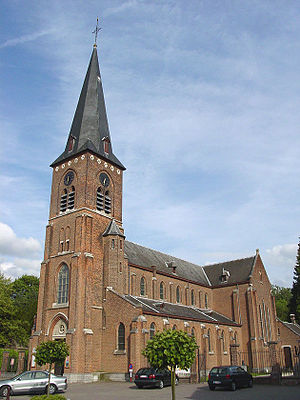
Boortmeerbeek
Municipality in Flemish Community, Belgium
Distance: Approx. 3872 meters
Latitude and longitude: 50.98333333,4.56666667
Boortmeerbeek (Dutch pronunciation: [ˈboːrtmeːrˌbeːk] ) is a town in the Belgian province of Flemish Brabant. The municipality comprises the towns of Boortmeerbeek proper, Schiplaken and Hever. The total area is 18.64 km2 which gives a population density of 620 inhabitants per km2.
Flemish Region
Northernmost federal region of Belgium
Distance: Approx. 3314 meters
Latitude and longitude: 51,4.5
The Flemish Region (Dutch: Vlaams Gewest, pronounced [ˌvlaːms xəˈʋɛst] ), usually simply referred to as Flanders (Dutch: Vlaanderen [ˈvlaːndərə(n)] ), is one of the three regions of Belgium—alongside the Walloon Region and the Brussels-Capital Region. Covering the northern portion of the country, the Flemish Region is primarily Dutch-speaking. With an area of 13,626 km2 (5,261 sq mi), it accounts for only 45% of Belgium's territory, but 58% of its population.
Flemish Community
Institutional community of Belgium
Distance: Approx. 3314 meters
Latitude and longitude: 51,4.5
The Flemish Community is one of the three institutional communities of Belgium, established by the Belgian constitution and having legal responsibilities only within the precise geographical boundaries of the Dutch-language area and of the bilingual area of Brussels-Capital. Unlike in the French Community of Belgium, the competences of the Flemish Community have been unified with those of the Flemish Region and are exercised by one directly elected Flemish Parliament based in Brussels.

Rijmenam
Village in Flemish Region, Belgium
Distance: Approx. 3404 meters
Latitude and longitude: 51.002,4.586
Rijmenam is a village located in the Belgian province of Antwerp and is part of the municipality of Bonheiden.
Hever, Belgium
Distance: Approx. 1700 meters
Latitude and longitude: 51,4.55
Hever is a village in the province of Flemish Brabant in Flanders, Belgium. It was a separate municipality until 1977 and is now a part of Boortmeerbeek.

Nekkerspoel
Neighbourhood in Antwerp, Flemish Region
Distance: Approx. 3506 meters
Latitude and longitude: 51.03083333,4.49888889
Nekkerspoel is a neighbourhood of Mechelen, Belgium, immediately east of the city. The name means pool of one or more Nekkers or water demons. and it is presumed that in earlier centuries locals taking a shortcut through the marshlands, of which the Mechels Broek is a surviving remnant, may have strayed off safer pathways and lost their lives.
Schiplaken
Distance: Approx. 3902 meters
Latitude and longitude: 50.98,4.53
Schiplaken is a village within the municipality of Boortmeerbeek, in the province of Flemish Brabant, Belgium.

Planckendael
Zoo in Mechelen, Belgium
Distance: Approx. 2271 meters
Latitude and longitude: 51.001389,4.516389
Planckendael is a zoo, located on the grounds of Planckendael castle in the village district of Muizen, in Mechelen, Belgium. In 1956 the Royal Zoological Society of Antwerp (KMDA) bought the Planckendael estate in order to acquire a larger space for animals than what they owned: the city zoo in Antwerp. Planckendael hosts exotic animals like rhinos, bison and various antelope species.
Mechelen Toy Museum
Toy museum in Mechelen, Belgium
Distance: Approx. 3969 meters
Latitude and longitude: 51.03027778,4.49083333
The Mechelen Toy Museum (Dutch: Speelgoedmuseum Mechelen) is a Toy Museum\ situated in the Nekkerspoel hamlet in Mechelen, Belgium, is a museum containing a unique collection of past and contemporary toys on a total surface of 7,000 m2. The museum was founded in April 1982, and since 1998 it is a recognized museum. The permanent collection is subdivided in the following categories: Circus and kermesse Construction toys Creative and educational toys Stuffed toys Mechanical and iron toys Optical and sound-making toys Puppets Puzzles and board games Soldiers Toys around the world Traditional child games and Pieter Bruegel Trains Transport in miniature Apart from that there are also changing exhibitions.
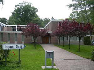
Bethlehem Abbey, Bonheiden
Distance: Approx. 870 meters
Latitude and longitude: 51.02,4.55
Bethlehem Abbey in the village of Bonheiden, Belgium, is a house of Benedictine nuns of the Subiaco Cassinese Congregation. The monastery was built in 1965 as a Redemptorist house but was transferred to the Benedictines in 1975. The community formerly ran a publishing imprint which produced Dutch translations of the writings of Basil of Caesarea and Athanasius of Alexandria.
Weather in this IP's area
broken clouds
14 Celsius
14 Celsius
13 Celsius
15 Celsius
1007 hPa
89 %
1007 hPa
1006 hPa
10000 meters
6.69 m/s
230 degree
75 %
07:42:36
19:20:02