Country:
Region:
City:
Latitude and Longitude:
Time Zone:
Postal Code:
IP information under different IP Channel
ip-api
Country
Region
City
ASN
Time Zone
ISP
Blacklist
Proxy
Latitude
Longitude
Postal
Route
Luminati
Country
Region
vlg
City
willebroek
ASN
Time Zone
Europe/Brussels
ISP
Arcadiz Telecom NV
Latitude
Longitude
Postal
IPinfo
Country
Region
City
ASN
Time Zone
ISP
Blacklist
Proxy
Latitude
Longitude
Postal
Route
db-ip
Country
Region
City
ASN
Time Zone
ISP
Blacklist
Proxy
Latitude
Longitude
Postal
Route
ipdata
Country
Region
City
ASN
Time Zone
ISP
Blacklist
Proxy
Latitude
Longitude
Postal
Route
Popular places and events near this IP address

Willebroek
Municipality in Flemish Community, Belgium
Distance: Approx. 709 meters
Latitude and longitude: 51.06666667,4.36666667
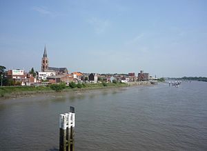
Willebroek (Dutch pronunciation: [ˈʋɪləbruk], old spelling: Willebroeck, also French: Willebrouck) is a municipality located in the Belgian province of Antwerp. The municipality comprises the towns of Blaasveld, Heindonk, Tisselt, Klein Willebroek, and Willebroek proper. In 2021, Willebroek had a total population of 27,081.
Boom, Belgium
Municipality in Flemish Community, Belgium
Distance: Approx. 2540 meters
Latitude and longitude: 51.08333333,4.36666667
Boom ( BOHM, Dutch: [boːm] ) is a Belgian town, located in both the arrondissement and province of Antwerp. In 2021, Boom had a total population of 18,799. The total area is 7.37 km2 (2.85 sq mi).

Fort Breendonk
Military fort which served as a Nazi prison camp in Willebroek, Belgium
Distance: Approx. 1623 meters
Latitude and longitude: 51.05638889,4.34138889
Fort Breendonk (Dutch: Fort van Breendonk, French: Fort de Breendonk) is a former military installation at Breendonk, near Mechelen, Belgium, which served as a Nazi prison camp (Auffanglager) during the German occupation of Belgium during World War II. Originally constructed between 1906 and 1913 as part of the second ring of the National Redoubt defending Antwerp, Fort Breendonk was used by the Belgian Army and was covered by a five-metre thick layer of soil for defense against artillery fire, a water-filled moat and measured 656 by 984 feet (200 by 300 m). It was used in both World War I and World War II by which time it had become militarily obsolete. Fort Breendonk was requisitioned by the Schutzstaffel (SS) shortly after the Belgian surrender on 28 May 1940 and used as a prison camp for the detention of political prisoners, resistance members, and Jews.

Dyle (river)
River in Belgium
Distance: Approx. 4205 meters
Latitude and longitude: 51.0735,4.4201
The Dyle (French: [dil]; Dutch: Dijle [ˈdɛilə]) is a river in central Belgium, left tributary of the Rupel. It is 86 kilometres (53 mi) long. It flows through the Belgian provinces of Walloon Brabant, Flemish Brabant and Antwerp.

Hazewinkel
Distance: Approx. 2143 meters
Latitude and longitude: 51.066,4.393
The Hazewinkel is a 2000-meter rowing and regatta course belonging to Sport Vlaanderen in Heindonk, municipality of Willebroek, near Mechelen, Belgium. The site consists of a finish tower, boathouses, a cafeteria, and eight basic huts that house athletes using the lake. The course hosted British Rowing's final trials for some years as well as a World Rowing Junior Championships (1997), two World Rowing Under 23 Championships (1996, 2006), and two World Rowing Championships (1980, 1985).

Duvel Moortgat Brewery
Flemish family-controlled brewery founded in 1871 in Belgium
Distance: Approx. 3202 meters
Latitude and longitude: 51.041996,4.32871
Duvel Moortgat Brewery (Brouwerij Duvel Moortgat) is a Flemish family-controlled brewery founded in 1871 in Antwerp Province, Belgium. Its strong golden pale ale, Duvel, is exported to more than forty countries. Duvel is Brabantian, Ghent and Antwerp dialect for devil, the standard Dutch word being duivel [ˈdœy̯vəl].

Breendonk
Village in Flemish Region
Distance: Approx. 2424 meters
Latitude and longitude: 51.05,4.33333333
Breendonk is a village in the municipality of Puurs-Sint-Amands in the province of Antwerp, Belgium, with a population of 3,000, halfway between Brussels and Antwerp.
Brussels–Scheldt Maritime Canal
Canal in Belgium
Distance: Approx. 3658 meters
Latitude and longitude: 51.028,4.357
The Brussels–Scheldt Maritime Canal (French: Canal maritime de Bruxelles à l'Escaut; Dutch: Zeekanaal Brussel-Schelde), also known as the Willebroek Canal amongst other similar names, is an important canal in Belgium. The 28-kilometre-long (17 mi) canal has a width of 30 metres (98 ft) and a draught of 2 metres (6 ft 7 in), and connects Brussels with the Scheldt river at Wintam and ultimately the sea. The canal is one of the oldest navigable canals in Belgium and indeed in Europe.

Heindonk
Village in Flemish Region
Distance: Approx. 3107 meters
Latitude and longitude: 51.06666667,4.40694444
Heindonk is a Belgian village in the municipality of Willebroek in the province of Antwerp in Belgium. It is situated northwest of the city of Mechelen.

Tomorrowland (festival)
Belgian annual electronic dance music festival
Distance: Approx. 3841 meters
Latitude and longitude: 51.09222222,4.38555556
Tomorrowland is a large-scale annual electronic dance music festival held in Boom, Antwerp, Belgium. Taking place within De Schorre provincial recreational park, it debuted in 2005, from an idea conceived by brothers Manu and Michiel Beers. Since then, Tomorrowland has become one of the best known music festivals in the world.
Harmonium Art museuM
Musical instrument museum in Klein-Willebroek
Distance: Approx. 2190 meters
Latitude and longitude: 51.08024111,4.36541889
The Harmonium Art museuM (HAM) is a museum on pump organs in the province of Antwerp, Belgium. It is located at the former Church of the Immaculate Conception in Klein-Willebroek. The collection has been brought together by Ben Roemendael.

Ruisbroek, Antwerp
Village in Flemish Region
Distance: Approx. 3851 meters
Latitude and longitude: 51.088,4.33
Ruisbroek is a village in the municipality of Puurs-Sint-Amands located in the Antwerp Province of Belgium. Ruisbroek was an independent municipality until 1977 was merged into Puurs. In 2019, Puurs itself was merged into Puurs-Sint-Amands.
Weather in this IP's area
few clouds
7 Celsius
6 Celsius
5 Celsius
8 Celsius
1010 hPa
85 %
1010 hPa
1010 hPa
10000 meters
1.54 m/s
250 degree
20 %
08:04:37
16:51:15

