185.166.253.4 - IP Lookup: Free IP Address Lookup, Postal Code Lookup, IP Location Lookup, IP ASN, Public IP
Country:
Region:
City:
Location:
Time Zone:
Postal Code:
IP information under different IP Channel
ip-api
Country
Region
City
ASN
Time Zone
ISP
Blacklist
Proxy
Latitude
Longitude
Postal
Route
Luminati
Country
ASN
Time Zone
Europe/Rome
ISP
web2objects GmbH
Latitude
Longitude
Postal
IPinfo
Country
Region
City
ASN
Time Zone
ISP
Blacklist
Proxy
Latitude
Longitude
Postal
Route
IP2Location
185.166.253.4Country
Region
lombardia
City
colico
Time Zone
Europe/Rome
ISP
Language
User-Agent
Latitude
Longitude
Postal
db-ip
Country
Region
City
ASN
Time Zone
ISP
Blacklist
Proxy
Latitude
Longitude
Postal
Route
ipdata
Country
Region
City
ASN
Time Zone
ISP
Blacklist
Proxy
Latitude
Longitude
Postal
Route
Popular places and events near this IP address

Domaso
Comune in Lombardy, Italy
Distance: Approx. 3428 meters
Latitude and longitude: 46.15,9.33333333
Domaso (Comasco: Dumàs [duˈmaːs]) is a comune (municipality) in the Province of Como in the Italian region Lombardy, located about 80 kilometres (50 mi) north of Milan and about 40 kilometres (25 mi) northeast of Como. As of 9 October 2011, it had a population of 1,455 and an area of 6.1 km². Domaso borders the following municipalities: Colico, Gravedona, Livo, Peglio, Vercana.

Gera Lario
Comune in Lombardy, Italy
Distance: Approx. 3822 meters
Latitude and longitude: 46.16666667,9.36666667
Gera Lario (Ticinese: Gera) is a comune (municipality) in the Province of Como in the Italian region of Lombardy, located about 80 kilometres (50 mi) north of Milan and about 45 kilometres (28 mi) northeast of Como. As of 31 December 2004, it had a population of 942 and an area of 6.7 km². Gera Lario borders the following municipalities: Colico, Dubino, Montemezzo, Piantedo, Sorico, Trezzone, Vercana.

Sorico
Comune in Lombardy, Italy
Distance: Approx. 3955 meters
Latitude and longitude: 46.16666667,9.38333333
Sorico (Comasco: Suregh [ˈsuːrek]) is a comune (municipality) in the Province of Como in the Italian region Lombardy, located about 80 kilometres (50 mi) north of Milan and about 45 kilometres (28 mi) northeast of Como. As of 31 December 2004, it had a population of 1,188 and an area of 23.3 square kilometres (9.0 sq mi). The municipality of Sorico contains the frazioni (subdivisions, mainly villages and hamlets) Albonico, Bugiallo, and Dascio.
Trezzone
Comune in Lombardy, Italy
Distance: Approx. 4109 meters
Latitude and longitude: 46.16666667,9.35
Trezzone (Lombard: Trezzon [tretsũː] or [treˈtsõː]) is a comune (municipality) in the Province of Como in the Italian region Lombardy, located about 80 kilometres (50 mi) north of Milan and about 45 kilometres (28 mi) northeast of Como. As of 31 December 2004, it had a population of 212 and an area of 4.0 square kilometres (1.5 sq mi). Trezzone borders the following municipalities: Gera Lario, Montemezzo, Vercana.

Piantedo
Comune in Lombardy, Italy
Distance: Approx. 3617 meters
Latitude and longitude: 46.13333333,9.41666667
Piantedo (Lombard: Pianté) is a comune (municipality) in the Province of Sondrio in the Italian region of Lombardy, located about 80 km north of Milan and about 35 km west of Sondrio. As of 31 December 2004, it had a population of 1,258 and an area of 6.7 km2. Piantedo borders the following municipalities: Colico, Delebio, Dubino, Gera Lario, Pagnona.

Mera (Lake Como)
River in Switzerland and Italy
Distance: Approx. 3851 meters
Latitude and longitude: 46.1668,9.3751
The Mera (Lombard: Maira) is a river in Switzerland and Italy. Its source is near the Piz Mungiroi, in the Grisons, Switzerland. First, it flows east in the direction to Maloja Pass, then turns west through the Val Bregaglia (German: Bergell) and crosses the border to Italy in Castasegna (Dogana).
Piona Abbey
Distance: Approx. 3102 meters
Latitude and longitude: 46.123755,9.331581
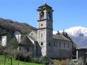
The Piona Priory or Piona Abbey, is a religious complex on the Lecco bank of Lake Como in the territory of the comune of Colico, northern Italy. The abbey is set at the top of a small peninsula, the Olgiasca, which – like a crooked finger – points into the lake, creating an inlet.
Curcio
Frazione in Lombardy, Italy
Distance: Approx. 2321 meters
Latitude and longitude: 46.134,9.3998
Curcio is a part of the mainland of Colico, Lombardy, northern Italy. The name Curcio is first mentioned in a slab dated 1585, which can still be seen as a part of the public washing fountain of the town. The first church was built in 1842 and dedicated to Holy Guardian Angels; a new church was built in 1946-1957.

Fort Montecchio-Lusardi
Distance: Approx. 1548 meters
Latitude and longitude: 46.14361111,9.38166667
Fort Montecchio-Lusardi is a military fort situated in Colico, in the province of Lecco, northern Italy. It was built between 1911 and 1914. It is the only Italian fort from World War I which has been preserved intact with its original weapons.

Fort Fuentes
Distance: Approx. 3152 meters
Latitude and longitude: 46.1479,9.404
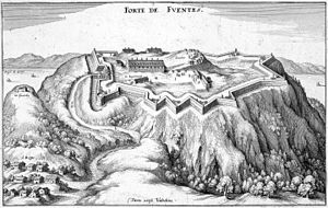
Fort Fuentes, Italian: Forte di Fuentes, is a former military fort on the hill of Montecchio or Monteggiolo near Colico, in the province of Lecco, Lombardy, northern Italy. It was built by the Spanish governor of Milan, Don Pedro Enríquez de Acevedo, Count of Fuentes, to command the Pian di Spagna and the strategic Trivio di Fuentes, the crossroads between the Valtellina, the Valchiavenna and the Alto Lario, in order to defend the northern border of the Spanish domain against the Grisons to the north. Construction was begun in 1603 or October 1609 under military architect Gabrio Brusca, and was substantially complete within three years.
Colico railway station
Railway station in Italy
Distance: Approx. 408 meters
Latitude and longitude: 46.135833,9.371667
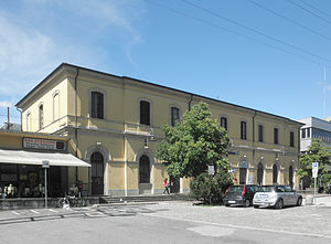
Colico railway station is a railway station in Italy. Located on the Tirano–Lecco railway (with trains also to and from Milano Centrale) and the Colico-Chiavenna railway, it serves the town of Colico.

Livo (river)
River in Italy
Distance: Approx. 3565 meters
Latitude and longitude: 46.1488,9.3301
The Livo (Italian: Torrente di Livo) is an Italian river that arises at an elevation of about 1,800 metres (5,900 ft) in the alpine basin of Lake Darengo, northwest of Lake Como. The river runs through the homonymous valley and flows into Lake Como in Domaso.
Weather in this IP's area
few clouds
5 Celsius
5 Celsius
3 Celsius
5 Celsius
1033 hPa
43 %
1033 hPa
1005 hPa
10000 meters
0.89 m/s
1.79 m/s
52 degree
19 %

