185.165.76.179 - IP Lookup: Free IP Address Lookup, Postal Code Lookup, IP Location Lookup, IP ASN, Public IP
Country:
Region:
City:
Location:
Time Zone:
Postal Code:
ISP:
ASN:
language:
User-Agent:
Proxy IP:
Blacklist:
IP information under different IP Channel
ip-api
Country
Region
City
ASN
Time Zone
ISP
Blacklist
Proxy
Latitude
Longitude
Postal
Route
db-ip
Country
Region
City
ASN
Time Zone
ISP
Blacklist
Proxy
Latitude
Longitude
Postal
Route
IPinfo
Country
Region
City
ASN
Time Zone
ISP
Blacklist
Proxy
Latitude
Longitude
Postal
Route
IP2Location
185.165.76.179Country
Region
zonguldak
City
zonguldak
Time Zone
Europe/Istanbul
ISP
Language
User-Agent
Latitude
Longitude
Postal
ipdata
Country
Region
City
ASN
Time Zone
ISP
Blacklist
Proxy
Latitude
Longitude
Postal
Route
Popular places and events near this IP address

Zonguldak
Municipality in Turkey
Distance: Approx. 721 meters
Latitude and longitude: 41.45638889,31.79861111
Zonguldak (Turkish pronunciation: [zoŋˈguɫdak]) is a city of about 100 thousand people in the Black Sea region of Turkey. It is the seat of Zonguldak Province and Zonguldak District. It was established in 1849 as a port town for the nearby coal mines in Ereğli.
Kozlu Dam
Dam in Turkey
Distance: Approx. 3576 meters
Latitude and longitude: 41.4199,31.8015
Kozlu Dam is a dam in Zonguldak Province, Turkey, built between 1979 and 1986. The development was backed by the Turkish State Hydraulic Works.
Zonguldak railway station
Distance: Approx. 504 meters
Latitude and longitude: 41.4469,31.7938
Zonguldak railway station (Turkish: Zonguldak garı) is a regional (formally inter-city) railway station in Zonguldak, Turkey. It is the western terminus of the Zonguldak-Filyos Regional and was the former northern terminus of the Karaelmas Express from Ankara. It was opened in 1937 as the northern terminus of the Irmak-Zonguldak railway.
Zonguldak Bülent Ecevit University
Public university in Zonguldak, Turkey
Distance: Approx. 2530 meters
Latitude and longitude: 41.45111111,31.76277778
Zonguldak Bülent Ecevit University (Turkish: Zonguldak Bülent Ecevit Üniversitesi, formerly Zonguldak Karaelmas University) is a state university located in Zonguldak, Turkey. The university was founded in 1992 with a primary focus on education in Mining and Engineering.

Gökgöl Cave
Show cave in Zonguldak Province, Turkey
Distance: Approx. 3327 meters
Latitude and longitude: 41.44305556,31.83138889
Gökgöl Cave (Turkish: Gökgöl Mağarası) is a show cave in Zonguldak Province, Turkey. It is the fifth biggest cave in the country. It is close to a main highway and is well-decorated with stalactites and stalagmites and attracts many visitors.

Kozlu, Zonguldak
Municipality in Zonguldak, Turkey
Distance: Approx. 4121 meters
Latitude and longitude: 41.43333333,31.75
Kozlu is a town in the central part of Zonguldak Province, Turkey. It is situated at the coast of the Black Sea, west of Zonguldak city. It is almost merged with Zonguldak.
Kilimli
Municipality in Zonguldak, Turkey
Distance: Approx. 4889 meters
Latitude and longitude: 41.48333333,31.83333333
Kilimli is a town in Zonguldak Province, Turkey. It is the seat of Kilimli District. Its population is 19,989 (2022).
Çağlı, Zonguldak
Village in Zonguldak, Turkey
Distance: Approx. 5817 meters
Latitude and longitude: 41.39916667,31.795
Çağlı is a village in Zonguldak District, Zonguldak Province, Turkey. Its population is 197 (2022).
İnağzı Cave
Cave in northern Turkey
Distance: Approx. 3687 meters
Latitude and longitude: 41.47138889,31.82833333
İnağzı Cave (Turkish: İnağzı Mağarası) is a cave located in Zonguldak, northern Turkey.
Crenides (Bithynia)
Town on the Pontic coast of Bithynia
Distance: Approx. 5918 meters
Latitude and longitude: 41.49065,31.84095
Crenides or Krenides (Ancient Greek: Κρηνίδες), or Cranides or Kranides (Κρανίδες), was a town on the Pontic coast of Bithynia, according to Arrian 60 stadia east of Sandaraca; according to Marcian only 20 stadia. It was between Heraclea and the mouth of the Billaeus. The site of Crenides is near the modern Kilimli, Turkey.
Sandaraca
Coastal town of ancient Bithynia
Distance: Approx. 789 meters
Latitude and longitude: 41.4566075,31.786683
Sandaraca or Sandarake (Ancient Greek: Σανδαράκη) was a coastal town of ancient Bithynia, at a distance of 90 stadia to the east of the river Oxines Its site is located near Zonguldak in Asiatic Turkey.
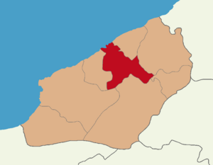
Zonguldak District
District of Zonguldak Province, Turkey
Distance: Approx. 2092 meters
Latitude and longitude: 41.43333333,31.8
Zonguldak District (also: Merkez, meaning "central" in Turkish) is a district of the Zonguldak Province of Turkey. Its seat is the city of Zonguldak. Its area is 272 km2, and its population is 118,776 (2022).
Weather in this IP's area
overcast clouds
6 Celsius
4 Celsius
6 Celsius
6 Celsius
1019 hPa
66 %
1019 hPa
1002 hPa
10000 meters
2.69 m/s
2.99 m/s
118 degree
100 %

