Country:
Region:
City:
Latitude and Longitude:
Time Zone:
Postal Code:
IP information under different IP Channel
ip-api
Country
Region
City
ASN
Time Zone
ISP
Blacklist
Proxy
Latitude
Longitude
Postal
Route
Luminati
Country
Region
be
City
bern
ASN
Time Zone
Europe/Zurich
ISP
Init7 (Switzerland) Ltd.
Latitude
Longitude
Postal
IPinfo
Country
Region
City
ASN
Time Zone
ISP
Blacklist
Proxy
Latitude
Longitude
Postal
Route
db-ip
Country
Region
City
ASN
Time Zone
ISP
Blacklist
Proxy
Latitude
Longitude
Postal
Route
ipdata
Country
Region
City
ASN
Time Zone
ISP
Blacklist
Proxy
Latitude
Longitude
Postal
Route
Popular places and events near this IP address

Bremgarten bei Bern
Municipality in Bern, Switzerland
Distance: Approx. 1748 meters
Latitude and longitude: 46.96666667,7.43333333
Bremgarten bei Bern is a municipality in the Bern-Mittelland administrative district in the canton of Bern in Switzerland.

Wankdorfhalle
Distance: Approx. 2042 meters
Latitude and longitude: 46.964919,7.466213
The Wankdorfhalle is an indoor sporting arena near the Stadion Wankdorf football stadium in Bern, Switzerland. The capacity of the arena is 3,100 people. It hosted some matches at the 2006 European Men's Handball Championship and the home games of BSV Bern Muri and Bern Capitals.

Felsenau Power Plant
Hydroelectric power plant in Bern, Switzerland
Distance: Approx. 1296 meters
Latitude and longitude: 46.9688,7.4391
The Felsenau power plant (German: Kraftwerk Felsenau) is a hydroelectric power plant located on the river Aar in Bern, Switzerland. It was built in 1909 by the city's utility company, Energie Wasser Bern. After a 1989 modernisation, the turbine hall is now used as a museum.

Reichenbach Castle
Distance: Approx. 1333 meters
Latitude and longitude: 46.99055556,7.44916667
Reichenbach castle (Schloss Reichenbach) is located in Zollikofen, about 5 kilometres north of Bern. The castle was founded as a medieval fort, probably built on the site of an earlier Roman fort, on the river Aar. The medieval castle was later rebuilt in the Baroque style.

Bremgarten Castle
Historic site in Bremgarten bei Bern
Distance: Approx. 396 meters
Latitude and longitude: 46.9776,7.4433
Bremgarten Castle (German: Schloss Bremgarten) is a castle in the municipality of Bremgarten of the canton of Bern in Switzerland. It is a Swiss heritage site of national significance.
Neubrügg
Covered wooden bridge over the river Aare
Distance: Approx. 1625 meters
Latitude and longitude: 46.97388889,7.42805556
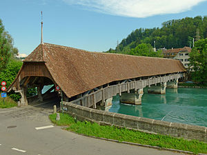
The Neubrügg or Neubrücke (English: New Bridge) is a covered wooden bridge over the river Aare between the village of Kirchlindach and Bern in the canton of Bern in Switzerland. It is a Swiss heritage site of national significance.

Bern Wankdorf railway station
Railway station in Bern, Switzerland
Distance: Approx. 1772 meters
Latitude and longitude: 46.96781889,7.465465
Bern Wankdorf railway station (German: Bahnhof Bern Wankdorf) is a railway station in the municipality of Bern, in the Swiss canton of Bern. It is the first station east of Bern and is an intermediate stop on multiple railway lines.

Bern Felsenau railway station
Railway station in Bern, Switzerland
Distance: Approx. 1221 meters
Latitude and longitude: 46.96805556,7.44388889
Bern Felsenau railway station (German: Bahnhof Bern Felsenau) is a railway station in the municipality of Bern, in the Swiss canton of Bern. It is an intermediate stop on the 1,000 mm (3 ft 3+3⁄8 in) gauge Zollikofen–Bern line of Regionalverkehr Bern-Solothurn.

Bern Tiefenau railway station
Railway station in Bern, Switzerland
Distance: Approx. 631 meters
Latitude and longitude: 46.97305556,7.45
Bern Tiefenau railway station (German: Bahnhof Bern Tiefenau) is a railway station in the municipality of Bern, in the Swiss canton of Bern. It is an intermediate stop on the 1,000 mm (3 ft 3+3⁄8 in) gauge Zollikofen–Bern line of Regionalverkehr Bern-Solothurn.

Worblaufen railway station
Railway station in Ittigen, Switzerland
Distance: Approx. 742 meters
Latitude and longitude: 46.97888889,7.45805556
Worblaufen railway station (German: Bahnhof Worblaufen) is a railway station situated in the municipality of Ittigen, within the canton of Bern in Switzerland. The station serves as a keilbahnhof, a term used to describe a wedge-shaped or junction station. It specifically operates as the nexus for three 1,000 mm (3 ft 3+3⁄8 in) gauge lines managed by the Regionalverkehr Bern-Solothurn (RBS) network.

Steinibach railway station
Railway station in Zollikofen, Switzerland
Distance: Approx. 892 meters
Latitude and longitude: 46.98305556,7.45805556
Steinibach railway station (German: Bahnhof Steinibach) is a railway station in the municipality of Zollikofen, in the Swiss canton of Bern. It is an intermediate stop on the 1,000 mm (3 ft 3+3⁄8 in) gauge Zollikofen–Bern line of Regionalverkehr Bern-Solothurn.

Unterzollikofen railway station
Railway station in Zollikofen, Switzerland
Distance: Approx. 1624 meters
Latitude and longitude: 46.99194444,7.45694444
Unterzollikofen railway station (German: Bahnhof Unterzollikofen) is a railway station in the municipality of Zollikofen, in the Swiss canton of Bern. It is the northern terminus of the 1,000 mm (3 ft 3+3⁄8 in) gauge Zollikofen–Bern line of Regionalverkehr Bern-Solothurn.
Weather in this IP's area
overcast clouds
11 Celsius
11 Celsius
10 Celsius
15 Celsius
1026 hPa
81 %
1026 hPa
965 hPa
10000 meters
1.03 m/s
100 %
07:16:07
17:11:21
