Country:
 France
Region:
City:
Latitude and Longitude:
Time Zone:
Postal Code:
IP information under different IP Channel
ip-api
Country
Region
City
ASN
Time Zone
ISP
Blacklist
Proxy
Latitude
Longitude
Postal
Route
IPinfo
Country
Region
City
ASN
Time Zone
ISP
Blacklist
Proxy
Latitude
Longitude
Postal
Route
MaxMind
Country
Region
City
ASN
Time Zone
ISP
Blacklist
Proxy
Latitude
Longitude
Postal
Route
Luminati
Country
FRASN
Time Zone
Europe/Paris
ISP
Kyxar SARL
Latitude
Longitude
Postal
db-ip
Country
Region
City
ASN
Time Zone
ISP
Blacklist
Proxy
Latitude
Longitude
Postal
Route
ipdata
Country
Region
City
ASN
Time Zone
ISP
Blacklist
Proxy
Latitude
Longitude
Postal
Route
Popular places and events near this IP address

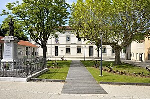
Romans-sur-Isère
Commune in Auvergne-Rhône-Alpes, France
Distance: Approx. 372 meters
Latitude and longitude: 45.0464,5.0517
Romans-sur-Isère (French pronunciation: [ʁɔmɑ̃ syʁizɛːʁ]; Occitan: Rumans d'Isèra; Old Occitan: Romans) is a commune in the Drôme department in southeastern France.

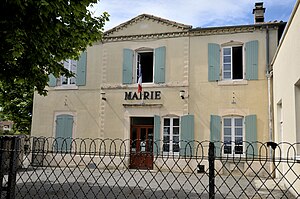
Bourg-de-Péage
Commune in Auvergne-Rhône-Alpes, France
Distance: Approx. 1105 meters
Latitude and longitude: 45.0386,5.0508
Bourg-de-Péage (French pronunciation: [buʁ də peaʒ]; Vivaro-Alpine dialect of Occitan: Lo Borg dau Peatge, [lu buɾk ˈdaw peˈad͡ʒe]; Catalan: Lo Peatge de Pisançon) is a commune in the Drôme department in the region of Auvergne-Rhône-Alpes, France. Its inhabitants are called Péageois; in 2017, the population was 10,205.

Mours-Saint-Eusèbe
Commune in Auvergne-Rhône-Alpes, France
Distance: Approx. 2680 meters
Latitude and longitude: 45.0722,5.0519
Mours-Saint-Eusèbe is a commune in the Drôme department in southeastern France.
Peyrins
Commune in Auvergne-Rhône-Alpes, France
Distance: Approx. 5076 meters
Latitude and longitude: 45.0939,5.0481
Peyrins (French pronunciation: [pɛʁɛ̃]; Occitan: Pairin) is a commune in the Drôme department, southeastern France.

Chatuzange-le-Goubet
Commune in Auvergne-Rhône-Alpes, France
Distance: Approx. 5665 meters
Latitude and longitude: 45.0078,5.0914
Chatuzange-le-Goubet (French pronunciation: [ʃatyzɑ̃ʒ lə ɡubɛ]; Vivaro-Alpine: Chatusange e los Gobets) is a commune in the Drôme department in southeastern France. A hoard of Roman silver objects was found in the commune in the nineteenth century. Known as the Chatuzange Treasure, it can now be seen in the British Museum.
Génissieux
Commune in Auvergne-Rhône-Alpes, France
Distance: Approx. 4984 meters
Latitude and longitude: 45.0844,5.0853
Génissieux (French pronunciation: [ʒenisjø]; Occitan: Geniciu) is a commune in the Drôme department in southeastern France.

Granges-les-Beaumont
Commune in Auvergne-Rhône-Alpes, France
Distance: Approx. 5089 meters
Latitude and longitude: 45.0519,4.9833
Granges-les-Beaumont (French pronunciation: [ɡʁɑ̃ʒ le bomɔ̃], literally Granges near Beaumont; Occitan: Las Granjas) is a commune in the Drôme department in southeastern France.
Canton of Bourg-de-Péage
Distance: Approx. 940 meters
Latitude and longitude: 45.04,5.05
The canton of Bourg-de-Péage is an administrative division of the Drôme department, southeastern France. Its borders were modified at the French canton reorganisation which came into effect in March 2015. Its seat is in Bourg-de-Péage.
Canton of Vercors-Monts du Matin
Distance: Approx. 6319 meters
Latitude and longitude: 45,5.09
The canton of Vercors-Monts du Matin is an administrative division of the Drôme department, southeastern France. It was created at the French canton reorganisation which came into effect in March 2015. Its seat is in Chatuzange-le-Goubet.
Canton of Romans-sur-Isère
Distance: Approx. 977 meters
Latitude and longitude: 45.05,5.06
The canton of Romans-sur-Isère is an administrative division of the Drôme department, southeastern France. It was created at the French canton reorganisation which came into effect in March 2015. Its seat is in Romans-sur-Isère.
2020 Romans-sur-Isère knife attack
Stabbing attack in France
Distance: Approx. 370 meters
Latitude and longitude: 45.04638889,5.05166667
In late morning on 4 April 2020, a knife attack occurred in Romans-sur-Isère, Auvergne-Rhône-Alpes, France, resulting in the death of two people and the wounding of five others. The attacker, Abdallah Ahmed-Osman, a 33-year old Sudanese refugee, was charged with terrorist crimes.

Collegiate Church of Saint-Barnard
Distance: Approx. 654 meters
Latitude and longitude: 45.0425,5.04916667
The Collegiate Church of Saint-Barnard is a former collegiate church in Romans-sur-Isère, France, founded in 838 by Saint Bernard of Vienne on the banks of the Isère river. The church is the subject of a classification as historical monuments by the list of 1840, supplemented by a classification in 1942 for the classification of the plots of land around it.
Weather in this IP's area
overcast clouds
15 Celsius
15 Celsius
15 Celsius
15 Celsius
1013 hPa
88 %
1013 hPa
993 hPa
10000 meters
3.6 m/s
180 degree
100 %
07:59:37
18:49:51