185.163.30.226 - IP Lookup: Free IP Address Lookup, Postal Code Lookup, IP Location Lookup, IP ASN, Public IP
Country:
Region:
City:
Location:
Time Zone:
Postal Code:
IP information under different IP Channel
ip-api
Country
Region
City
ASN
Time Zone
ISP
Blacklist
Proxy
Latitude
Longitude
Postal
Route
Luminati
Country
ASN
Time Zone
Europe/Paris
ISP
Celeste SAS
Latitude
Longitude
Postal
IPinfo
Country
Region
City
ASN
Time Zone
ISP
Blacklist
Proxy
Latitude
Longitude
Postal
Route
IP2Location
185.163.30.226Country
Region
auvergne-rhone-alpes
City
villeneuve
Time Zone
Europe/Paris
ISP
Language
User-Agent
Latitude
Longitude
Postal
db-ip
Country
Region
City
ASN
Time Zone
ISP
Blacklist
Proxy
Latitude
Longitude
Postal
Route
ipdata
Country
Region
City
ASN
Time Zone
ISP
Blacklist
Proxy
Latitude
Longitude
Postal
Route
Popular places and events near this IP address

Ambérieux-en-Dombes
Commune in Auvergne-Rhône-Alpes, France
Distance: Approx. 5779 meters
Latitude and longitude: 45.9992,4.9033
Ambérieux-en-Dombes (French pronunciation: [ɑ̃beʁjø ɑ̃ dɔ̃b] , literally Ambérieux in Dombes) is a commune in the department of Ain in the Auvergne-Rhône-Alpes region of eastern France.

Ars-sur-Formans
Commune in Auvergne-Rhône-Alpes, France
Distance: Approx. 3331 meters
Latitude and longitude: 45.9928,4.8236
Ars-sur-Formans is a commune in the Ain department in the Auvergne-Rhône-Alpes region of eastern France.
Chaleins
Commune in Auvergne-Rhône-Alpes, France
Distance: Approx. 2602 meters
Latitude and longitude: 46.0314,4.8053
Chaleins is a commune in the Ain department in eastern France.

Messimy-sur-Saône
Commune in Auvergne-Rhône-Alpes, France
Distance: Approx. 6260 meters
Latitude and longitude: 46.0492,4.7653
Messimy-sur-Saône (French pronunciation: [mɛsimi syʁ son], literally Messimy on Saône) is a commune in the Ain department in eastern France.
Misérieux
Commune in Auvergne-Rhône-Alpes, France
Distance: Approx. 5593 meters
Latitude and longitude: 45.9742,4.8114
Misérieux (French pronunciation: [mizeʁjø]) is a commune in the Ain department in eastern France.

Fareins
Commune in Auvergne-Rhône-Alpes, France
Distance: Approx. 5683 meters
Latitude and longitude: 46.0202,4.7623
Fareins (French pronunciation: [faʁɛ̃]) is a commune in the Ain department in eastern France.

Francheleins
Commune in Auvergne-Rhône-Alpes, France
Distance: Approx. 6237 meters
Latitude and longitude: 46.0744,4.8092
Francheleins (French pronunciation: [fʁɑ̃ʃlɛ̃], before 1998: Amareins-Francheleins-Cesseins) is a commune in the Ain department in eastern France.
Sainte-Euphémie
Commune in Auvergne-Rhône-Alpes, France
Distance: Approx. 6190 meters
Latitude and longitude: 45.9731,4.7964
Sainte-Euphémie (French pronunciation: [sɛ̃t øfemi] ) is a commune in the Ain department in eastern France.
Frans, Ain
Commune in Auvergne-Rhône-Alpes, France
Distance: Approx. 5741 meters
Latitude and longitude: 45.9922,4.7747
Frans (French pronunciation: [fʁɑ̃]), known colloquially as Frans-les-Vernes, is a commune in the Ain department in eastern France.

Savigneux, Ain
Commune in Auvergne-Rhône-Alpes, France
Distance: Approx. 2386 meters
Latitude and longitude: 46.0019,4.8483
Savigneux (French pronunciation: [saviɲø]) is a commune in the Ain department in eastern France.

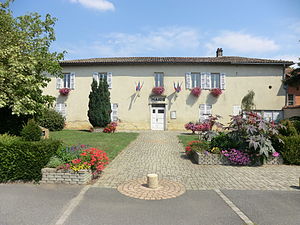
Villeneuve, Ain
Commune in Auvergne-Rhône-Alpes, France
Distance: Approx. 139 meters
Latitude and longitude: 46.0219,4.8375
Villeneuve (French pronunciation: [vilnœv] ; Arpitan: Velanôva) is a commune in the Ain department in eastern France.
Agricultural school of Cibeins
Institut d'agronomie school
Distance: Approx. 4826 meters
Latitude and longitude: 45.98406667,4.80431667
École d’agriculture de Cibeins is a domain dedicated to agricultural education located in Cibeins, in the municipality of Misérieux in Ain, France.
Weather in this IP's area
overcast clouds
5 Celsius
2 Celsius
5 Celsius
6 Celsius
1029 hPa
79 %
1029 hPa
996 hPa
10000 meters
4.69 m/s
7.1 m/s
352 degree
99 %


