Country:
 France
Region:
City:
Latitude and Longitude:
Time Zone:
Postal Code:
IP information under different IP Channel
ip-api
Country
Region
City
ASN
Time Zone
ISP
Blacklist
Proxy
Latitude
Longitude
Postal
Route
IPinfo
Country
Region
City
ASN
Time Zone
ISP
Blacklist
Proxy
Latitude
Longitude
Postal
Route
MaxMind
Country
Region
City
ASN
Time Zone
ISP
Blacklist
Proxy
Latitude
Longitude
Postal
Route
Luminati
Country
FRASN
Time Zone
Europe/Paris
ISP
ADISTA SAS
Latitude
Longitude
Postal
db-ip
Country
Region
City
ASN
Time Zone
ISP
Blacklist
Proxy
Latitude
Longitude
Postal
Route
ipdata
Country
Region
City
ASN
Time Zone
ISP
Blacklist
Proxy
Latitude
Longitude
Postal
Route
Popular places and events near this IP address

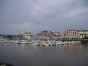
Soorts-Hossegor
Commune in Nouvelle-Aquitaine, France
Distance: Approx. 2517 meters
Latitude and longitude: 43.6594,-1.4267
Soorts-Hossegor (French pronunciation: [sɔʁts ɔsgɔʁ]; Occitan: Sòrts e Òssagòr) is a commune in the French department of Landes, Nouvelle-Aquitaine, southwestern France, 20 km (12 miles) north of Biarritz. The town is on a 3,700-acre (1,500 ha) plot of land with 4 beaches on 3.5 km of European Atlantic shoreline, and a lake. Its inhabitants are called Hossegoriens.

Boudigau
River in France
Distance: Approx. 4181 meters
Latitude and longitude: 43.65555556,-1.44666667
The Boudigau (French pronunciation: [budiɡo]) is a coastal river of the Landes, in Aquitaine, Southwest France. It is 24.5 km (15.2 mi) long. It collects waters of the Orx marsh, in Maremne, and flows north behind the dunes fronting the Atlantic Ocean.

Angresse
Commune in Nouvelle-Aquitaine, France
Distance: Approx. 2091 meters
Latitude and longitude: 43.66,-1.3711
Angresse (French pronunciation: [ɑ̃ɡʁɛs]; Occitan: Angressa) is a commune of the Landes department in Nouvelle-Aquitaine in southwestern France.
Capbreton
Commune in Nouvelle-Aquitaine, France
Distance: Approx. 3687 meters
Latitude and longitude: 43.6431,-1.4311
Capbreton (French pronunciation: [kabʁətɔ̃]; Occitan: Capberton) is a commune in the Landes department in Nouvelle-Aquitaine in southwestern France. Located at the mouth of the Boudigau and Bourret rivers, the town is situated about 40 km north of Biarritz. The town is a popular holiday destination for sailors, surfers, and beach-goers.

Seignosse
Commune in Nouvelle-Aquitaine, France
Distance: Approx. 3451 meters
Latitude and longitude: 43.69,-1.3717
Seignosse (French pronunciation: [sɛɲɔs]; Occitan: Senhòssa) is a commune in the Landes department in Nouvelle-Aquitaine in southwestern France.

Bénesse-Maremne
Commune in Nouvelle-Aquitaine, France
Distance: Approx. 4480 meters
Latitude and longitude: 43.635,-1.3586
Bénesse-Maremne (French pronunciation: [benɛs maʁɛn]; Occitan: Benessa de Maremne) is a commune in the Landes department in Nouvelle-Aquitaine in southwestern France.

Orx
Commune in Nouvelle-Aquitaine, France
Distance: Approx. 7101 meters
Latitude and longitude: 43.6039,-1.3692
Orx (French pronunciation: [ɔʁks]; Occitan: Òrcs) is a commune in the Landes department in Nouvelle-Aquitaine in southwestern France.

Saint-Vincent-de-Tyrosse
Commune in Nouvelle-Aquitaine, France
Distance: Approx. 7187 meters
Latitude and longitude: 43.6606,-1.3072
Saint-Vincent-de-Tyrosse (French pronunciation: [sɛ̃ vɛ̃sɑ̃ də tiʁɔs]; Gascon: Sent Vincenç de Tiròssa) is a commune in the Landes department in Nouvelle-Aquitaine in southwestern France.

Saubion
Commune in Nouvelle-Aquitaine, France
Distance: Approx. 4049 meters
Latitude and longitude: 43.6725,-1.3472
Saubion (French pronunciation: [sobjɔ̃]; Occitan: Sauvion) is a commune in the Landes department in Nouvelle-Aquitaine in southwestern France.

Tosse
Commune in Nouvelle-Aquitaine, France
Distance: Approx. 5904 meters
Latitude and longitude: 43.69,-1.3319
Tosse (French pronunciation: [tɔs]; Occitan: Tòssa) is a commune in the Landes department in Nouvelle-Aquitaine in southwestern France.
Canton of Pays Tyrossais
Distance: Approx. 7770 meters
Latitude and longitude: 43.66,-1.3
The canton of Pays Tyrossais is an administrative division of the Landes department, southwestern France. It was created at the French canton reorganisation which came into effect in March 2015. Its seat is in Saint-Vincent-de-Tyrosse.

Airbus Training Centre Europe
Distance: Approx. 4392 meters
Latitude and longitude: 43.625764,-1.386671
Airbus Training Centre Europe is one of the eight centres of the French aerospace company Airbus SAS dedicated to airline pilot and engineer training. Located at Blagnac, close to Toulouse, France, the centre is approved to deliver courses on the Airbus A300, A310, A320 family, A330, A340, A350XWB and A380. The centre is equipped with six full flight simulators.
Weather in this IP's area
broken clouds
14 Celsius
14 Celsius
13 Celsius
15 Celsius
1019 hPa
98 %
1019 hPa
1017 hPa
10000 meters
3.28 m/s
4.85 m/s
222 degree
69 %
08:24:53
19:15:46