185.161.59.184 - IP Lookup: Free IP Address Lookup, Postal Code Lookup, IP Location Lookup, IP ASN, Public IP
Country:
Region:
City:
Location:
Time Zone:
Postal Code:
IP information under different IP Channel
ip-api
Country
Region
City
ASN
Time Zone
ISP
Blacklist
Proxy
Latitude
Longitude
Postal
Route
Luminati
Country
Region
50
City
trondheim
ASN
Time Zone
Europe/Oslo
ISP
Nte Telekom As
Latitude
Longitude
Postal
IPinfo
Country
Region
City
ASN
Time Zone
ISP
Blacklist
Proxy
Latitude
Longitude
Postal
Route
IP2Location
185.161.59.184Country
Region
trondelag
City
steinkjer
Time Zone
Europe/Oslo
ISP
Language
User-Agent
Latitude
Longitude
Postal
db-ip
Country
Region
City
ASN
Time Zone
ISP
Blacklist
Proxy
Latitude
Longitude
Postal
Route
ipdata
Country
Region
City
ASN
Time Zone
ISP
Blacklist
Proxy
Latitude
Longitude
Postal
Route
Popular places and events near this IP address

Guldbergaunet Stadion
Football stadium in Steinkjer, Norway
Distance: Approx. 1036 meters
Latitude and longitude: 64.021452,11.510496
Gulbergaunet stadion is an association football venue in Steinkjer Municipality in Norway. The all-time record attendance is 13,997 when Steinkjer FK played against Lyn (and lost 1–0) in the Norwegian Football Cup semi final in 1970. The venue hosted the Norwegian Athletics Championships in 1978 and 2000.

Steinkjer Station
Railway station in Steinkjer, Norway
Distance: Approx. 391 meters
Latitude and longitude: 64.01138889,11.49555556
Steinkjer Station (Norwegian: Steinkjer stasjon) is a railway station located in the town of Steinkjer in Steinkjer Municipality in Trøndelag county, Norway. The station is located on the Nordland Line, serving both local and express trains northbound through Innherred and on to Nordland county, and southbound to the city of Trondheim. The staffed station sits adjacent to the European route E6 highway.

Nord-Trøndelag County Municipality
Former County in Norway
Distance: Approx. 665 meters
Latitude and longitude: 64.0145,11.4818
Nord-Trøndelag County Municipality (Norwegian: Nord-Trøndelag fylkeskommune) was the regional governing administration of the old Nord-Trøndelag county in Norway. The county municipality was established in its current form on 1 January 1976 when the law was changed to allow elected county councils in Norway. The county municipality was dissolved on 1 January 2018, when Nord-Trøndelag was merged with the neighboring Sør-Trøndelag county, creating the new Trøndelag county which is led by the Trøndelag County Municipality.
Trondheim og omland
Distance: Approx. 880 meters
Latitude and longitude: 64.0139,11.4775
Trondheim og omland is an economic region in Trøndelag county, Norway. It consists of the municipalities of Trondheim, Rissa, Midtre Gauldal, Melhus, Skaun, Klæbu, Malvik, Selbu, Stjørdal and Tydal. The center of the region is the city of Trondheim.

Inntrøndelag District Court
District court in Trøndelag, Norway
Distance: Approx. 880 meters
Latitude and longitude: 64.0074,11.5011
Inntrøndelag District Court (Norwegian: Inntrøndelag tingrett) was a district court in the Inntrøndelag region in Trøndelag county, Norway. The court was based in Steinkjer. The court existed until 2021.

Steinkjer Church
Church in Trøndelag, Norway
Distance: Approx. 64 meters
Latitude and longitude: 64.0149202,11.49409443
Steinkjer Church (Norwegian: Steinkjer kirke) is a parish church of the Church of Norway in Steinkjer Municipality in Trøndelag county, Norway. It is located in the town of Steinkjer. It is the church for the Steinkjer parish which is part of the Stiklestad prosti (deanery) in the Diocese of Nidaros.

Steinkjerelva
River in Trøndelag, Norway
Distance: Approx. 691 meters
Latitude and longitude: 64.01233,11.4825
Steinkjerelva is a 2.2-kilometer (1.4 mi) long river in the town of Steinkjer in Steinkjer Municipality in Trøndelag county, Norway. It forms at the confluence between the rivers Byaelva and Ogna at Guldbergaunet and flows through the town of Steinkjer before flowing into Beitstadfjorden, the inner part of the Trondheimsfjord. The river is crossed by four bridges, including one for the Nordland Line and the Sneppen Bridge which is part of the European route E6 highway.
Figgja
River in Trøndelag, Norway
Distance: Approx. 996 meters
Latitude and longitude: 64.00603,11.49805
Figgja is a 14-kilometer (8.7 mi) long river in Steinkjer Municipality in Trøndelag county, Norway. The river drains the lake Leksdalsvatnet and flows north into Beitstadfjorden, the inner part of Trondheimsfjord, at the town of Steinkjer.

Steinkjersannan
Neighborhood in Steinkjer, Norway
Distance: Approx. 693 meters
Latitude and longitude: 64.01,11.50416667
Steinkjersannan or Sannan is a neighborhood of town of Steinkjer in Steinkjer Municipality in Trøndelag county, Norway. From the 17th century until the 2005, the area was used as a military camp.

Steinkjer (town)
Town in Trøndelag, Norway
Distance: Approx. 11 meters
Latitude and longitude: 64.0148,11.4954
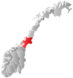
(Norwegian) or Stïentje (Southern Sami) is the administrative centre of Steinkjer Municipality and Trøndelag county in Norway. The town is located at the northeastern end of the inner-most part of the Trondheimsfjorden, at the mouth of the river Steinkjerelva. In the eastern part of the town, the river of Figgja also flows into the fjord.

Trøndelag County Municipality
County in Norway
Distance: Approx. 11 meters
Latitude and longitude: 64.0148,11.4954
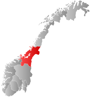
Trøndelag County Municipality (Norwegian: Trøndelag fylkeskommune or Southern Sami: Trööndelagen fylhkentjïelte) is the democratically elected regional governing administration of Trøndelag county in Norway. The main responsibilities of the county municipality includes the running of 36 upper secondary schools, with 17,000 pupils. It administers thousands of kilometers of county roadways, public transport, dental care, culture, and cultural heritage.

Vestland County Municipality
County in Norway
Distance: Approx. 11 meters
Latitude and longitude: 64.0148,11.4954
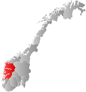
Vestland County Municipality (Norwegian: Vestland fylkeskommune) is the democratically elected regional governing administration of Vestland county in Norway. The main responsibilities of the county municipality includes the overseeing the county's upper secondary schools, county roadways, public transport, dental care, culture, and cultural heritage.
Weather in this IP's area
overcast clouds
-8 Celsius
-14 Celsius
-8 Celsius
-8 Celsius
989 hPa
71 %
989 hPa
988 hPa
10000 meters
4.91 m/s
12.54 m/s
82 degree
100 %