Country:
Region:
City:
Latitude and Longitude:
Time Zone:
Postal Code:
IP information under different IP Channel
ip-api
Country
Region
City
ASN
Time Zone
ISP
Blacklist
Proxy
Latitude
Longitude
Postal
Route
Luminati
Country
Region
ct
City
arbucies
ASN
Time Zone
Europe/Madrid
ISP
Adamo Telecom Iberia S.A.
Latitude
Longitude
Postal
IPinfo
Country
Region
City
ASN
Time Zone
ISP
Blacklist
Proxy
Latitude
Longitude
Postal
Route
db-ip
Country
Region
City
ASN
Time Zone
ISP
Blacklist
Proxy
Latitude
Longitude
Postal
Route
ipdata
Country
Region
City
ASN
Time Zone
ISP
Blacklist
Proxy
Latitude
Longitude
Postal
Route
Popular places and events near this IP address
Turó de l'Home
Distance: Approx. 8476 meters
Latitude and longitude: 41.77252778,2.4375
Turó de l'Home is a mountain of Catalonia, part of the Montseny Massif. With its elevation of 1,712 m (5,617 ft) above sea level, it is the highest peak of the Montseny Massif. The top of the mountain is a triangulation station.

Les Agudes
Mountain in Catalonia, Spain
Distance: Approx. 7051 meters
Latitude and longitude: 41.78944444,2.44388889
Les Agudes is a mountain of Catalonia, Spain. It has an elevation of 1,706 metres (5,597 ft) above sea level. It is straddling the municipalities of Arbúcies in the Selva comarca and Fogars de Montclús and Montseny in the Vallès Oriental.

Turó de Morou
Mountain in Spain
Distance: Approx. 5918 meters
Latitude and longitude: 41.77277778,2.48083333
Turó de Morou is a mountain of Catalonia, Spain. It has an elevation of 1,303 metres above sea level.
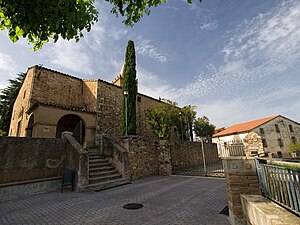
Arbúcies
Municipality in Catalonia, Spain
Distance: Approx. 299 meters
Latitude and longitude: 41.81777778,2.51694444
Arbúcies (Catalan pronunciation: [əɾˈβusiəs]) is a village in the province of Girona, in the autonomous community of Catalonia, Spain. The municipality covers an area of 86.24 square kilometres (33.30 sq mi) with a population of 6481 in 2014.

Breda, Spain
Municipality in Catalonia, Spain
Distance: Approx. 8151 meters
Latitude and longitude: 41.75,2.56
Breda (Catalan pronunciation: [ˈbɾɛðə]) is a village in the province of Girona and autonomous community of Catalonia, Spain. The municipality covers an area of 5.09 square kilometres (1.97 sq mi) and the population in 2014 was 3,751.
Riells i Viabrea
Municipality in Catalonia, Spain
Distance: Approx. 4605 meters
Latitude and longitude: 41.776,2.513
Riells i Viabrea (Catalan pronunciation: [riˈeʎz i βiəˈβɾeə]) is a municipality in the province of Girona and autonomous community of Catalonia, Spain. The municipality covers an area of 27 square kilometres (10 sq mi) and the population in 2014 was 4,000.

Sant Feliu de Buixalleu
Municipality in Catalonia, Spain
Distance: Approx. 6173 meters
Latitude and longitude: 41.79305556,2.5875
Sant Feliu de Buixalleu (Catalan pronunciation: [ˈsaɱ fəˈliw ðə βuʃəˈʎew]) is a village in the province of Girona and autonomous community of Catalonia, Spain. The village is situated in the southeast of the ancient Catalan comarca of Selva. The municipality covers an area of 61.94 square kilometres (23.92 sq mi) and the population in 2014 was 776.

Dan-Air Flight 1903
1970 aviation accident
Distance: Approx. 5580 meters
Latitude and longitude: 41.79583333,2.45944444
Dan-Air Flight 1903 was an unscheduled international passenger service from Manchester to Barcelona, operated by Dan Air Services Limited under contract with British tour operator Clarksons Holidays, which arranged for the flight to carry a group of holidaymakers who had booked an all-inclusive package holiday with the operator. On 3 July 1970, the de Havilland Comet 4 aircraft serving the flight crashed into the wooded slopes of the Serralada del Montseny near Arbúcies, in the Province of Girona of Catalonia, Spain. The crash resulted in the aircraft's destruction and the deaths of all 112 on board.
Santa Fe Reservoir
Dam in Fogars de Montclús, Catalonia
Distance: Approx. 6816 meters
Latitude and longitude: 41.76833333,2.47055556
The Santa Fe Reservoir (Catalan: Pantà de Santa Fe) is a reservoir on the Riera de Gualba, a tributary of the Tordera River. It is located within the Fogars de Montclús municipal term, Catalonia, Spain. The area is a popular destination for excursions and picnics and is easily accessible on foot from the nearest road.
Sant Salvador, Breda
Church
Distance: Approx. 8216 meters
Latitude and longitude: 41.748453,2.5571
Sant Salvador de Breda is a parish church and former Benedictine monastery in Breda, Province of Girona, Catalonia, Spain.
Gualba
Municipality in Catalonia, Spain
Distance: Approx. 9527 meters
Latitude and longitude: 41.73222222,2.50472222
Gualba (Catalan pronunciation: [ˈgwalβə]) is a municipality in Catalonia, Spain. It is in Barcelona Province in the comarca of Vallès Oriental. As of 2014, the population was 1,429.
Weather in this IP's area
clear sky
11 Celsius
10 Celsius
8 Celsius
13 Celsius
1024 hPa
67 %
1024 hPa
989 hPa
10000 meters
1.29 m/s
1.29 m/s
342 degree
3 %
07:39:49
17:29:33


