Country:
Region:
City:
Latitude and Longitude:
Time Zone:
Postal Code:
IP information under different IP Channel
ip-api
Country
Region
City
ASN
Time Zone
ISP
Blacklist
Proxy
Latitude
Longitude
Postal
Route
Luminati
Country
Region
ct
City
centelles
ASN
Time Zone
Europe/Madrid
ISP
Apfutura Telecom Sl
Latitude
Longitude
Postal
IPinfo
Country
Region
City
ASN
Time Zone
ISP
Blacklist
Proxy
Latitude
Longitude
Postal
Route
db-ip
Country
Region
City
ASN
Time Zone
ISP
Blacklist
Proxy
Latitude
Longitude
Postal
Route
ipdata
Country
Region
City
ASN
Time Zone
ISP
Blacklist
Proxy
Latitude
Longitude
Postal
Route
Popular places and events near this IP address
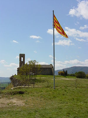
Tona, Spain
Municipality in Catalonia, Spain
Distance: Approx. 5839 meters
Latitude and longitude: 41.85,2.23333333
Tona (Catalan pronunciation: [ˈtonə]) is a municipality in the province of Barcelona, part of the autonomous community of Catalonia, northeastern Spain. It located in the Plain of Vic, in the comarca of Osona. It includes two exclaves to the east.

Aiguafreda, Spain
Municipality in Catalonia, Spain
Distance: Approx. 4744 meters
Latitude and longitude: 41.76916667,2.25444444
Aiguafreda (Catalan pronunciation: [ˌajɣwəˈfɾɛðə]) is a municipality in the comarca of Vallès Oriental, in the province of Barcelona, Catalonia, Spain. It is located near the Montseny massif. It has a population of 2,190 and occupies an area of 7.96 km².
Seva, Spain
Municipality in Catalonia, Spain
Distance: Approx. 7454 meters
Latitude and longitude: 41.84055556,2.28527778
Seva (Catalan pronunciation: [ˈsɛβə]) is a municipality in the comarca of Osona in Catalonia, Spain. The municipality includes a large exclave to the south-west.

Centelles
Municipality in Catalonia, Spain
Distance: Approx. 611 meters
Latitude and longitude: 41.79944444,2.22166667
Centelles (Catalan pronunciation: [sənˈtɛʎəs]; locally [sənˈtɛjəs]) is a municipality in the comarca of Osona in Catalonia, Spain. It is situated in the upper valley of the Congost River in the south of the comarca. The municipality is served by the C-17 road.

Balenyà
Municipality in Catalonia, Spain
Distance: Approx. 2626 meters
Latitude and longitude: 41.81638889,2.23638889
Balenyà (Catalan pronunciation: [bələˈɲa]) is a municipality in the comarca of Osona in Catalonia, Spain.
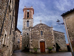
Collsuspina
Place in Catalonia, Spain
Distance: Approx. 4401 meters
Latitude and longitude: 41.82694444,2.17611111
Collsuspina (Catalan pronunciation: [ˌkɔʎsusˈpinə]) is a municipality in the comarca of Moianès in Catalonia, Spain. Until May 2015 it was part of Osona.

Sant Martí de Centelles
Municipality in Catalonia, Spain
Distance: Approx. 4913 meters
Latitude and longitude: 41.76527778,2.25166667
Sant Martí de Centelles (Catalan pronunciation: [ˈsam məɾˈti ðə sənˈtɛʎəs]; locally [- sənˈtɛjəs]) is a municipality in the comarca of Osona in Catalonia, Spain.

Turó de Bellver
Distance: Approx. 6395 meters
Latitude and longitude: 41.84722222,2.17138889
Turó de Bellver is a mountain of Catalonia, Spain. It has an elevation of 1,041 metres above sea level.

Puig Castellar (Balenyà)
Distance: Approx. 2597 meters
Latitude and longitude: 41.81944444,2.19805556
Puig Castellar (Balenyà) is a mountain of Catalonia, Spain. It has an elevation of 1,017 metres above sea level.
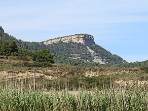
Roc de la Guàrdia (Balenyà)
Distance: Approx. 2995 meters
Latitude and longitude: 41.82519444,2.20361111
Roc de la Guàrdia (Balenyà) is a mountain of Catalonia, Spain. It has an elevation of 891 metres above sea level. It is the emblematic mountain of Els Hostalets de Balenyà town nearby.
Club Hípic El Montanyà
Spanish horse club
Distance: Approx. 3714 meters
Latitude and longitude: 41.804475,2.25855833
The Club Hípic El Montanyà (English: El Montanyà Horse Club) is a Spanish horse club, located in the comarca of Osona, Catalonia. For the 1992 Summer Olympics in neighboring Barcelona, it hosted the equestrian dressage and the cross country part of the eventing competitions. The venue was constructed on a golf course in 1991 over 200 ha (490 acres).
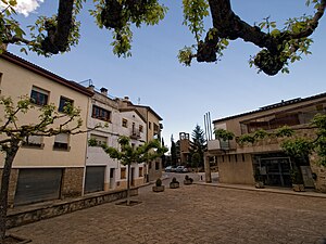
Castellcir
Municipality in Catalonia, Spain
Distance: Approx. 6798 meters
Latitude and longitude: 41.76194444,2.14972222
Castellcir (Catalan pronunciation: [kəsˌteʎˈsi]) is a village in the province of Barcelona and autonomous community of Catalonia, Spain. The municipality covers an area of 34.2 square kilometres (13.2 sq mi) and the population in 2014 was 718. The municipality includes an exclave to the west.
Weather in this IP's area
clear sky
9 Celsius
9 Celsius
7 Celsius
11 Celsius
1024 hPa
92 %
1024 hPa
955 hPa
10000 meters
1.07 m/s
0.98 m/s
27 degree
10 %
07:41:00
17:30:49
