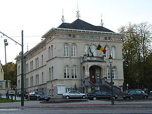
Country:
Region:
City:
Latitude and Longitude:
Time Zone:
Postal Code:
IP information under different IP Channel
ip-api
Country
Region
City
ASN
Time Zone
ISP
Blacklist
Proxy
Latitude
Longitude
Postal
Route
Luminati
Country
ASN
Time Zone
Europe/Brussels
ISP
Sopra Steria Benelux SA
Latitude
Longitude
Postal
IPinfo
Country
Region
City
ASN
Time Zone
ISP
Blacklist
Proxy
Latitude
Longitude
Postal
Route
db-ip
Country
Region
City
ASN
Time Zone
ISP
Blacklist
Proxy
Latitude
Longitude
Postal
Route
ipdata
Country
Region
City
ASN
Time Zone
ISP
Blacklist
Proxy
Latitude
Longitude
Postal
Route
Popular places and events near this IP address

Watermael-Boitsfort
Municipality of the Brussels-Capital Region, Belgium
Distance: Approx. 691 meters
Latitude and longitude: 50.8,4.41666667
Watermael-Boitsfort (French, pronounced [watɛʁmal bwafɔʁ]) or Watermaal-Bosvoorde (Dutch, pronounced [ˈʋaːtərmaːl ˈbɔsfoːrdə] ; archaic Dutch: Watermael-Boschvoorde), often simply called Boitsfort in French or Bosvoorde in Dutch, is one of the 19 municipalities of the Brussels-Capital Region, Belgium. Located in the south-eastern part of the region, it is bordered by Auderghem, the City of Brussels (namely the Bois de la Cambre/Ter Kamerenbos), Ixelles, and Uccle, as well as the Flemish municipalities of Hoeilaart, Overijse and Sint-Genesius-Rode. In common with all of Brussels' municipalities, it is legally bilingual (French–Dutch).
International School of Brussels
Private school in Brussels, Belgium
Distance: Approx. 1717 meters
Latitude and longitude: 50.78888889,4.41694444
The International School of Brussels (ISB) is an English-language international school with grades spanning from pre-school to high school. Its 40-acre (16 ha) campus lies in the Brussels commune of Watermael-Boitsfort.
Beaulieu metro station
Metro station in Brussels, Belgium
Distance: Approx. 1674 meters
Latitude and longitude: 50.815,4.40944444
Beaulieu is a Brussels Metro station on the eastern branch of line 5. It is located in the municipality of Auderghem, in the south-eastern part of Brussels, Belgium. The station takes its name from the nearby Avenue de Beaulieu/Beaulieulaan.

Demey metro station
Metro station in Brussels, Belgium
Distance: Approx. 1120 meters
Latitude and longitude: 50.81333333,4.42138889
Demey is a Brussels Metro station on the eastern branch of line 5. It is located in the municipality of Auderghem, in the south-eastern part of Brussels, Belgium. It is named after a former Mayor of Auderghem, Gustave Demey.

Herrmann-Debroux metro station
Metro station in Brussels, Belgium
Distance: Approx. 1028 meters
Latitude and longitude: 50.8125,4.42805556
Herrmann-Debroux is a Brussels Metro station serving as the eastern terminus of line 5. It is located in the municipality of Auderghem, in the south-eastern part of Brussels, Belgium. It is named after the Belgian politician and former Mayor of Auderghem, Carl Herrmann-Debroux.
Auderghem
Municipality of the Brussels-Capital Region, Belgium
Distance: Approx. 1469 meters
Latitude and longitude: 50.81666667,4.42611111
Auderghem (French, pronounced [odœʁɡɛm]; former Dutch spelling) or Oudergem (Dutch, pronounced [ˈʌudərɣɛm] ) is one of the 19 municipalities of the Brussels-Capital Region, Belgium. Located in the south-eastern part of the region, along the Woluwe valley and at the entrance to the Sonian Forest, it is bordered by Etterbeek, Ixelles, Watermael-Boitsfort, and Woluwe-Saint-Pierre, as well as the Flemish municipalities of Tervuren and Overijse. In common with all of Brussels' municipalities, it is legally bilingual (French–Dutch).

Boitsfort railway station
Railway station in Brussels, Belgium
Distance: Approx. 1523 meters
Latitude and longitude: 50.7947,4.4082
Boitsfort railway station (French: Gare de Boitsfort) or Bosvoorde railway station (Dutch: Station Bosvoorde) is a railway station in the municipality of Watermael-Boitsfort in Brussels, Belgium, operated by the National Railway Company of Belgium (NMBS/SNCB). It lies on line 161, between Watermael and Groenendaal railway stations. The station can be accessed via the Chaussée de La Hulpe/Terhulpsesteenweg next to the Sonian Forest and the Boitsfort Hippodrome.

Rouge Cloître Abbey
Former abbey in Brussels, Belgium
Distance: Approx. 1427 meters
Latitude and longitude: 50.80777778,4.44388889
Rouge Cloître Abbey (French: Abbaye du Rouge-Cloître) or Roodklooster Abbey (Dutch: Abdij van het Roodklooster) is a former Augustinian priory, founded in 1367. It is located in the Sonian Forest, in south-eastern Brussels, Belgium. It was abolished in 1796.

Church of St. Clement, Watermael-Boitsfort
Church in Watermael-Boitsfort, Belgium
Distance: Approx. 1519 meters
Latitude and longitude: 50.80972222,4.40555556
The Church of St. Clement (French: Église Saint-Clément; Dutch: Sint-Clemenskerk) is a Catholic church in the municipality of Watermael-Boitsfort in Brussels, Belgium. It is one of the earliest examples of Romanesque architecture in Belgium, dating from the 11th century.

CBR Building
Functionalist building in Brussels, Belgium
Distance: Approx. 1649 meters
Latitude and longitude: 50.79527778,4.40527778
The CBR Building is a functionalist office building situated in Watermael-Boitsfort, a municipality of Brussels, Belgium. Designed by the architects Constantin Brodzki and Marcel Lambrichs and built between 1967 and 1970, its prefabricated modular facade showcases white concrete instead of hiding it as a construction material, classifying the building as a New Brutalist piece of architecture. In November 2018, it was added to the list of protected heritage within the Brussels-Capital Region.

Royale Belge
Functionalist building in Brussels, Belgium
Distance: Approx. 204 meters
Latitude and longitude: 50.8016759,4.4250841
The Royale Belge former headquarters is a functionalist building from 1967 to 1970, located in Watermael-Boitsfort, a municipality of Brussels, Belgium..
Dry Borren
Historic site in Brussels, Belgium
Distance: Approx. 1509 meters
Latitude and longitude: 50.80654,4.44567
Dry Borren (French: Trois-Fontaines; Latin: Tres Fontes) is a historic site in the Sonian Forest in the Brussels municipality of Auderghem, Belgium. It was originally a hunting lodge for the dukes of Brabant, built on a site where three springs originated.
Weather in this IP's area
mist
8 Celsius
8 Celsius
7 Celsius
9 Celsius
1027 hPa
94 %
1027 hPa
1018 hPa
1700 meters
0.51 m/s
340 degree
100 %
07:43:03
17:08:50


