185.154.253.118 - IP Lookup: Free IP Address Lookup, Postal Code Lookup, IP Location Lookup, IP ASN, Public IP
Country:
Region:
City:
Location:
Time Zone:
Postal Code:
IP information under different IP Channel
ip-api
Country
Region
City
ASN
Time Zone
ISP
Blacklist
Proxy
Latitude
Longitude
Postal
Route
Luminati
Country
Region
ct
City
creixell
ASN
Time Zone
Europe/Madrid
ISP
Sisnet Nuevas Tecnologias S.l.
Latitude
Longitude
Postal
IPinfo
Country
Region
City
ASN
Time Zone
ISP
Blacklist
Proxy
Latitude
Longitude
Postal
Route
IP2Location
185.154.253.118Country
Region
navarra, comunidad foral de
City
pamplona
Time Zone
Europe/Madrid
ISP
Language
User-Agent
Latitude
Longitude
Postal
db-ip
Country
Region
City
ASN
Time Zone
ISP
Blacklist
Proxy
Latitude
Longitude
Postal
Route
ipdata
Country
Region
City
ASN
Time Zone
ISP
Blacklist
Proxy
Latitude
Longitude
Postal
Route
Popular places and events near this IP address

Navarre
Autonomous community and province of Spain
Distance: Approx. 539 meters
Latitude and longitude: 42.81666667,-1.65
Navarre ( nə-VAR; Spanish: Navarra [naˈβara] ; Basque: Nafarroa [nafaro.a]), officially the Chartered Community of Navarre, is a landlocked foral autonomous community and province in northern Spain, bordering the Basque Autonomous Community, La Rioja, and Aragon in Spain and New Aquitaine in France. The capital city is Pamplona (Basque: Iruña). The present-day province makes up the majority of the territory of the medieval Kingdom of Navarre, a long-standing Pyrenean kingdom that occupied lands on both sides of the western Pyrenees, with its northernmost part, Lower Navarre, located in the southwest corner of France.

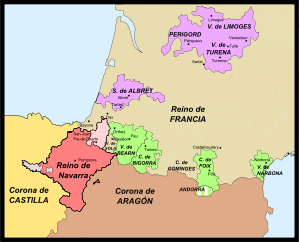
Kingdom of Navarre
Medieval kingdom around the Pyrenees
Distance: Approx. 53 meters
Latitude and longitude: 42.81694444,-1.64277778
The Kingdom of Navarre ( nə-VAR), originally the Kingdom of Pamplona occupied lands on both sides of the western Pyrenees, with its northernmost areas originally reaching the Atlantic Ocean (Bay of Biscay), between present-day Spain and France. The medieval state took form around the city of Pamplona during the first centuries of the Iberian Reconquista. The kingdom had its origins in the conflict in the buffer region between the Carolingian Empire and the Ummayad Emirate of Córdoba that controlled most of the Iberian Peninsula.

Plaza de Toros de Pamplona
Distance: Approx. 331 meters
Latitude and longitude: 42.81586667,-1.63954722
Plaza de Toros de Pamplona is a bullring in Pamplona, Spain. It is currently used for bullfighting, sporting or cultural events and music concerts. Built in 1922 by Francisco Urcola, the stadium holds 19,720 people.

Roman Catholic Archdiocese of Pamplona and Tudela
Roman Catholic archdiocese in Spain
Distance: Approx. 378 meters
Latitude and longitude: 42.8197,-1.641
The Archdiocese of Pamplona and Tudela (Latin: Archidioecesis Pampilonensis et Tudelensis) is a Latin Church archdiocese of the Catholic Church located in the cities of Pamplona and Tudela in Spain.

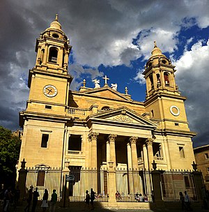
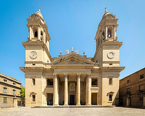
Pamplona Cathedral
Cathedral in Spain
Distance: Approx. 378 meters
Latitude and longitude: 42.81970278,-1.64099167
Pamplona Cathedral (Santa María de la Asunción) is a Roman Catholic church in the archdiocese of Pamplona, Spain. The current 15th century Gothic church replaced an older Romanesque one. Archaeological excavations have revealed the existence of another two earlier churches.

Spanish conquest of Iberian Navarre
Conflicts over control of Navarre (1512–1529)
Distance: Approx. 179 meters
Latitude and longitude: 42.8183,-1.6442
The Spanish conquest of the Iberian part of Navarre was initiated by Ferdinand II of Aragon and completed by his grandson and successor Charles V in a series of military campaigns lasting from 1512 to 1524. Ferdinand was both the king of Aragon and regent of Castile in 1512. When Pope Julius II declared a Holy League against France in late 1511, Navarre attempted to remain neutral.

St Nicholas' Church, Pamplona
Distance: Approx. 176 meters
Latitude and longitude: 42.81555556,-1.64472222
San Nicolás is a historical church in Pamplona, Spain. It was built in the 12th century not only with religious functions, but also as a defensive bastion of the quarter during the strife with the neighbouring ones of St. Saturnino and Navarrería.
Hotel La Perla
Hotel in Pamplona, Spain
Distance: Approx. 105 meters
Latitude and longitude: 42.8177,-1.643
Hotel La Perla (Spanish: Gran Hotel La Perla) is a five-star hotel in Pamplona, Spain and is located in the Plaza del Castillo (Castle Square), with one side facing Estafeta Street, one of the main routes in the Running of the Bulls. The balconies of the hotel are among the most coveted sites from which to view the event.
Cámara de Comptos de Navarra
Historic site in Pamplona, Spain
Distance: Approx. 204 meters
Latitude and longitude: 42.817471,-1.645731
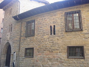
The Cámara de los Comptos (Spanish: Cámara de los Comptos) is a building located in Pamplona, Spain. It was declared Bien de Interés Cultural in 1868.

Museum of Navarre, Pamplona
Museum in Pamplona, Navarre, Spain
Distance: Approx. 388 meters
Latitude and longitude: 42.8195,-1.6464
The Museum of Navarra (Spanish: Museo de Navarra; Basque: Nafarroako Museoa) is the art museum of Navarre, and is located on Calle Cuesta Santo Domingo in Pamplona, in the Navarre province of Spain.

Palacio de los Condes del Vado y de Guenduláin
Distance: Approx. 157 meters
Latitude and longitude: 42.81661,-1.6453
The Palacio de los Condes del Vado y de Guenduláin is a palace located in the city of Toledo, in Castile-La Mancha, Spain.

City Hall Square, Pamplona-Iruña (Spain)
Square in Navarre, Spain
Distance: Approx. 177 meters
Latitude and longitude: 42.818323,-1.644018
Udaletxe Plaza or Plaza Consistorial (City Hall Square) is a town square beside Pamplona-Iruña City Hall in the center of the Pamplona-Iruña Old Town in Pamplona-Iruña, Navarre. It is worldwide known by San Fermin. The square is host to the start of the festival, on 6 July, with the txupinazo and to the end of the festival, on 14 July, with the Gaixoa Ni or Pobre de Mí.
Weather in this IP's area
fog
6 Celsius
6 Celsius
6 Celsius
7 Celsius
1030 hPa
100 %
1030 hPa
954 hPa
450 meters
0.51 m/s
80 degree
100 %
