Country:
Region:
City:
Latitude and Longitude:
Time Zone:
Postal Code:
IP information under different IP Channel
ip-api
Country
Region
City
ASN
Time Zone
ISP
Blacklist
Proxy
Latitude
Longitude
Postal
Route
Luminati
Country
Region
14
City
grodziskmazowiecki
ASN
Time Zone
Europe/Warsaw
ISP
Netfala
Latitude
Longitude
Postal
IPinfo
Country
Region
City
ASN
Time Zone
ISP
Blacklist
Proxy
Latitude
Longitude
Postal
Route
db-ip
Country
Region
City
ASN
Time Zone
ISP
Blacklist
Proxy
Latitude
Longitude
Postal
Route
ipdata
Country
Region
City
ASN
Time Zone
ISP
Blacklist
Proxy
Latitude
Longitude
Postal
Route
Popular places and events near this IP address

Grodzisk Mazowiecki
Place in Masovian Voivodeship, Poland
Distance: Approx. 669 meters
Latitude and longitude: 52.10888889,20.625
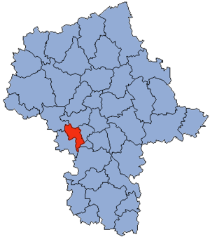
Grodzisk Mazowiecki (Polish pronunciation: [ˈɡrɔd͡ʑisk mazɔˈvjɛt͡skʲi]) is a town in central Poland, the capital of Grodzisk Mazowiecki County in the Masovian Voivodeship, with 29,363 inhabitants (2011). It is 30 kilometres (19 mi) southwest of Warsaw.

Grodzisk County, Masovian Voivodeship
County in Masovian Voivodeship, Poland
Distance: Approx. 669 meters
Latitude and longitude: 52.10888889,20.625
Grodzisk County (Polish: powiat grodziski) is a unit of territorial administration and local government (powiat) in Masovian Voivodeship, east-central Poland. It came into being on 1 January 1999, as a result of the Polish local government reforms passed in 1998. Its administrative seat and largest town is Grodzisk Mazowiecki, which lies 29 kilometres (18 mi) south-west of Warsaw.
Milanówek
Place in Masovian Voivodeship, Poland
Distance: Approx. 1861 meters
Latitude and longitude: 52.11666667,20.65
Milanówek [mʲilaˈnuvɛk] is a town and a seat of a separate commune in Poland. Located next to the Grodzisk Mazowiecki County near Warsaw, it is often considered an outlying suburb of the capital of Poland but is in fact an independent entity administratively and culturally. Milanówek is however part of wider Warsaw agglomeration.
Gmina Grodzisk Mazowiecki
Polish administrative district
Distance: Approx. 669 meters
Latitude and longitude: 52.10888889,20.625
Gmina Grodzisk Mazowiecki is an urban-rural gmina (administrative district) in Grodzisk Mazowiecki County, Masovian Voivodeship, in east-central Poland. Its seat is the town of Grodzisk Mazowiecki, which lies approximately 29 kilometres (18 mi) south-west of Warsaw. The gmina covers an area of 107.03 square kilometres (41.3 sq mi), and as of 2006 its total population is 37,432 (out of which the population of Grodzisk Mazowiecki amounts to 27,055, and the population of the rural part of the gmina is 10,377).

Kady
Village in Masovian Voivodeship, Poland
Distance: Approx. 2508 meters
Latitude and longitude: 52.09416667,20.66416667
Kady [ˈkadɨ] is a village in the administrative district of Gmina Grodzisk Mazowiecki, within Grodzisk Mazowiecki County, Masovian Voivodeship, in east-central Poland.

Kozerki
Village in Masovian Voivodeship, Poland
Distance: Approx. 2209 meters
Latitude and longitude: 52.1,20.6
Kozerki [kɔˈzɛrki] is a village in the administrative district of Gmina Grodzisk Mazowiecki, within Grodzisk Mazowiecki County, Masovian Voivodeship, in east-central Poland. It lies approximately 2 kilometres (1 mi) south-west of Grodzisk Mazowiecki and 31 km (19 mi) south-west of Warsaw.

Odrano-Wola
Village in Masovian Voivodeship, Poland
Distance: Approx. 1568 meters
Latitude and longitude: 52.09138889,20.64027778
Odrano-Wola [ɔˈdranɔ ˈvɔla] is a village in the administrative district of Gmina Grodzisk Mazowiecki, within Grodzisk Mazowiecki County, Masovian Voivodeship, in east-central Poland.

Szczęsne, Masovian Voivodeship
Village in Masovian Voivodeship, Poland
Distance: Approx. 2710 meters
Latitude and longitude: 52.08305556,20.65055556
Szczęsne [ˈʂt͡ʂɛ̃snɛ] is a village in the administrative district of Gmina Grodzisk Mazowiecki, within Grodzisk Mazowiecki County, Masovian Voivodeship, in east-central Poland.

Wólka Grodziska, Masovian Voivodeship
Village in Masovian Voivodeship, Poland
Distance: Approx. 2279 meters
Latitude and longitude: 52.11,20.59944444
Wólka Grodziska [ˈvulka ɡrɔˈd͡ʑiska] is a village in the administrative district of Gmina Grodzisk Mazowiecki, within Grodzisk Mazowiecki County, Masovian Voivodeship, in east-central Poland.

Grodzisk Mazowiecki railway station
Railway station in Grodzisk Mazowiecki, Poland
Distance: Approx. 896 meters
Latitude and longitude: 52.10972222,20.62166667
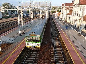
Grodzisk Mazowiecki railway station is a railway station serving Grodzisk Mazowiecki in Grodzisk Mazowiecki County, Poland. It is classed as Category B on the classification of Polish railway stations and is served exclusively by Koleje Mazowieckie, which runs services from Skierniewice to Warszawa Wschodnia. It was built as part of the first stage of the Warsaw–Vienna railway: the 30 km (19 mi) stretch from Warsaw to Grodzisk Mazowiecki opened on 14 June 1845.

Milanówek railway station
Railway station in Milanówek, Poland
Distance: Approx. 3329 meters
Latitude and longitude: 52.12472222,20.66722222
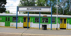
Milanówek railway station is a railway station in Milanówek, Poland. The station is served by Koleje Mazowieckie, who run trains from Skierniewice to Warszawa Wschodnia.
Grodzisk Mazowiecki Radońska station
Railway station in Poland
Distance: Approx. 464 meters
Latitude and longitude: 52.10066,20.62852
Grodzisk Mazowiecki Radońska is a station of the Warsaw Commuter Railway located at Radońska in Grodzisk Mazowiecki, Poland.
Weather in this IP's area
overcast clouds
4 Celsius
4 Celsius
3 Celsius
5 Celsius
1005 hPa
90 %
1005 hPa
992 hPa
10000 meters
0.89 m/s
250 degree
100 %
07:03:30
15:42:12

