185.152.112.200 - IP Lookup: Free IP Address Lookup, Postal Code Lookup, IP Location Lookup, IP ASN, Public IP
Country:
Region:
City:
Location:
Time Zone:
Postal Code:
ISP:
ASN:
language:
User-Agent:
Proxy IP:
Blacklist:
IP information under different IP Channel
ip-api
Country
Region
City
ASN
Time Zone
ISP
Blacklist
Proxy
Latitude
Longitude
Postal
Route
db-ip
Country
Region
City
ASN
Time Zone
ISP
Blacklist
Proxy
Latitude
Longitude
Postal
Route
IPinfo
Country
Region
City
ASN
Time Zone
ISP
Blacklist
Proxy
Latitude
Longitude
Postal
Route
IP2Location
185.152.112.200Country
Region
nitriansky kraj
City
ilava
Time Zone
Europe/Bratislava
ISP
Language
User-Agent
Latitude
Longitude
Postal
ipdata
Country
Region
City
ASN
Time Zone
ISP
Blacklist
Proxy
Latitude
Longitude
Postal
Route
Popular places and events near this IP address

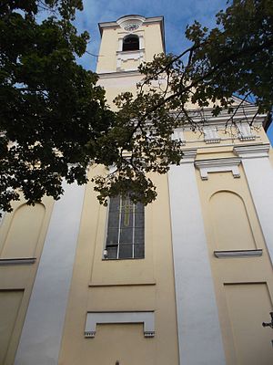
Ilava
Town in Slovakia
Distance: Approx. 459 meters
Latitude and longitude: 48.99361111,18.23444444
Ilava (German: Illau, Hungarian: Illava) is a town in the Trenčín Region, northwestern Slovakia.

Ilava District
District in Trenčín Region, Slovakia
Distance: Approx. 104 meters
Latitude and longitude: 48.99861111,18.235
Ilava District (Slovak: okres Ilava, Hungarian: Illavai járás) is a district in the Trenčín Region of western Slovakia. Until 1918, the district was part of the county of Kingdom of Hungary of Trencsén.

Bohunice, Ilava District
Municipality in Slovakia
Distance: Approx. 3819 meters
Latitude and longitude: 49.02,18.19555556
Bohunice (Hungarian: Vágbanya) is a village and municipality in Ilava District in the Trenčín Region of north-western Slovakia.
Dulov
Municipality in Slovakia
Distance: Approx. 4109 meters
Latitude and longitude: 49.03333333,18.25
Dulov (Hungarian: Dúlóújfalu) is a village and municipality in the Ilava District of the Trenčín Region of Slovakia.
Kameničany
Municipality in Slovakia
Distance: Approx. 4756 meters
Latitude and longitude: 48.99166667,18.17083333
Kameničany (Hungarian: Köveskő) is a village and municipality in Ilava District in the Trenčín Region of north-western Slovakia.

Košeca
Municipality in Slovakia
Distance: Approx. 3115 meters
Latitude and longitude: 49.01666667,18.26666667
Košeca (Hungarian: Kasza) is a village and municipality in Ilava District in the Trenčín Region of north-western Slovakia.
Ladce
Municipality in Slovakia
Distance: Approx. 5295 meters
Latitude and longitude: 49.03333333,18.28333333
Ladce (Hungarian: Lédec) is a village and municipality in Ilava District in the Trenčín Region of north-western Slovakia.

Pruské
Village in Slovakia
Distance: Approx. 4193 meters
Latitude and longitude: 49.03333333,18.21666667
Pruské (Hungarian: Poroszka) is a village and municipality in Ilava District in the Trenčín Region of north-western Slovakia.

Sedmerovec
Municipality in Slovakia
Distance: Approx. 5438 meters
Latitude and longitude: 49.01666667,18.16666667
Sedmerovec (Hungarian: Szedmerőc) is a village and municipality in Ilava District in the Trenčín Region of north-western Slovakia.
Slavnica
Municipality in Slovakia
Distance: Approx. 3804 meters
Latitude and longitude: 49,18.18333333
Slavnica (Hungarian: Szalonca) is a village and municipality in Ilava District in the Trenčín Region of north-western Slovakia.
Tuchyňa
Municipality in Slovakia
Distance: Approx. 4193 meters
Latitude and longitude: 49.03333333,18.21666667
Tuchyňa (Hungarian: Tohány) is a village and municipality in Ilava District in the Trenčín Region of north-western Slovakia.

Horovce, Púchov District
Municipality in Slovakia
Distance: Approx. 5524 meters
Latitude and longitude: 49.0453,18.2567
Horovce (Hungarian: Horóc) is a village and municipality in Púchov District in the Trenčín Region of north-western Slovakia.
Weather in this IP's area
light rain
2 Celsius
-0 Celsius
2 Celsius
2 Celsius
1025 hPa
94 %
1025 hPa
973 hPa
321 meters
2 m/s
5.46 m/s
153 degree
100 %
