185.15.25.194 - IP Lookup: Free IP Address Lookup, Postal Code Lookup, IP Location Lookup, IP ASN, Public IP
Country:
Region:
City:
Location:
Time Zone:
Postal Code:
IP information under different IP Channel
ip-api
Country
Region
City
ASN
Time Zone
ISP
Blacklist
Proxy
Latitude
Longitude
Postal
Route
Luminati
Country
ASN
Time Zone
Europe/Paris
ISP
NXO France SAS
Latitude
Longitude
Postal
IPinfo
Country
Region
City
ASN
Time Zone
ISP
Blacklist
Proxy
Latitude
Longitude
Postal
Route
IP2Location
185.15.25.194Country
Region
auvergne-rhone-alpes
City
saint-priest
Time Zone
Europe/Paris
ISP
Language
User-Agent
Latitude
Longitude
Postal
db-ip
Country
Region
City
ASN
Time Zone
ISP
Blacklist
Proxy
Latitude
Longitude
Postal
Route
ipdata
Country
Region
City
ASN
Time Zone
ISP
Blacklist
Proxy
Latitude
Longitude
Postal
Route
Popular places and events near this IP address

Privas
Prefecture and commune in Auvergne-Rhône-Alpes, France
Distance: Approx. 4495 meters
Latitude and longitude: 44.7358,4.597
Privas (French: [pʁiva]; Occitan: Privàs [pɾiˈβas], also Catalan: [pɾiˈbas]) is a city located in France, in the department of Ardèche. With its 8,465 inhabitants (2019), it is the least populated prefecture (capital of a department). It was the location of the 1629 Siege of Privas.

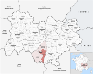
Arrondissement of Privas
Arrondissement in Auvergne-Rhône-Alpes, France
Distance: Approx. 4397 meters
Latitude and longitude: 44.73194444,4.59805556
The arrondissement of Privas is an arrondissement of France in the Ardèche department in the Auvergne-Rhône-Alpes region. It has 66 communes. Its population is 86,154 (2021), and its area is 1,145.5 km2 (442.3 sq mi).
Ajoux
Commune in Auvergne-Rhône-Alpes, France
Distance: Approx. 6045 meters
Latitude and longitude: 44.7575,4.4942
Ajoux (French pronunciation: [aʒu]) is a commune in the Ardèche department in the Auvergne-Rhône-Alpes region of southern France.

Creysseilles
Commune in France
Distance: Approx. 4244 meters
Latitude and longitude: 44.7558,4.5444
Creysseilles (French pronunciation: [kʁesɛj]; Occitan: Creisselhas) is a commune in the Ardèche department in southern France.

Coux, Ardèche
Commune in Auvergne-Rhône-Alpes, France
Distance: Approx. 6229 meters
Latitude and longitude: 44.735,4.6211
Coux (French pronunciation: [kuks]; Occitan: Cos) is a commune of the Ardèche department in southern France.
Saint-Priest, Ardèche
Commune in Auvergne-Rhône-Alpes, France
Distance: Approx. 79 meters
Latitude and longitude: 44.7172,4.5469
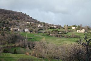
Saint-Priest (French pronunciation: [sɛ̃ pʁi(jɛst)]) is a commune in the Ardèche department in southern France.

Veyras, Ardèche
Commune in Auvergne-Rhône-Alpes, France
Distance: Approx. 2263 meters
Latitude and longitude: 44.7347,4.5619
Veyras is a commune in the Ardèche department in southern France.

Freyssenet
Commune in Auvergne-Rhône-Alpes, France
Distance: Approx. 3842 meters
Latitude and longitude: 44.6833,4.5422
Freyssenet is a commune in the Ardèche department in southern France.
Lyas
Commune in Auvergne-Rhône-Alpes, France
Distance: Approx. 4984 meters
Latitude and longitude: 44.7403,4.6006
Lyas (French pronunciation: [ljas]; Occitan: Lias) is a commune in the Ardèche department in southern France.
Pourchères
Commune in Auvergne-Rhône-Alpes, France
Distance: Approx. 4554 meters
Latitude and longitude: 44.7478,4.5072
Pourchères (French pronunciation: [puʁʃɛʁ]) is a commune in the Ardèche department in southern France.

Siege of Privas
1629 siege
Distance: Approx. 4570 meters
Latitude and longitude: 44.7347,4.5988
The siege of Privas was undertaken by Louis XIII of France from 14 May 1629, and the city of Privas was captured on 28 May 1629. It was one of the last events of the Huguenot rebellions (1621-1629).

Canton of Privas
Canton in Auvergne-Rhône-Alpes, France
Distance: Approx. 4470 meters
Latitude and longitude: 44.73,4.6
The canton of Privas is an administrative division of the Ardèche department, southern France. Its borders were modified at the French canton reorganisation which came into effect in March 2015. Its seat is in Privas.
Weather in this IP's area
clear sky
-1 Celsius
-4 Celsius
-1 Celsius
-1 Celsius
1033 hPa
47 %
1033 hPa
968 hPa
10000 meters
2.52 m/s
3.73 m/s
28 degree
4 %

