Country:
Region:
City:
Latitude and Longitude:
Time Zone:
Postal Code:
IP information under different IP Channel
ip-api
Country
Region
City
ASN
Time Zone
ISP
Blacklist
Proxy
Latitude
Longitude
Postal
Route
Luminati
Country
Region
nor
City
malaunay
ASN
Time Zone
Europe/Paris
ISP
NXO France SAS
Latitude
Longitude
Postal
IPinfo
Country
Region
City
ASN
Time Zone
ISP
Blacklist
Proxy
Latitude
Longitude
Postal
Route
db-ip
Country
Region
City
ASN
Time Zone
ISP
Blacklist
Proxy
Latitude
Longitude
Postal
Route
ipdata
Country
Region
City
ASN
Time Zone
ISP
Blacklist
Proxy
Latitude
Longitude
Postal
Route
Popular places and events near this IP address

Upper Normandy
Place in France
Distance: Approx. 4481 meters
Latitude and longitude: 49.5,1
Upper Normandy (French: Haute-Normandie, IPA: [ot nɔʁmɑ̃di] ; Norman: Ĥâote-Normaundie) is a former administrative region of France. On 1 January 2016, Upper and Lower Normandy merged becoming one region called Normandy.

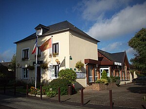
Malaunay
Commune in Normandy, France
Distance: Approx. 533 meters
Latitude and longitude: 49.5269,1.0411
Malaunay (French pronunciation: [malonɛ]) is a commune of the Rouen Metropolis in the Seine-Maritime department in Normandy, Northwestern France.
Maromme
Commune in Normandy, France
Distance: Approx. 4791 meters
Latitude and longitude: 49.4825,1.0428
Maromme (French pronunciation: [maʁɔm]) is a commune in the Seine-Maritime department in the Normandy region in northern France.
Pissy-Pôville
Commune in Normandy, France
Distance: Approx. 3941 meters
Latitude and longitude: 49.5294,0.9939
Pissy-Pôville (French pronunciation: [pisi povil]) is a commune in the Seine-Maritime department in the Normandy region in northern France. The 19th-century historian Théodore Bachelet (1820–1879) was born in this village.

Saint-Jean-du-Cardonnay
Commune in Normandy, France
Distance: Approx. 3439 meters
Latitude and longitude: 49.5069,1.01
Saint-Jean-du-Cardonnay (French pronunciation: [sɛ̃ ʒɑ̃ dy kaʁdɔnɛ]) is a commune in the Seine-Maritime department in the Normandy region in northern France.
Le Houlme
Commune in Normandy, France
Distance: Approx. 2125 meters
Latitude and longitude: 49.508,1.036
Le Houlme (French pronunciation: [lə ulm]) is a commune in the Seine-Maritime department in the Normandy region in northern France.

Houppeville
Commune in Normandy, France
Distance: Approx. 2689 meters
Latitude and longitude: 49.5133,1.0803
Houppeville (French pronunciation: [upvil]) is a commune in the Seine-Maritime department in the Normandy region in northern France.
Notre-Dame-de-Bondeville
Commune in Normandy, France
Distance: Approx. 4031 meters
Latitude and longitude: 49.4892,1.0492
Notre-Dame-de-Bondeville (French pronunciation: [nɔtʁ dam də bɔ̃dvil]) is a commune in the Seine-Maritime department in the Normandy region in northern France.
Eslettes
Commune in Normandy, France
Distance: Approx. 2423 meters
Latitude and longitude: 49.5469,1.0533
Eslettes is a commune in the Seine-Maritime department in the Normandy region in northern France.
Montville, Seine-Maritime
Commune in Normandy, France
Distance: Approx. 3173 meters
Latitude and longitude: 49.5472,1.0764
Montville (French pronunciation: [mɔ̃vil]) is a commune in the Seine-Maritime department in the Normandy region in north-western France.

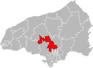
Canton of Notre-Dame-de-Bondeville
Canton in Normandy, France
Distance: Approx. 3189 meters
Latitude and longitude: 49.50361111,1.01944444
The Canton of Notre-Dame-de-Bondeville is a canton situated in the Seine-Maritime département and in the Normandy region of northern France.
Arboretum de Forêt Verte
Distance: Approx. 2687 meters
Latitude and longitude: 49.513,1.08
The Arboretum de Forêt Verte is an arboretum located within the Forêt Domaniale Verte near Houppeville, Seine-Maritime, Normandy, France. It was created in 1970 to study resistance of different trees to pollution.
Weather in this IP's area
overcast clouds
7 Celsius
4 Celsius
6 Celsius
7 Celsius
1025 hPa
90 %
1025 hPa
1009 hPa
10000 meters
4.12 m/s
90 degree
100 %
07:56:13
17:23:00


