185.15.22.138 - IP Lookup: Free IP Address Lookup, Postal Code Lookup, IP Location Lookup, IP ASN, Public IP
Country:
 Portugal
Region:
City:
Location:
Time Zone:
Postal Code:
ISP:
ASN:
language:
User-Agent:
Proxy IP:
Blacklist:
IP information under different IP Channel
ip-api
Country
Region
City
ASN
Time Zone
ISP
Blacklist
Proxy
Latitude
Longitude
Postal
Route
db-ip
Country
Region
City
ASN
Time Zone
ISP
Blacklist
Proxy
Latitude
Longitude
Postal
Route
IPinfo
Country
Region
City
ASN
Time Zone
ISP
Blacklist
Proxy
Latitude
Longitude
Postal
Route
IP2Location
185.15.22.138Country
ptRegion
santarem
City
tomar
Time Zone
Europe/Lisbon
ISP
Language
User-Agent
Latitude
Longitude
Postal
ipdata
Country
Region
City
ASN
Time Zone
ISP
Blacklist
Proxy
Latitude
Longitude
Postal
Route
Popular places and events near this IP address

Convent of Christ (Tomar)
Former Catholic convent in Tomar, Portugal
Distance: Approx. 774 meters
Latitude and longitude: 39.60472222,-8.4175
The Convent of Christ (Portuguese: Convento de Cristo/Mosteiro de Cristo) is a former Catholic convent in Tomar, Portugal. Originally a 12th-century Templar stronghold, when the order was dissolved in the 14th century the Portuguese branch was turned into the Knights of the Order of Christ, that later supported Portugal's maritime discoveries of the 15th century. The convent and castle complex are a historic and cultural monument and was listed as a UNESCO World Heritage site in 1983.

Médio Tejo
Intermunicipal community in Oeste e Vale do Tejo, Portugal
Distance: Approx. 678 meters
Latitude and longitude: 39.6,-8.41666667
The Comunidade Intermunicipal do Médio Tejo (Portuguese pronunciation: [ˈmɛðju ˈtɛʒu]; English: Middle Tagus) is an administrative division in Portugal. It was created in December 2008, replacing the former Comunidade Urbana do Médio Tejo created in 2004. It takes its name from the river Tagus.

Madalena (Tomar)
Distance: Approx. 3724 meters
Latitude and longitude: 39.587,-8.448
Madalena is a former civil parish in the municipality of Tomar, Portugal. In 2013, the parish merged into the new parish Madalena e Beselga. It has a total area of 30.56 km2 and a population of 3,466 inhabitants (2001).

Church of Santa Maria do Olival
Roman Catholic church in Tomar, Portugal
Distance: Approx. 172 meters
Latitude and longitude: 39.6015,-8.4073
The Church of Santa Maria do Olival (English: Saint Mary of the Olive Grove) is a Roman Catholic church in the city of Tomar, in Portugal. The Church has been characterized as National Monument since 1910.
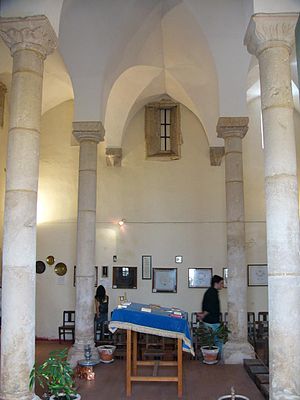
Synagogue of Tomar
Former synagogue, now museum, in Tomar, Portugal
Distance: Approx. 422 meters
Latitude and longitude: 39.60322222,-8.41386111
The Synagogue of Tomar (Portuguese: Sinagoga de Tomar) is a former Jewish congregation and synagogue, located at 73 Rua Dr. Joaquim Jaquinto, in the historic center of the city of Tomar, in the Santarém District of Portugal. The medieval synagogue was completed in the Gothic style by c. 1460, and was active as a synagogue until 1496, when Jews were expelled from Portugal.

Tomar
Town and municipality in Portugal
Distance: Approx. 678 meters
Latitude and longitude: 39.6,-8.41666667
Tomar (Portuguese pronunciation: [tuˈmaɾ] ), also known in English as Thomar (the ancient name of Tomar), is a city and a municipality in the Santarém district of Portugal. The town proper has a population of about 20,000. The municipality population in 2011 was 40,677, in an area of 351.20 km2 (135.60 sq mi).

Paialvo
Civil parish in Oeste e Vale do Tejo, Portugal
Distance: Approx. 6527 meters
Latitude and longitude: 39.563,-8.466
Paialvo is a Portuguese freguesia ("civil parish") located in the municipality of Tomar. The population in 2011 was 2,599, in an area of 22.31 km2. Paialvo Parish consists of thirteen places/villages: Bexiga, Carrascal, Carrazede, Casal Barreleiro, Charneca da Peralva, Curvaceiras, Delongo, Fontaínhas, Mouchões, Paialvo, Peralva, and Soudos e Vila Nova.

Tomar Castle
Castle in Tomar, Santarém, Portugal
Distance: Approx. 1189 meters
Latitude and longitude: 39.60416667,-8.42277778
The Tomar Castle is a castle in Portugal, where it is classified as a national monument. The Convento de Cristo was built inside its walls. The castle was built by King Afonso Henriques around 1160 on a strategic location, over a hill and near river Nabão.

Hermitage of Nossa Senhora da Conceição (Tomar)
Hermitage in Tomar, Portugal
Distance: Approx. 782 meters
Latitude and longitude: 39.60583611,-8.41683889
The Hermitage of Nossa Senhora da Conceição (Our Lady of Conception) is a 16th-century hermitage located in the civil parish of São João Baptista, in the municipality of Tomar, designated as a National Monument (Portuguese: Monumento Nacional) in 1910.

Igreja de São João Baptista (Tomar)
Distance: Approx. 248 meters
Latitude and longitude: 39.603109,-8.411708
The Church of Saint John the Baptist (Portuguese: Igreja de São João Baptista) is a 15th-century Catholic church in Tomar, Portugal that was built by King Manuel I and is of Manueline architecture. As its name implies, the church is dedicated to Saint John the Baptist. It has been classified as a National Monument since 1910.

Serra e Junceira
Civil parish in Oeste e Vale do Tejo, Portugal
Distance: Approx. 9369 meters
Latitude and longitude: 39.6,-8.3
Serra e Junceira is a civil parish in the municipality of Tomar, Portugal. It was formed in 2013 by the merger of the former parishes Serra and Junceira. The population in 2011 was 2,080, in an area of 46.57 km².
Madalena e Beselga
Civil parish in Oeste e Vale do Tejo, Portugal
Distance: Approx. 3724 meters
Latitude and longitude: 39.587,-8.448
Madalena e Beselga is a civil parish in the municipality of Tomar, Portugal. It was formed in 2013 by the merger of the former parishes Madalena and Beselga. The population in 2011 was 3,990, in an area of 44.44 km².
Weather in this IP's area
overcast clouds
12 Celsius
12 Celsius
11 Celsius
13 Celsius
1023 hPa
91 %
1023 hPa
1006 hPa
10000 meters
4.21 m/s
10.8 m/s
334 degree
100 %